Heavy rain and a subsequent change in water temperature caused a fish kill at a pond in The Villages, with vultures quickly arriving to feast on the dead fish. District Property Management confirmed there is no threat to residents.
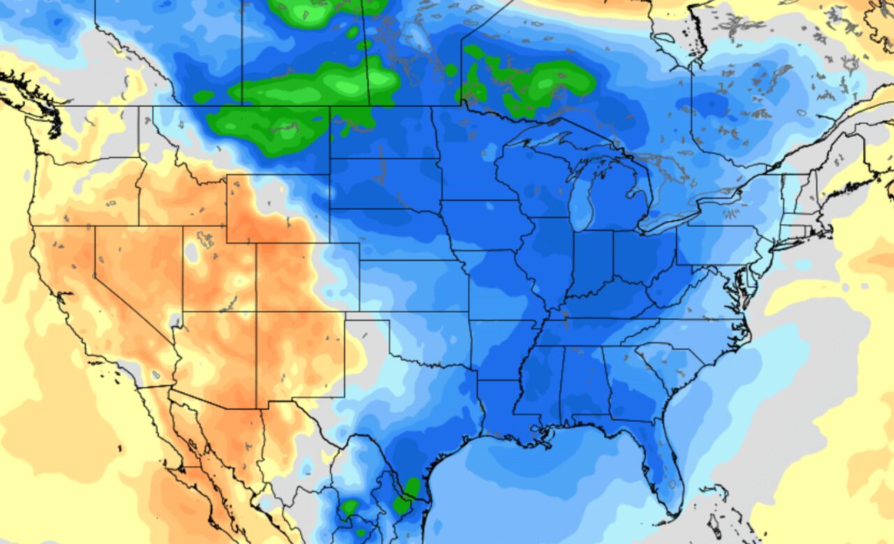
An abrupt temperature change in the Midwest is expected to bring severe storms, including the possibility of hail the size of hen eggs and tornadoes, from Missouri to Michigan. After record-shattering warmth, temperatures are set to plummet by as much as 40 degrees, with more than 50 daily record high temperatures potentially being broken. The severe storms are most likely to occur between Missouri and Michigan, primarily across northeastern Illinois and northern Indiana, with the potential for two-inch-thick hail and tornadoes.
A weather change is expected to move through Michigan around Thanksgiving, bringing colder temperatures and light precipitation. Thanksgiving itself is forecasted to be around six degrees colder than normal, with a high temperature of about 37 degrees. While there may be some light snow in northwest Lower Michigan, widespread heavy snow is not expected. The second half of the Thanksgiving holiday is expected to be drier. Overall, travel concerns due to the weather should not be a major issue at this time.
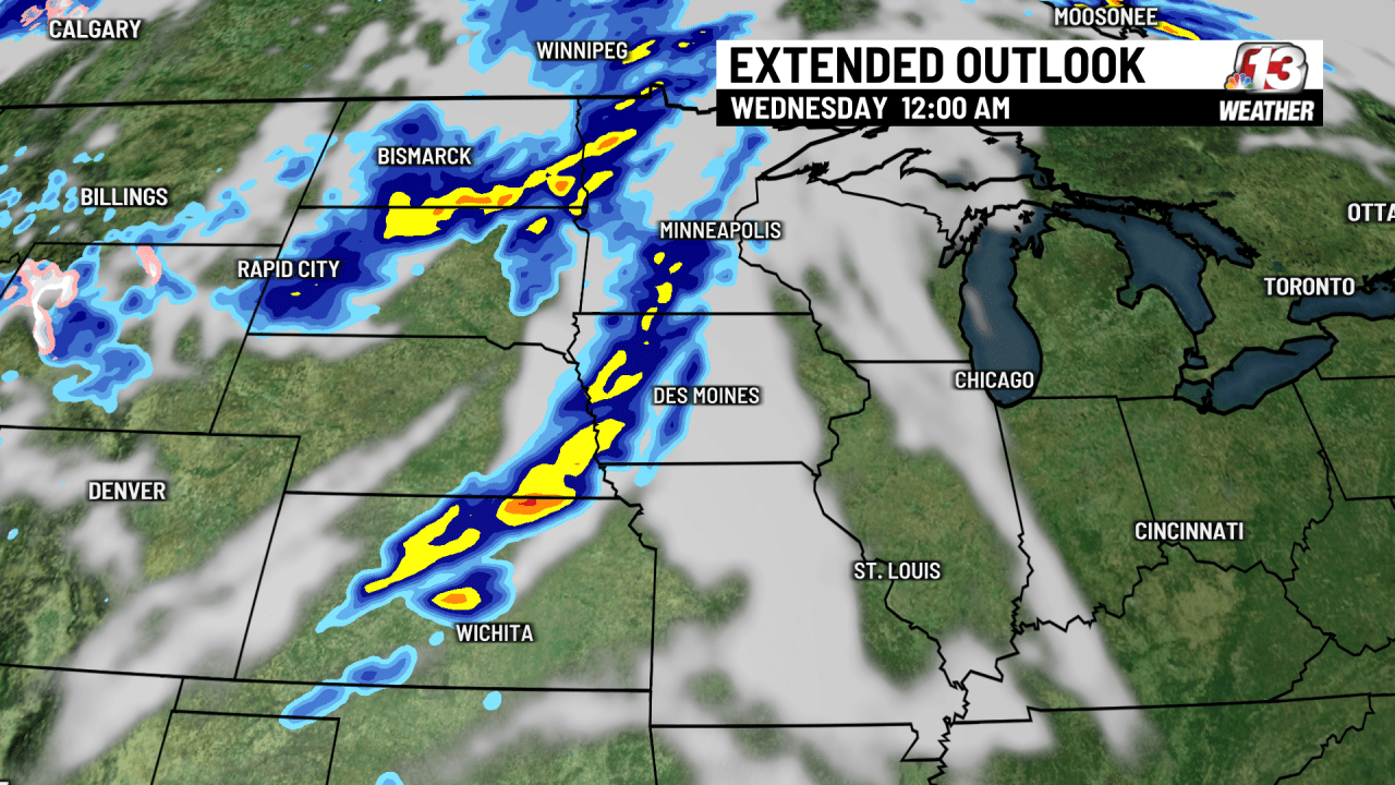
After experiencing record-breaking heat with three consecutive days of 90+ degree highs in Des Moines, Iowa, a temperature change is on the horizon. A trough of low pressure moving in from the western United States will bring clouds, precipitation, and cooler air to the region by mid-week. Rain chances are expected from Tuesday evening into Wednesday morning, but heavy rain and severe weather are not anticipated. Following the cold front, much cooler temperatures are forecasted, with lows potentially dipping into the 30s in parts of Iowa on Saturday morning.
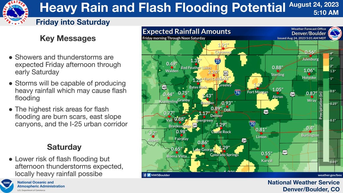
Fort Collins is experiencing a drastic weather change from hot and dry to chilly and rainy, with a 90% chance of rain and a temperature drop from 92 degrees to 66 degrees on Friday. The incoming weather system, fueled by remnants of Tropical Storm Harold and a strong cold front, is expected to bring heavy rainfall and potential flash flooding to the area. The National Weather Service forecasts rainfall amounts ranging from 0.90 inches in Denver/DIA to 2.24 inches in Fort Collins. While the exact location and intensity of the heaviest rain are uncertain, confidence is increasing for a significant rainfall event.
Colorado is expected to experience heavy rain and snow due to a spring storm that will last from Tuesday to Wednesday. Temperatures will drop by nearly 20 degrees, with the biggest impact of the storm expected on Wednesday. Snow totals are difficult to forecast, but the Pinpoint Weather team expects 0-5 inches of accumulation in Metro Denver, 5-10 inches in Foothills/Palmer Divide, and 4-24 inches in the Mountains. Stay updated with the latest forecast using the free Pinpoint Weather app.