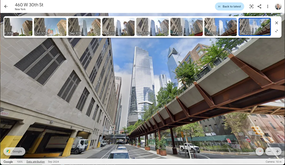
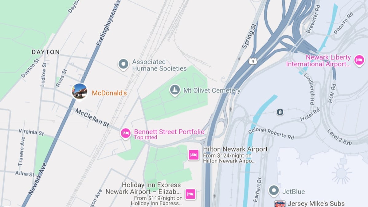
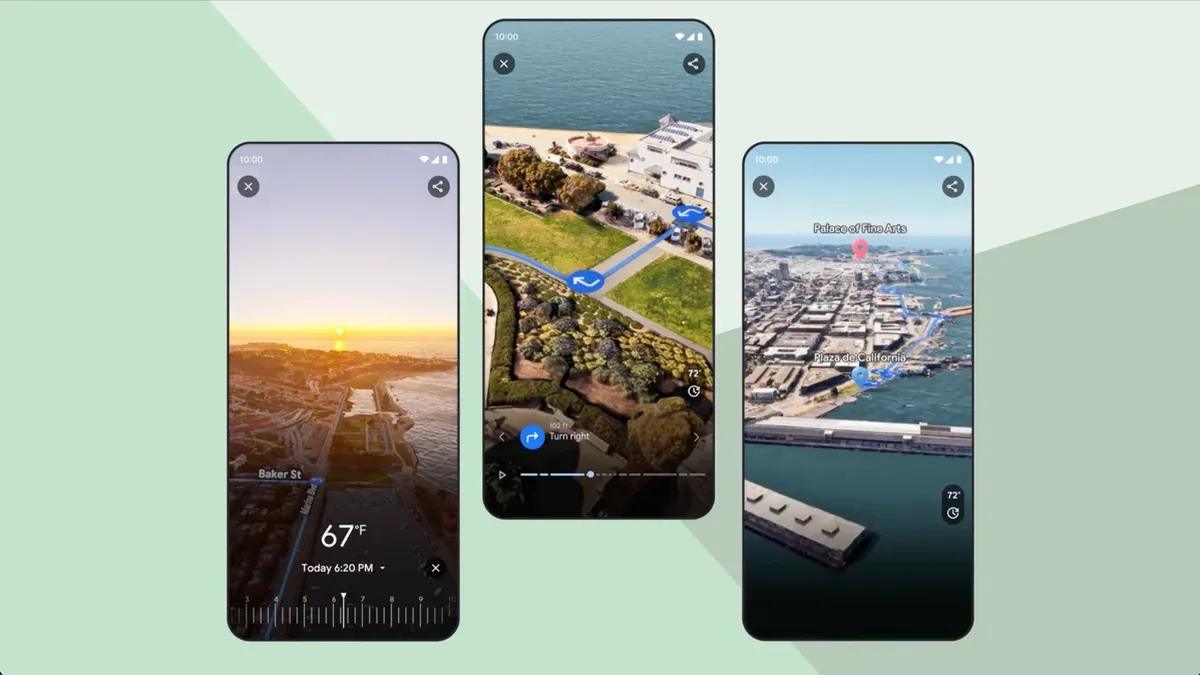
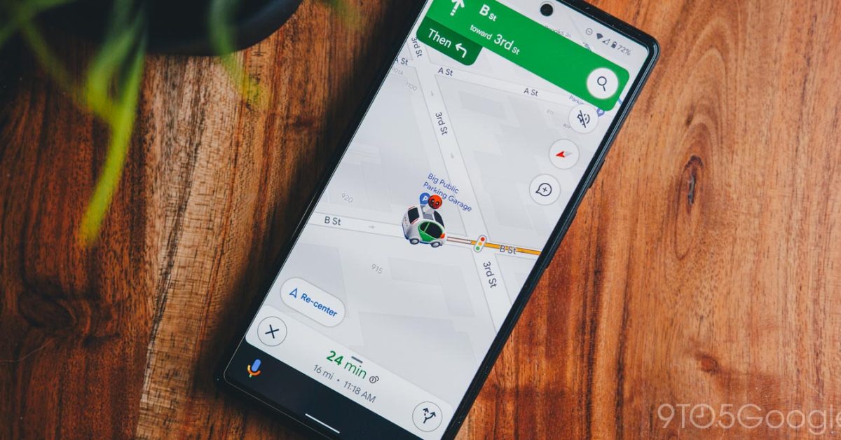
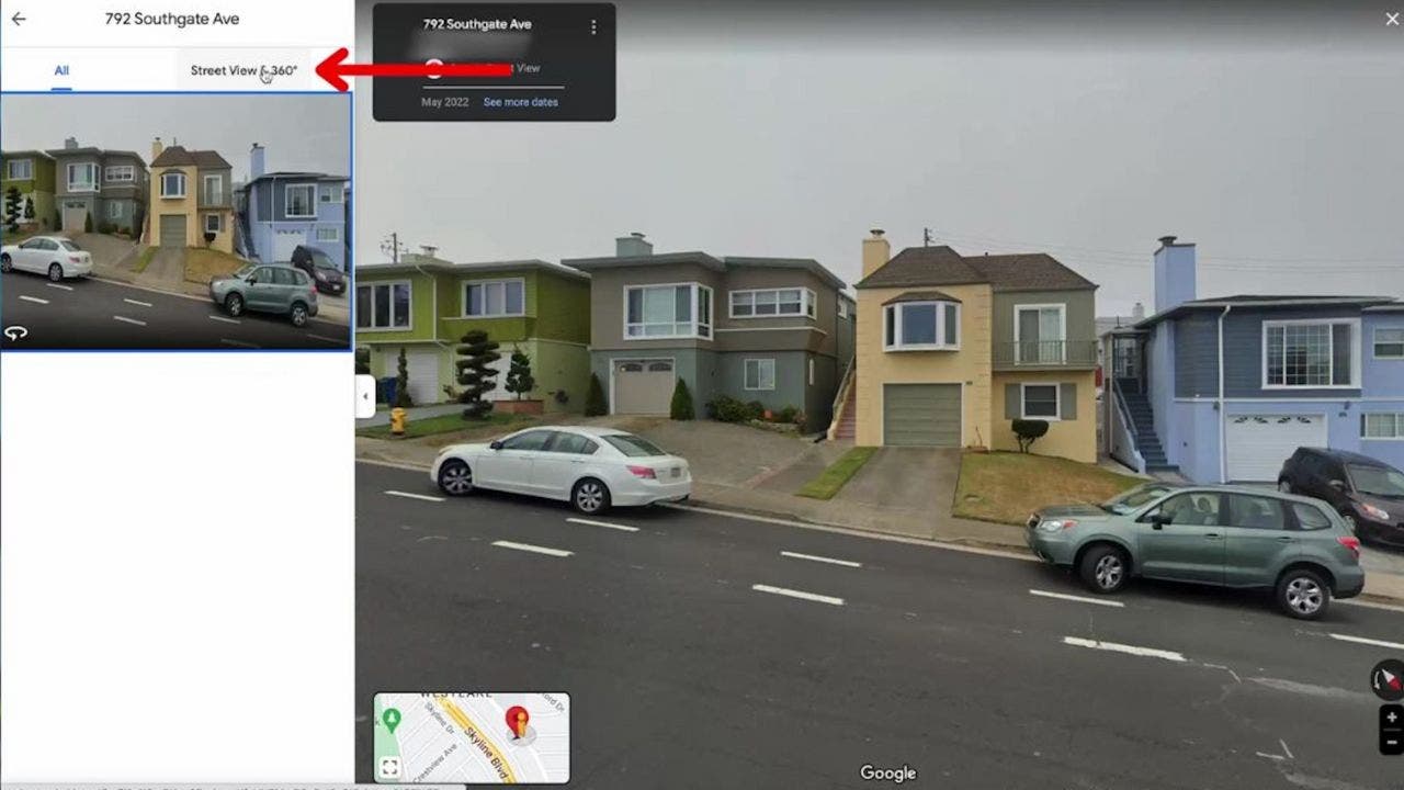
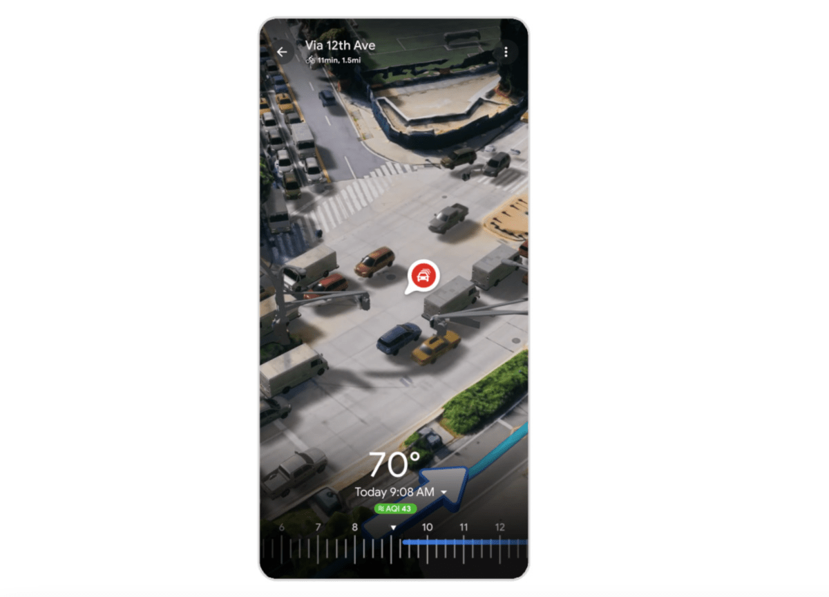
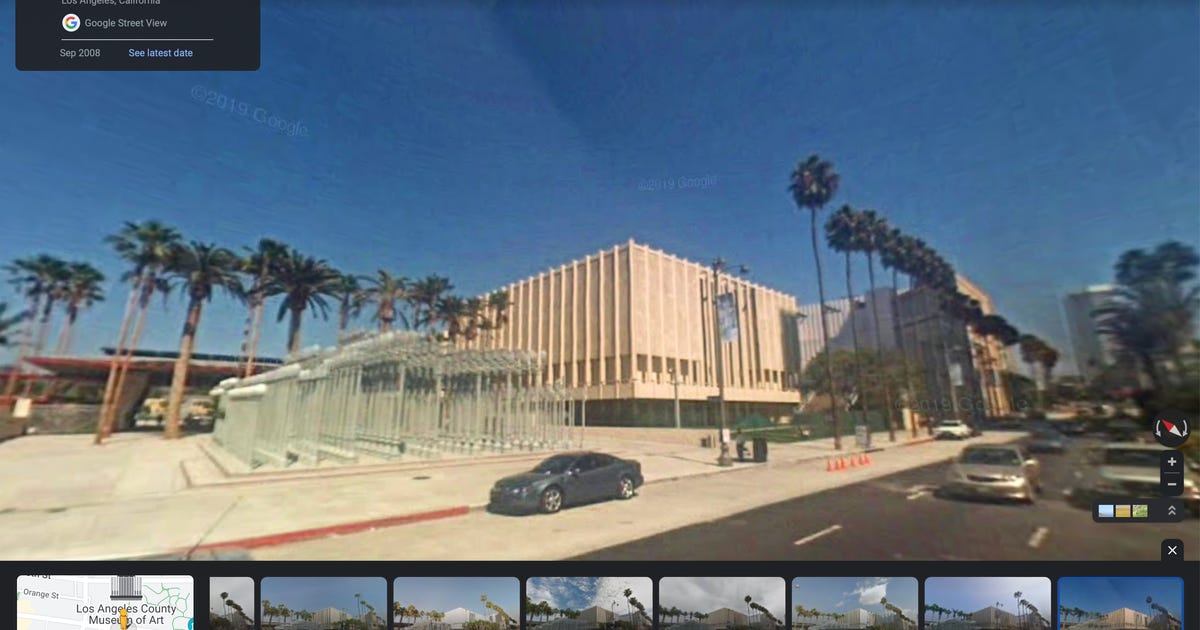
Google Maps offers 11 underrated features beyond basic navigation, including reporting road hazards, one-handed gestures, parking assistance, sharing trip progress, customizing vehicle avatars, using AI for activity suggestions, exploring historical Street View images, summoning ride shares, ordering groceries, finding EV chargers, and measuring distances, enhancing user experience in various ways.
An Argentine man was awarded $12,500 after a Google Street View camera captured him naked in his yard behind a tall wall, violating his privacy. The court ruled that Google’s failure to adequately blur his image constituted an invasion of privacy and awarded damages, emphasizing the company's responsibility to protect individuals' dignity even within private spaces. This case highlights ongoing privacy concerns related to Google's Street View service.
Google Earth now allows users to access historical Street View images, making it easier to see how neighborhoods and environments have changed over the years, which is useful for nostalgia and urban planning.
Google Earth celebrates its 20th birthday by adding historical Street View imagery, allowing users to explore past views of locations worldwide, along with new AI-driven insights for professional users in the US, enhancing urban planning capabilities.
Google Earth has introduced a new feature allowing users to view historical Street View images, enabling them to see how locations have changed over time, as part of its 20th anniversary updates. Additionally, professional users will soon gain access to AI-driven insights about environmental factors like tree canopy coverage and land surface temperatures.
Google Maps' Street View feature, while useful for navigation and finding local amenities, can also be exploited by criminals to plan home break-ins by assessing property value and security systems. To mitigate this risk, users can blur images of their homes, faces, or cars on Street View using the desktop version of Google Maps. This precaution can help protect against potential theft and personal harm.
Google Maps allows users to blur their homes on Street View for privacy reasons, but the process is permanent and cannot be undone. To blur your house, locate it on Street View, click "Report a problem," and follow the instructions to submit your request.
Google has provided an inside look at the technology behind its Immersive View feature for Google Maps, showcasing the evolution of its Street View camera technology and the methods used to capture imagery worldwide. Immersive View offers a three-dimensional rendering of destinations, allowing users to see weather forecasts, traffic conditions, and detailed surroundings. It combines footage from Street View with images from a 3D aerial camera, utilizing AI and computer vision to create realistic digital models. Two versions of Immersive View are available, with the route preview option rolling out in select cities.
A Brazilian woman discovered her boyfriend cheating on her with her best friend by using Google Street View. After noticing a Google car passing by her house, she decided to track its route on the website and found a Street View image of her boyfriend riding a motorbike with another woman. She eventually located them in a familiar spot and realized the woman was her closest friend. The story went viral on TikTok, with viewers amazed by the detective work possible with Street View. Some skeptics questioned the precision of the Google Maps vehicle's tracking.
Google Maps' Street View feature allows users to virtually visit locations worldwide, but it also poses privacy risks. Stalkers and criminals can easily examine homes and buildings through Street View. However, users can blur their homes on Google Maps to prevent others from seeing too many details. To do this, users need to access Google Maps on a computer, enter their home address, click on the photo of their home, select "Report a Problem," adjust the view to include the desired area to blur, choose what to blur (e.g., face, home, car), provide additional details, and submit the request. Google will review the report and notify the user of the approval or denial.
Google Maps Street View will operate in Germany again after a decade-old privacy concern. Google will capture new Street View imagery of Germany for Maps with vehicles hitting the road as of June 22, 2023. Property owners are allowed to submit a request to have their location blurred.
Google Maps' Street View feature allows users to view their home's location history dating back to 2007. To access this feature, users can search for an address on the Google Maps website, select the picture of the location, and choose the "See more dates" option. Google Maps also offers other useful features like different views (traffic, transit, biking) and recommendations for nearby stores.
Google Maps is introducing a new feature called "Immersive View for Routes" in select cities, which brings all the necessary information about a route into one place, including traffic simulations, bike lanes, complex intersections, parking, and more. The feature will roll out on both Android and iOS in 15 cities, and it uses computer vision and AI to fuse billions of Street View and aerial images together to create a digital model of the world. Google is also launching an Aerial View API for developers and an experimental release of Photorealistic 3D titles for developers.
Google Maps stores every image taken of a location, dating back to 2007. Users can access older Street View images on their phone or computer by tapping the Street View preview, then the large map, and finally the "See more dates" option. The earlier the date, the lower the quality of the image. This feature allows users to time travel and see what a location looked like over a decade ago.