Tag

South Central Pennsylvania

All articles tagged with #south central pennsylvania

weather1 year ago

"Pennsylvania Braces for Winter Storm: Snow and Rain Expected Across the State"

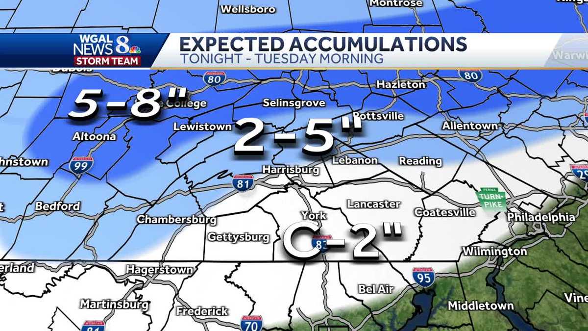
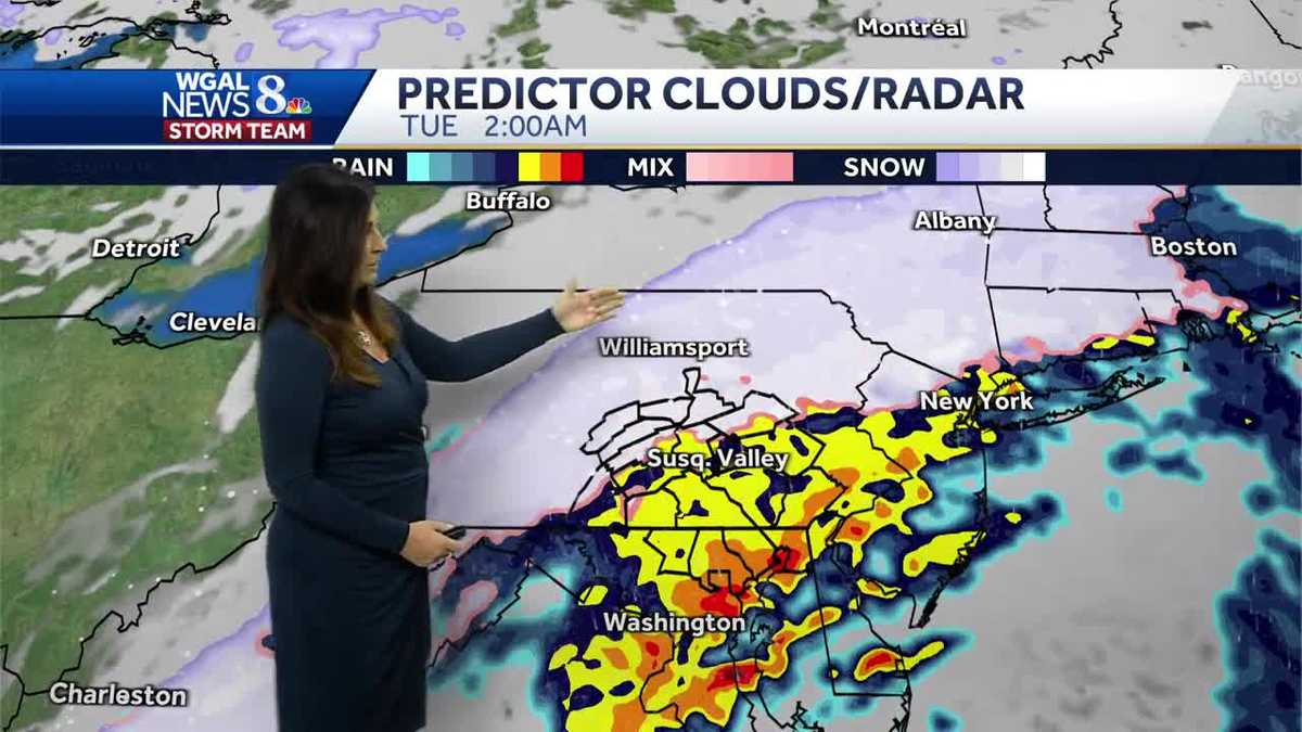
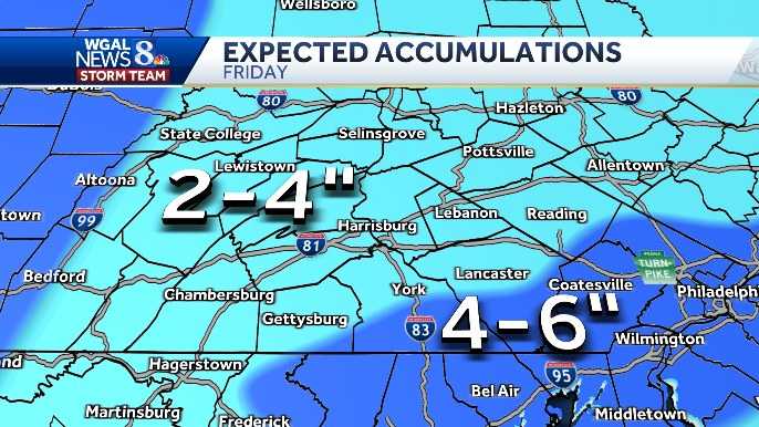
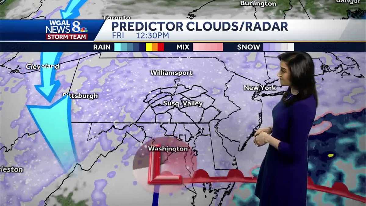
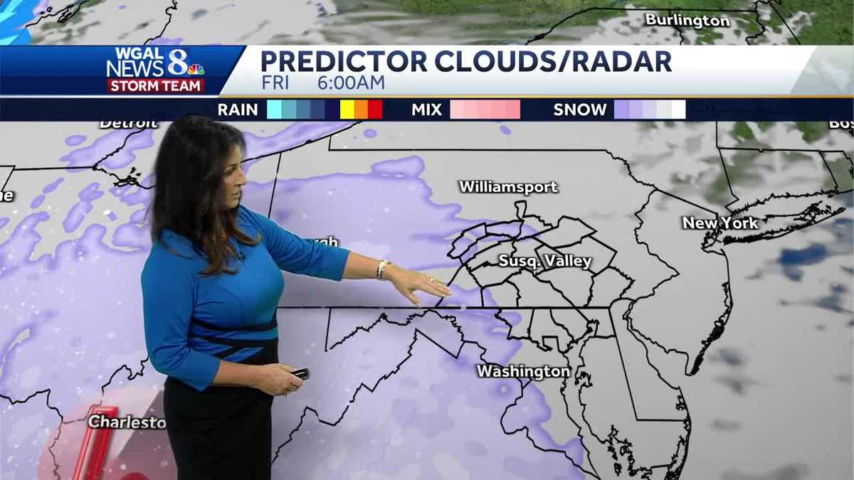
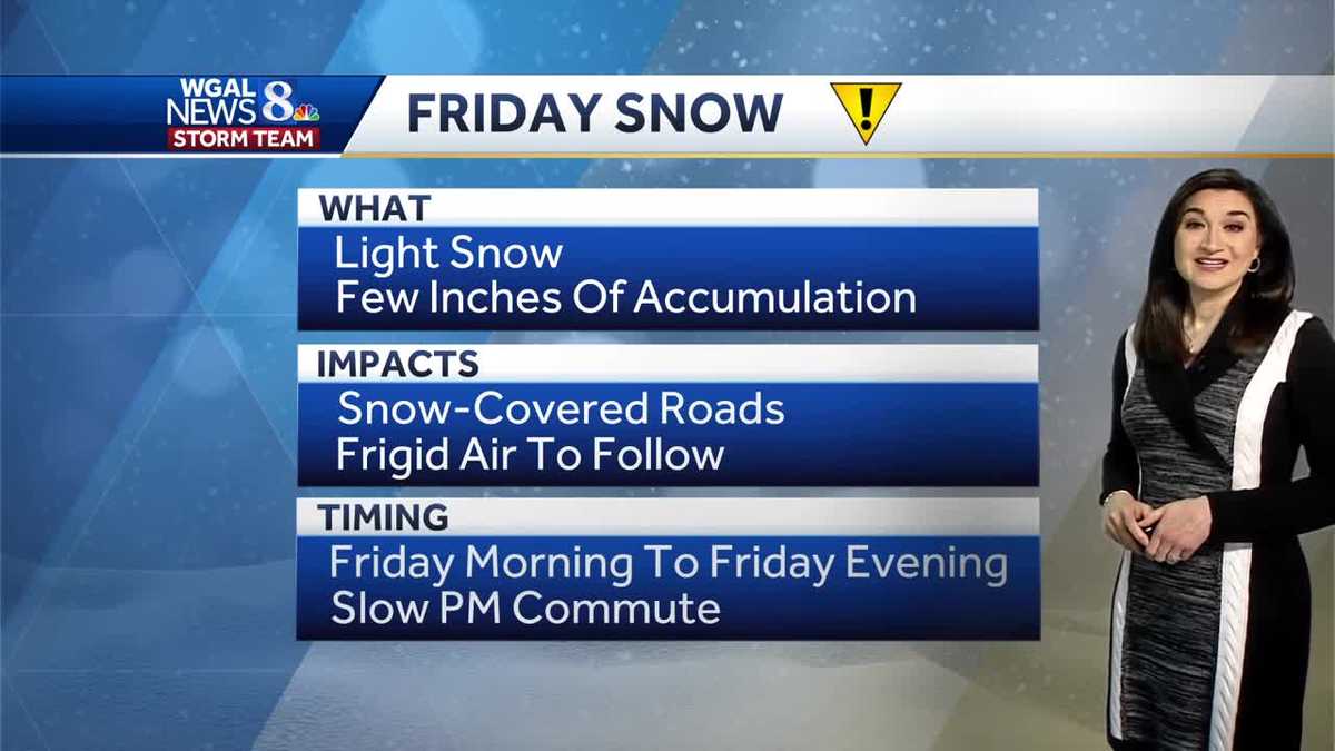
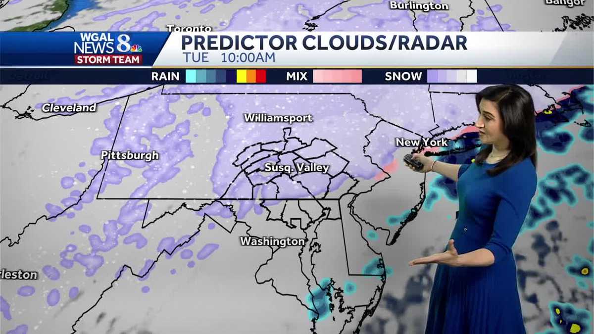
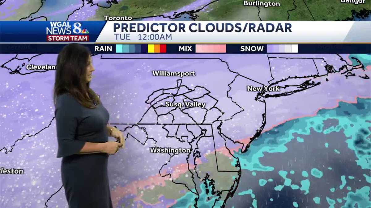
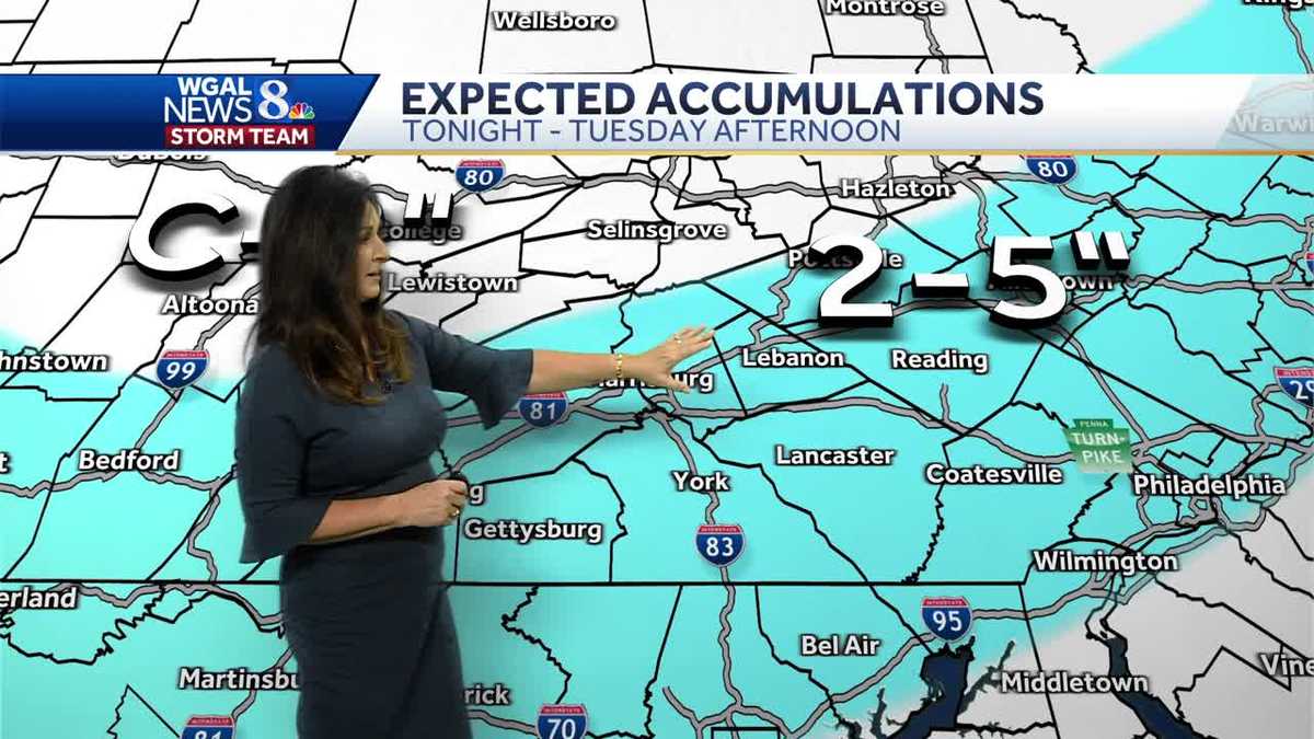
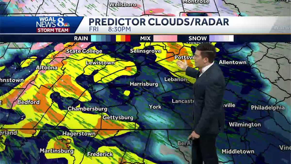
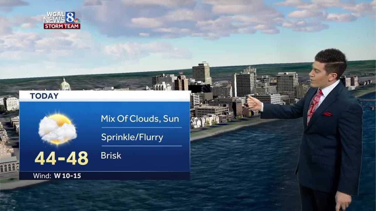
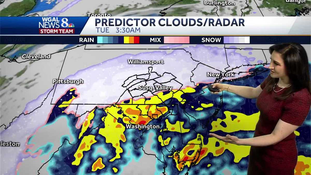
A winter storm is expected to hit South-Central Pennsylvania, with hour-by-hour snow projections available for the Susquehanna Valley. The article provides a Winter Weather Toolkit with various features such as radar tracking, closings, location-based alerts, road closures, email alerts, and a 10-day forecast. The WGAL News 8 Storm Team highlights the difference between Alert Days and Impact Days, and encourages viewers to share their snow photos and videos through various channels.

weather1 year ago

"Snowstorm Set to Hit South-Central Pennsylvania and Pittsburgh on Tuesday"

Winter storm watches and warnings are in effect for South-Central Pennsylvania as a winter storm is expected to bring snow, sleet, and rain. Light rain will develop Monday evening, changing to snow between 2 a.m. and 6 a.m. on Tuesday. Moderate to heavy snow is possible during the morning commute, with expected snow totals ranging from a coating to 2 inches in southern areas to 5 to 8 inches in northernmost counties. Winter storm watches and warnings are in effect for several counties, and residents are advised to stay weather aware and check for updates.

weather1 year ago

"Snowstorm Watch: Hour-by-Hour Projections for South-Central Pa."

A winter storm is expected to bring plowable snow to parts of South-Central Pennsylvania, with the track shifting since yesterday. Hour-by-hour snow projections for the Susquehanna Valley have been posted, and a Winter Weather Toolkit has been provided to help residents stay informed and prepared. The WGAL News 8 Storm Team has also highlighted the difference between Alert and Impact days in their forecasts, and residents are encouraged to share their snow photos and videos through various channels.

weather2 years ago

"Anticipating a Snowy Blanket: Winter Storm Forecast"

A winter storm is expected to bring 2-4 inches of fluffy snow to South-Central Pennsylvania, with slightly higher totals of 4-6 inches in some areas. The snow is anticipated to start between 3 a.m. and 8 a.m. on Friday, leading to a slow morning commute and continuing through the afternoon before tapering off by evening. Wind chills on Saturday morning will be near zero, with potential blowing and drifting snow due to 15-25 mph northwesterly winds. Travel impacts are expected throughout the day, and residents are advised to stay updated with WGAL for the latest weather alerts and information.

weather2 years ago

Pennsylvania's Friday Snowstorm: Hourly Projections and Impact on Commute

Hour-by-hour snow projections for Friday in South-Central Pennsylvania indicate light snow throughout the day with 2 to 4 inches of accumulation and snow-covered roads, impacting Friday evening commutes. The forecast also includes a Winter Weather Toolkit and ways to stay weather aware, as well as instructions for sharing weather photos and videos with WGAL.

weather2 years ago

"Wintry Weather Ahead: Snow Forecast for South-Central PA and Philadelphia"

Another winter storm is expected to bring snow to South-Central Pennsylvania on Friday, with updated hour-by-hour snowfall projections available. The storm is likely to disrupt daily routines and may lead to icy road conditions, prompting the need for weather awareness and preparedness. Residents are encouraged to stay updated on the forecast and share their snow photos and videos with the news team.

weather2 years ago

"Wintry Weather Ahead for South-Central and Eastern Pennsylvania"

South-Central Pennsylvania is expecting accumulating snow on Friday, with light snow developing in the morning and tapering off by late evening. Slow travel is expected throughout the day, especially during the evening commute. Behind the snow, Saturday will be windy and frigid, with wind chills near zero in the morning and in the teens in the afternoon. Residents are advised to stay updated with the WGAL app for fine-tuned projections and utilize winter weather tools for closings, radar tracking, road conditions, and location-based alerts.

weather2 years ago

"Continued Snowfall: More Accumulation Expected for Morning Commute in Philadelphia and South-Central Pennsylvania"

A winter storm is expected to bring more snow during the Tuesday morning commute in South-Central Pennsylvania, with 2-5 inches of powdery snow likely for most of the area. The storm will taper off by noon, but winds are expected to increase, potentially causing blowing and drifting, especially in rural areas. Temperatures will drop into the teens with wind chills near zero. The WGAL News 8 Storm Team has designated Tuesday as an Alert Day, and updates can be found on the WGAL app.

weather2 years ago

Snowfall Projections and Winter Weather Advisory for Pennsylvania and New Jersey

A winter storm is expected to bring snow to South-Central Pennsylvania, with hour-by-hour projections showing snowfall for the Susquehanna Valley. The area is under a winter weather advisory from this afternoon until noon tomorrow, with 2 to 4 inches of snow expected, possibly more in southeastern areas. The storm is forecasted to move out by midday tomorrow, followed by cold temperatures and the possibility of more snow later in the week. Residents are advised to stay weather aware and can access various weather features and alerts through the WGAL website and app.

weather2 years ago

"Early Week Snowstorm to Bring Travel Impacts to South-Central PA and NJ"

A winter storm is expected to bring several inches of snow to South-Central Pennsylvania, with light snow developing late Monday evening and continuing into Tuesday morning, impacting the commute. The WGAL News 8 Storm Team has designated Tuesday as an Impact Day, and there is another chance for snow at the end of the week. The snowfall is expected to range from 2 to 4 inches across most of the Susquehanna Valley, with higher totals likely in southeastern counties.

weather2 years ago

"Severe Weather Alert: Heavy Rain and Damaging Winds Forecasted for South-Central and Southeastern PA"

A storm system is expected to bring heavy rain and damaging winds to South-Central Pennsylvania, prompting the WGAL News 8 Storm Team to designate today as an Impact Day. The system will bring heavy rain and gusty winds, with the potential for flooding and power outages. The National Weather Service has issued a wind advisory for the area until Saturday evening. Residents are advised to stay updated on the weather and potential impacts through the WGAL app and utilize the available winter weather tools for real-time updates.

weather2 years ago

"Philadelphia Braces for New Storm After Flooding Cleanup"

South-Central Pennsylvania is expecting heavy rain and high winds, which could lead to flooding on Friday night into Saturday. There's also a chance of snow on Monday and Tuesday, with temperatures dropping into the 20s. The ground is already saturated, and the additional rain may worsen flooding. Wind speeds are expected to reach 20-30 mph with gusts of 40-50 mph. Residents are advised to stay updated on the weather conditions and utilize available tools for real-time updates.

weather2 years ago

"Pennsylvania Storm Causes Flooding, Power Outages, and Road Closures"

Flooding and storm damage have led to road closures in South-Central Pennsylvania, with multiple areas affected in Adams, Cumberland, Dauphin, Lancaster, Lebanon, Perry, and York counties. Downed trees, fallen power lines, and flooded roads have prompted closures and blockages, causing travel disruptions in the region.

astronomy2 years ago

"Stargazers in Pennsylvania and California Await Spectacular Geminids Meteor Shower"

The Geminid meteor shower is peaking this week in south-central Pennsylvania, with the best viewing times being late in the evening to early dawn. Skies will be clear, and there will be no light interference from the moon. Up to 120 meteors per hour may be visible. The meteor shower is named after the constellation Gemini, but it can be seen across the night sky.