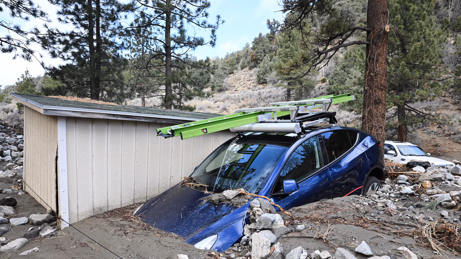
A strong storm system continues to pose risks of flooding, high surf, and avalanches in California, with ongoing dangers in Wrightwood, Los Angeles, and the Sierra Nevada, despite easing conditions, prompting emergency responses and evacuations.
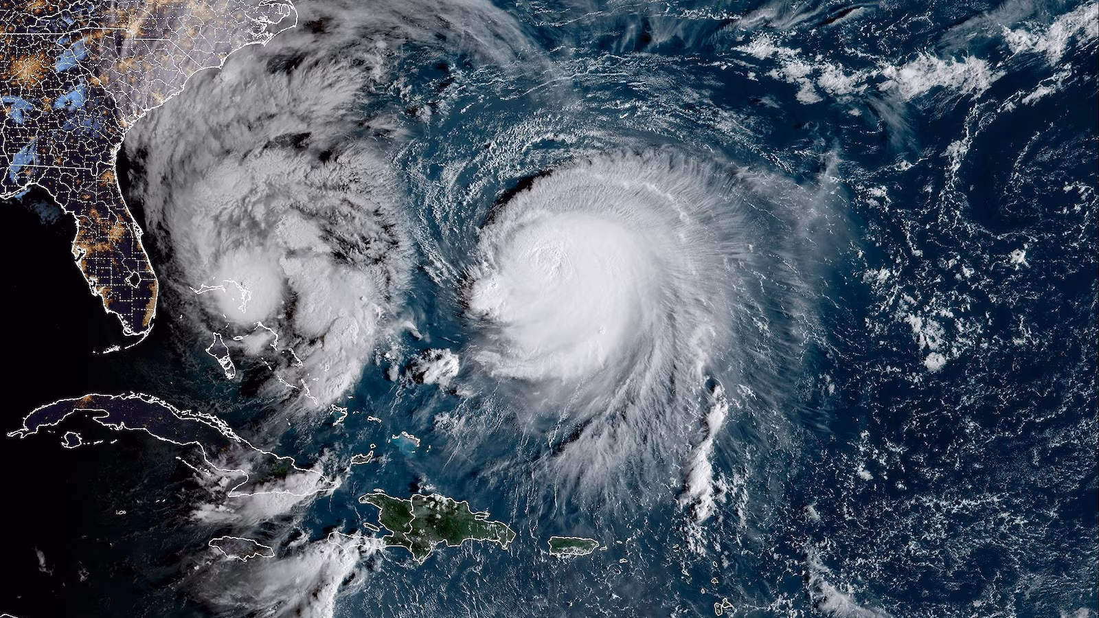
Tropical Storm Imelda is approaching the Southeast US coast but will not make landfall, bringing rain, strong winds, high surf, rip currents, and potential flooding from the Carolinas to Virginia, and possibly hitting Bermuda as a hurricane. Meanwhile, Hurricane Humberto is affecting Bermuda with heavy rain.
A yacht-sized passenger boat named Discovery ran aground in high surf off Honolulu, nearly flipping on its side before coming to rest against a reef, with no injuries reported. The vessel was emptied of fuel and batteries to prevent pollution, and efforts are underway to tow it away and inspect it before returning to service.
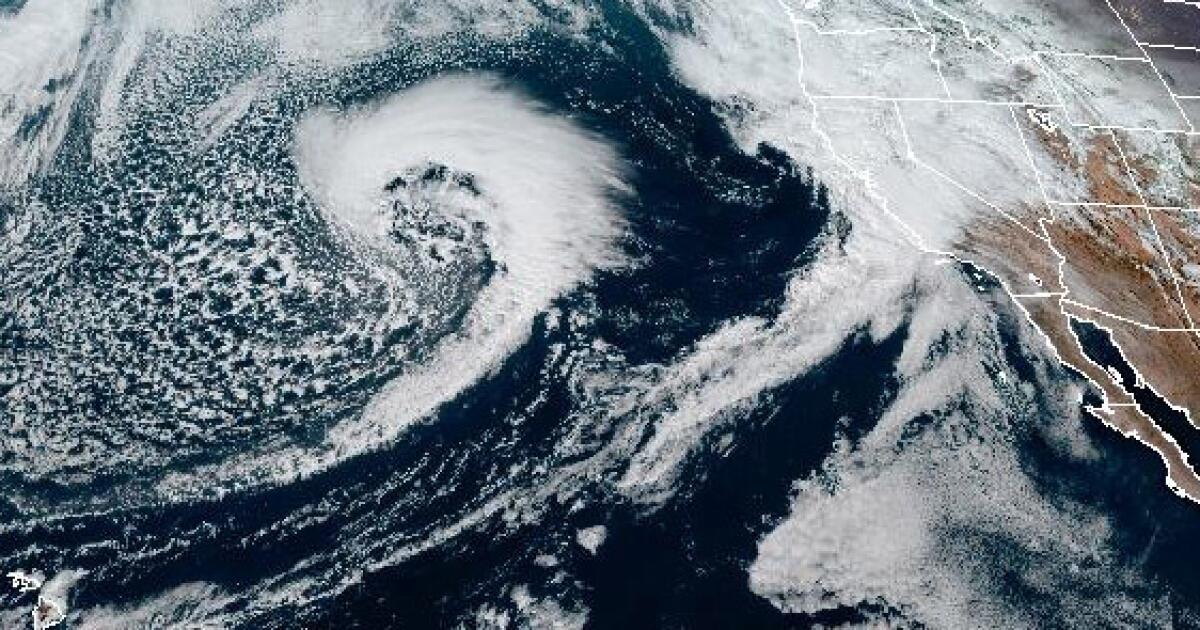
A storm system is expected to bring rain to Southern California through Wednesday, with light rain in Los Angeles County on Saturday developing into heavy showers by Wednesday. Meteorologists predict 2 to 5 inches of widespread rainfall, with higher-intensity showers and the potential for flooding, landslides, and mudflows due to saturated soils. A flood watch alert has been issued for a broad coastal area, and high surf with waves up to 20 feet is expected along the Central Coast. The storm will also bring strong winds and significant snowfall in higher elevations, with another possible system forecasted for next weekend.
'King tides' are expected to bring flooding to California’s coast, with the National Weather Service warning of 8-17 foot waves and rough conditions on Thursday and Friday. High surf, winds, and tides will create dangerous swimming and surfing conditions, as well as flooding in low-level areas, prompting a flood warning for most of the California coast.
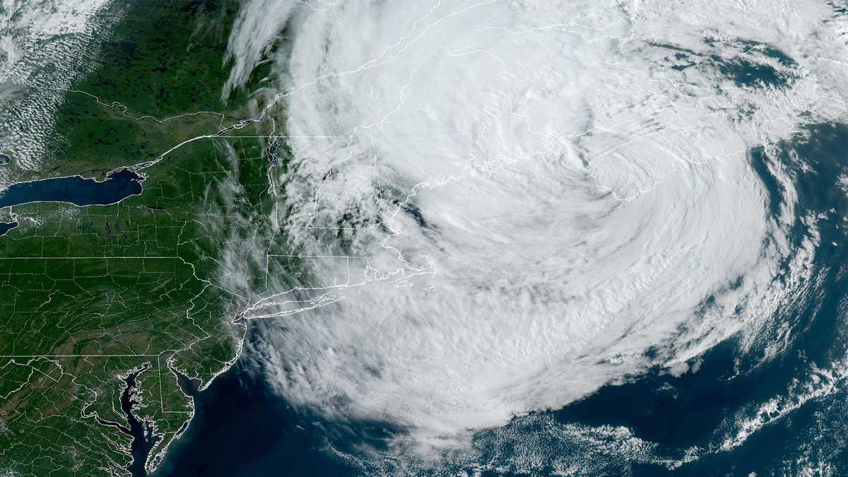
Gusty winds and high surf from the post-tropical cyclone formerly known as Hurricane Lee continue to affect the Massachusetts coast as the storm makes landfall in Canada. Lee made landfall in far western Nova Scotia with maximum sustained winds of about 70 mph. Although it no longer has tropical characteristics, the storm still brings strong winds, potentially causing power outages and downed trees along the Massachusetts coast. Rainfall of 1-4 inches and storm surge of 1-3 feet are expected in eastern Massachusetts, while inland areas are not expected to be heavily impacted. Sunny and mild conditions are forecasted for Sunday before rain returns on Monday.
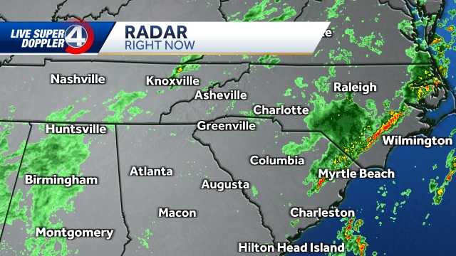
Tropical Storm Idalia is hitting the South Carolina coast with heavy rain, strong winds, and high storm surge. Wind gusts are currently at 65 mph, and the storm made landfall in Florida as a category 3 storm. Flooding is being reported in the Charleston area, and tide levels in the Charleston Harbor are over 9 feet. Wind gusts along the coast could reach 70-80 mph. The storm is also bringing scattered rain to the Upstate region of South Carolina.
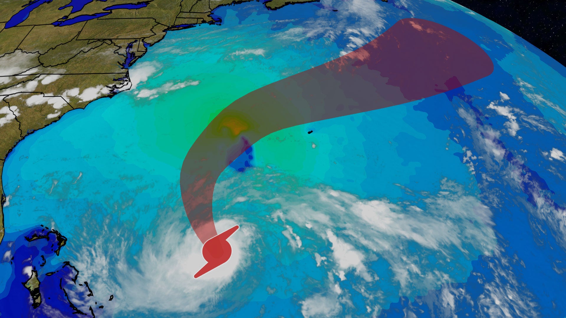
Hurricane Franklin is expected to become a major hurricane on Monday as it strengthens in the Bermuda Triangle. While it will remain well off the U.S. East Coast, it will generate high surf and rip currents, posing a threat to beachgoers. There is also a possibility that Franklin could track close to Bermuda, potentially bringing stronger winds, heavy rain, and coastal flooding to the archipelago. Interests in Bermuda should closely monitor the forecast and be prepared.
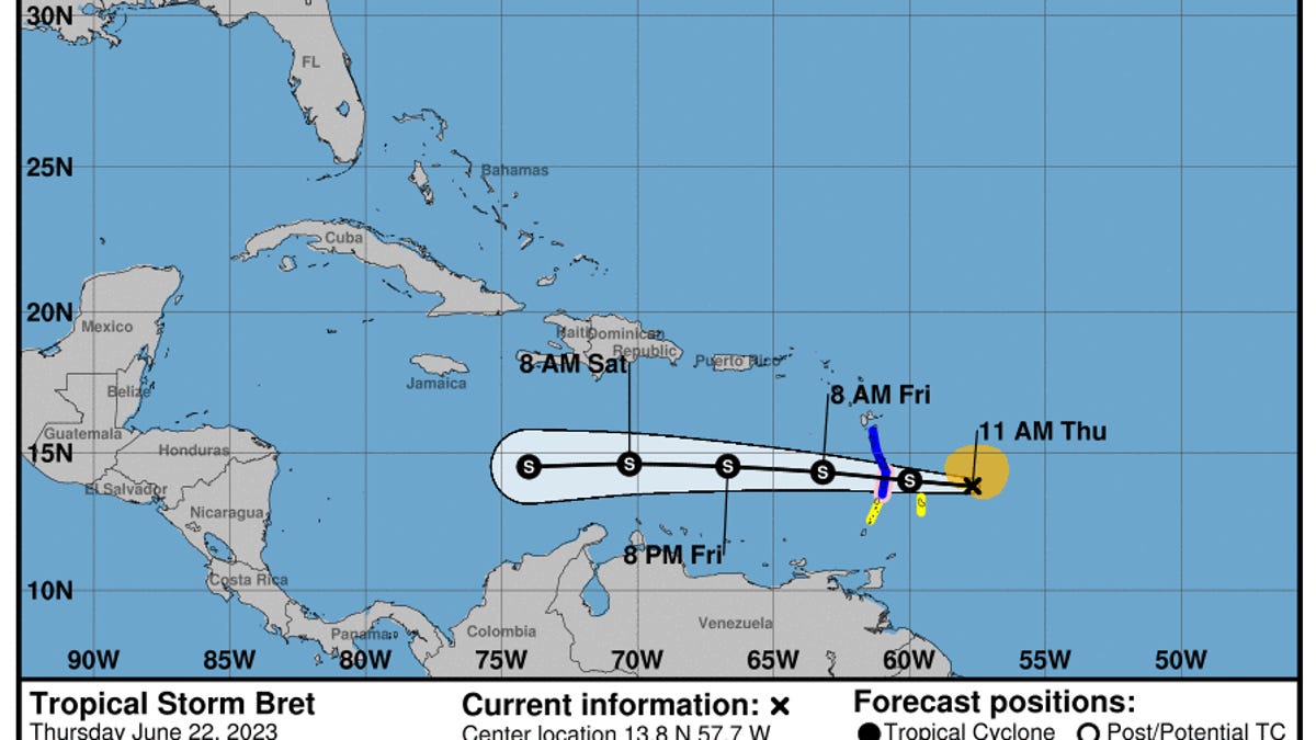
Tropical Storm Bret is approaching the eastern Caribbean islands with a hurricane watch issued for St. Lucia. A tropical storm warning is also in effect for Martinique and Dominica, where there is a risk of flooding from heavy rainfall, strong winds, and dangerous waves along the coast. The storm is expected to be near hurricane strength as it passes through the islands. Another storm, Tropical Depression Four, is also spinning in the open Atlantic Ocean.