Due to critically dry conditions and high winds forecasted for Wednesday, Xcel Energy is likely to implement a Public Safety Power Shutoff affecting parts of the Front Range to mitigate wildfire risks, with the situation closely monitored and updates provided to the public.
Central New York is now at high risk for wildfires due to ongoing dry and windy conditions, with nearly 40 counties affected. The New York State Department of Environmental Conservation has issued a high fire danger warning, and a statewide burn ban is in effect until November 30. The region has experienced significantly less rainfall than usual, exacerbating the fire risk. Firefighters are currently battling several large wildfires, including the largest in the state since 2008, with tragic consequences, such as the death of a young parks employee.
Massachusetts is experiencing multiple wildfires amid a red flag warning due to dry conditions and gusty winds. Fires have spread across the state, with significant incidents in Lynn Woods Reservation and North Andover, where homes were damaged for the first time. Firefighters are working to contain the blazes, with another red flag warning issued for Sunday. Public access to certain areas is restricted as efforts continue to manage the fires.
A red flag warning has been issued for the Washington area due to high winds and dry conditions, elevating the risk of fast-moving wildfires, with multiple fires already reported in western Virginia and eastern West Virginia. Wind gusts of 30 to 45 mph in the region and 40 to 60 mph in western Virginia are exacerbating the situation, with very dry relative humidity values further increasing the concern. Evacuations have been reported for some areas, and fire crews are facing challenges due to the high level of activity. The warning is in effect until 8 p.m., with continued fire caution advised for the following day.
Iowa is facing extreme fire danger on Monday with a red flag warning due to record-breaking temperatures, strong winds, and dry conditions. The National Weather Service advises against burning, using open flames outdoors, or heavy machinery that may spark fires. If a fire starts spreading rapidly, people are urged to call 911 immediately. The forecast for the week includes high temperatures, gusty winds, and a chance of snow on Wednesday.
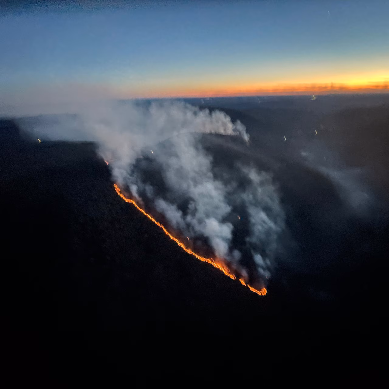
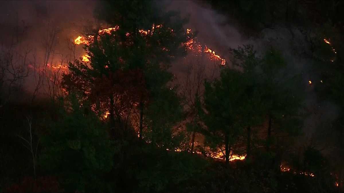
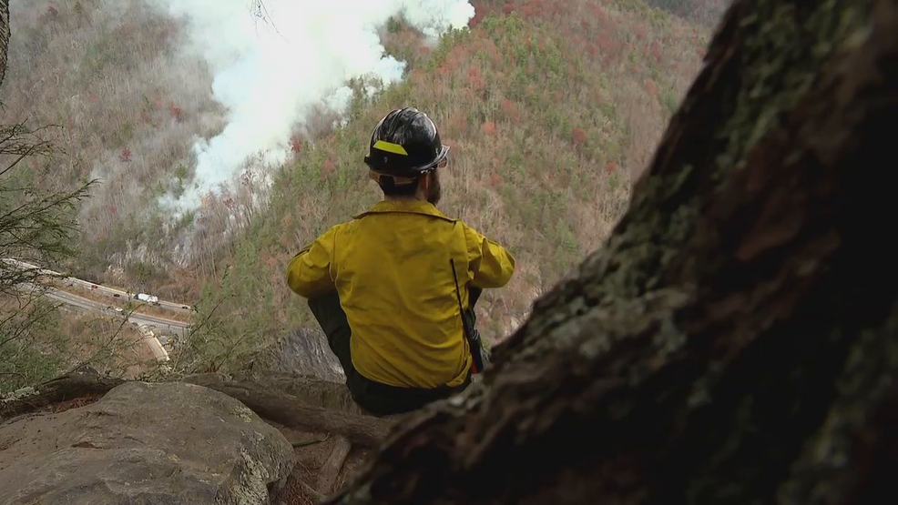
The Black Bear Fire in Haywood County, North Carolina, has rapidly grown to almost 1,200 acres due to steep slopes, dry weather, and windy conditions. Fire officials are using the latest tools and calling in additional crews to assess and combat the fire, while hoping for rain to help extinguish it.
The D.C.-area forecast predicts above-normal temperatures and below-average precipitation for the week, with highs reaching the 60s and dry conditions prevailing. Blustery winds are expected on Tuesday, making it feel colder. There is a chance of showers on Friday night, but the extent of rainfall is uncertain. The weekend is expected to be mostly clear with seasonable temperatures.
November in Washington, D.C. is expected to be cool and dry with fluctuating temperatures. The average temperature is projected to range from 47 to 49 degrees, slightly below the recent average. Rainfall is forecasted to be 1.5 to 2.5 inches, below the November norm of 2.91 inches. While November typically sees some snow, measurable snowfall is not expected this month. Computer models indicate slightly cooler and drier conditions for the first two weeks, with mixed signals for the second half. The El Niño pattern, which usually brings more precipitation, has not yet emerged. October was drier than normal, with only 0.65 inches of rain, and the third-warmest year on record continues in Washington, D.C.
A statewide burn ban has been implemented in Louisiana, prohibiting all "private" burning unless approved by local fire departments or government. The ban does not affect the use of barbeque grills, fire pits, and small campfires for recreational purposes. It is in response to dry conditions throughout the state, and violators will face consequences. The ban will remain in effect until further notice.
A heat wave is sweeping over Colorado, with high temperatures expected to be 3-5 degrees above average. Southern Colorado will experience hot and sunny weather with dry conditions and a light breeze. The forecast for various cities in the region predicts temperatures ranging from the 80s to the low 100s. Strenuous outdoor activities are cautioned against due to the dangerous heat, especially for the elderly and children. However, relief is expected by midweek as a cold front brings cooler temperatures and the possibility of thunderstorms.
After more than three weeks of no rain, SE Michigan is expected to receive some relief from drought conditions with showers forecasted for this weekend. A slow-moving cool front will bring much-needed rain to the area on Sunday, with some parts expected to receive up to half an inch of rain. However, the dry ground may cause some street flooding in flood-prone areas. The showers and storms are expected to move south of the area on Monday, leaving Metro Detroit mostly dry with some scattered showers possible on Thursday. The rest of the week is expected to be warm and dry with isolated shower chances on Sunday.
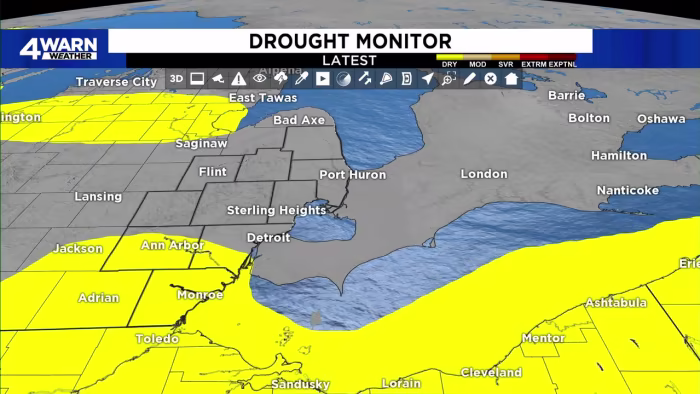
Air Quality Alerts will continue for most of the Midwest and East Coast due to hazy conditions caused by wildfire smoke from Canada. Temperatures will be in the 50s and 40s with a chance of a sprinkle or stray shower. It has been 19 days of dry conditions and no measurable rain at the Cleveland Hopkins International Airport. The latest Drought Monitor will be released today. The next chance of rain is Sunday evening into Monday with a small increase in humidity.
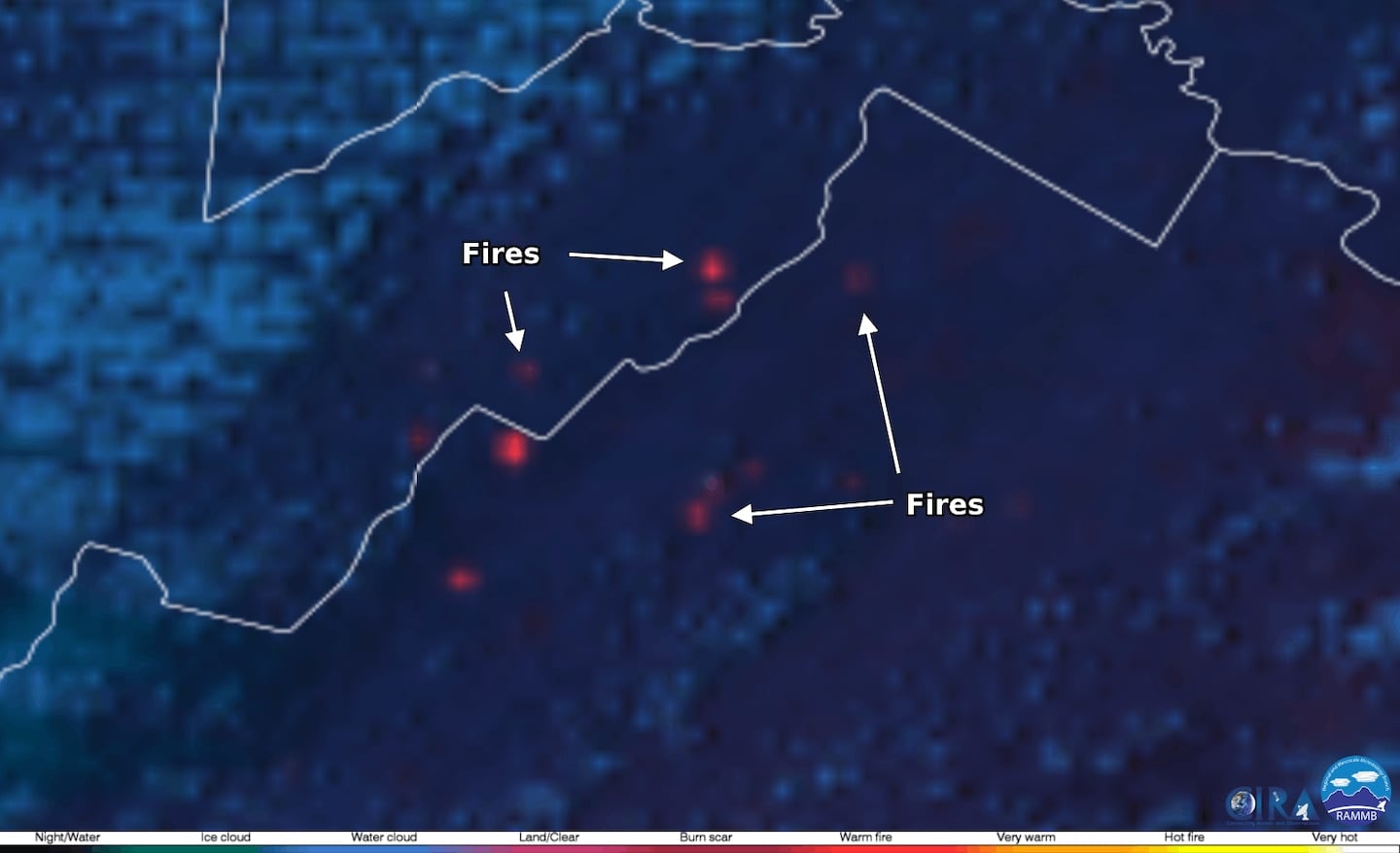
A large wildfire southeast of Grayling, Michigan, was ignited by a campfire on private property, burning 2,400 acres before firefighters contained more than 90% of the blaze. The wildfire happened in the heart of Crawford County’s jack pine forestland, an ecosystem at high risk for wildfire because of the dry conditions of jack pine stands. Dangerous fire risk conditions are expected to continue this week in the Grayling area and across the state. Locals are concerned about continued and future fire risk across the community, especially with the clear cutting of hardwood forests and replacing them with red pine plantations, another fire-prone species highly valued in the forestry industry as building material.
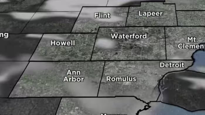
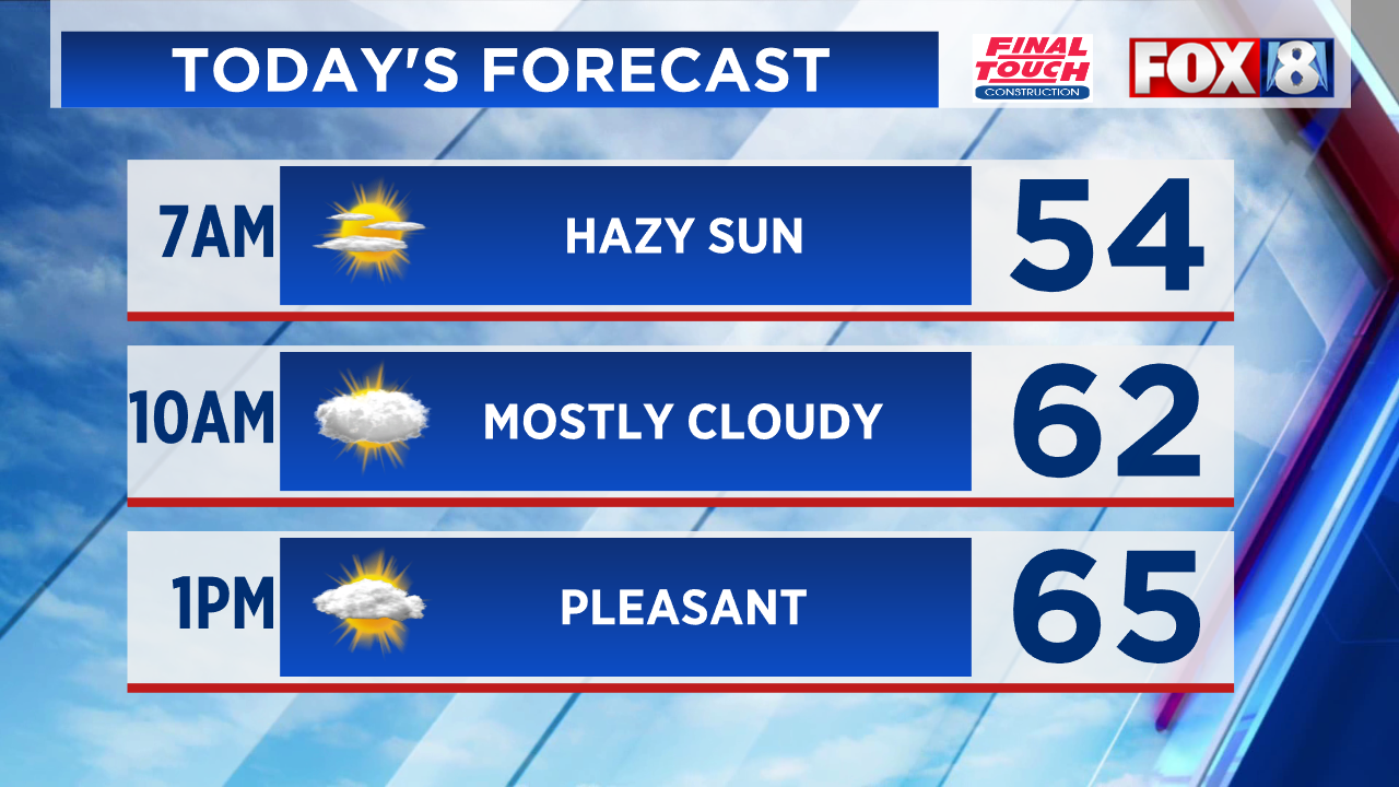
Abnormally dry conditions are expected to expand throughout Southeast Michigan, despite more moisture in the air. The fire danger risk will be "very high" to "exceptional" over the next several days. Sunday and Monday will see mostly sunny skies with highs in the lower 80s, while mid-week temperatures will be around normal in the mid to upper 70s.
Northeast Ohio and much of the state of Ohio are on the verge of a drought declaration due to prolonged hot and dry conditions. The National Oceanic and Atmospheric Administration's Drought Monitor Map took Ohio from perfectly fine to yellow, or D-0 conditions, in just one week from May 23 to May 30. Since then, there has been no rain and there is no significant rain in the foreseeable future. The dry conditions are leaving dry, brown yards, cracking soil, and wilting plants in outdoor gardens. Farmers are badly in need of rain, and many crops are in drought conditions.