Optimal Landing Spots for Future Mars Explorers Revealed in Detailed Water Map
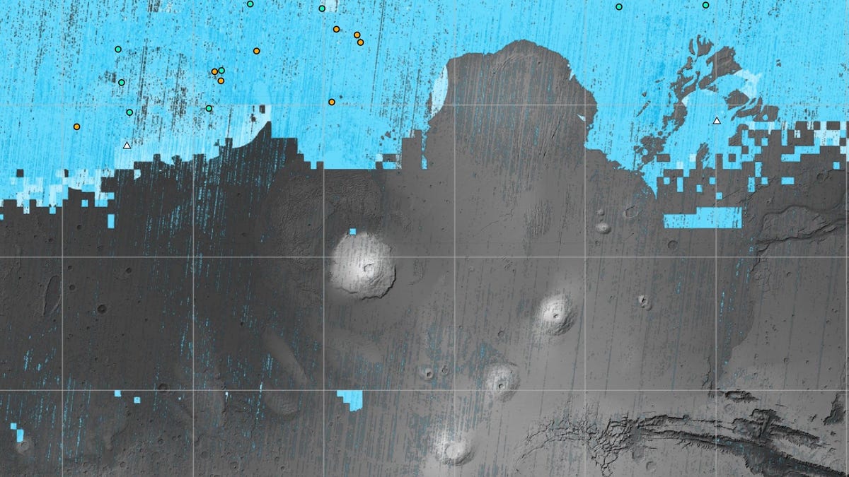
The NASA-funded Subsurface Water Ice Mapping project (SWIM) has released its most detailed map yet of subsurface water on Mars, identifying regions where ice may be buried beneath the surface for future astronauts to use. The map, created using data from NASA missions including the Mars Reconnaissance Orbiter, Mars Odyssey, and Mars Global Surveyor, reveals the possible locations of subsurface ice. The map shows that the ideal landing spot for future missions would be at the southernmost edge of the northern mid-latitudes region, where it is close enough to the buried ice but also not too far from the equator for slightly warmer weather. Subsurface ice is a valuable resource for astronauts, as it can be used for drinking water and making rocket fuel. The map could also provide insights into Mars' climate history.
Reading Insights
0
0
2 min
vs 4 min read
78%
614 → 134 words
Want the full story? Read the original article
Read on Gizmodo