Arctic chill returns to Philly as snow stubbornly sticks around
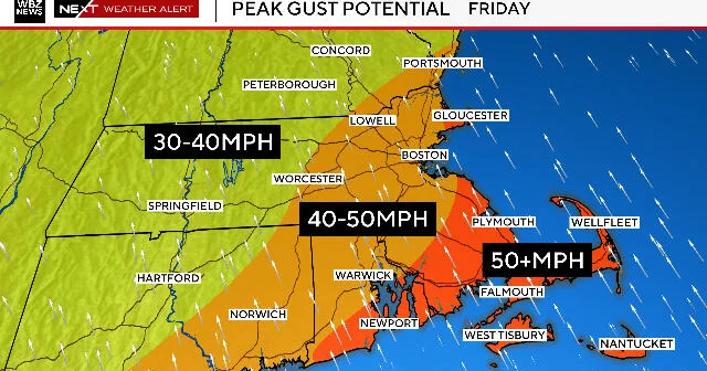
Arctic air is back in Philadelphia, with single-digit temps and gusts up to 60 mph that could cause outages while snow and ice linger on streets. Forecasters say there should be a warming trend into mid-next week, with highs in the 30s to near 40, which may start melting the snow, though overnight freezes and rain could refreeze surfaces and slow or complicate the melt. Exact timing for all snow to disappear remains uncertain and varies by neighborhood.