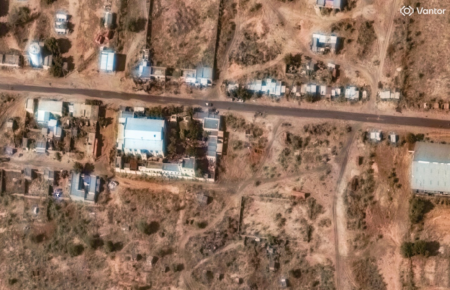
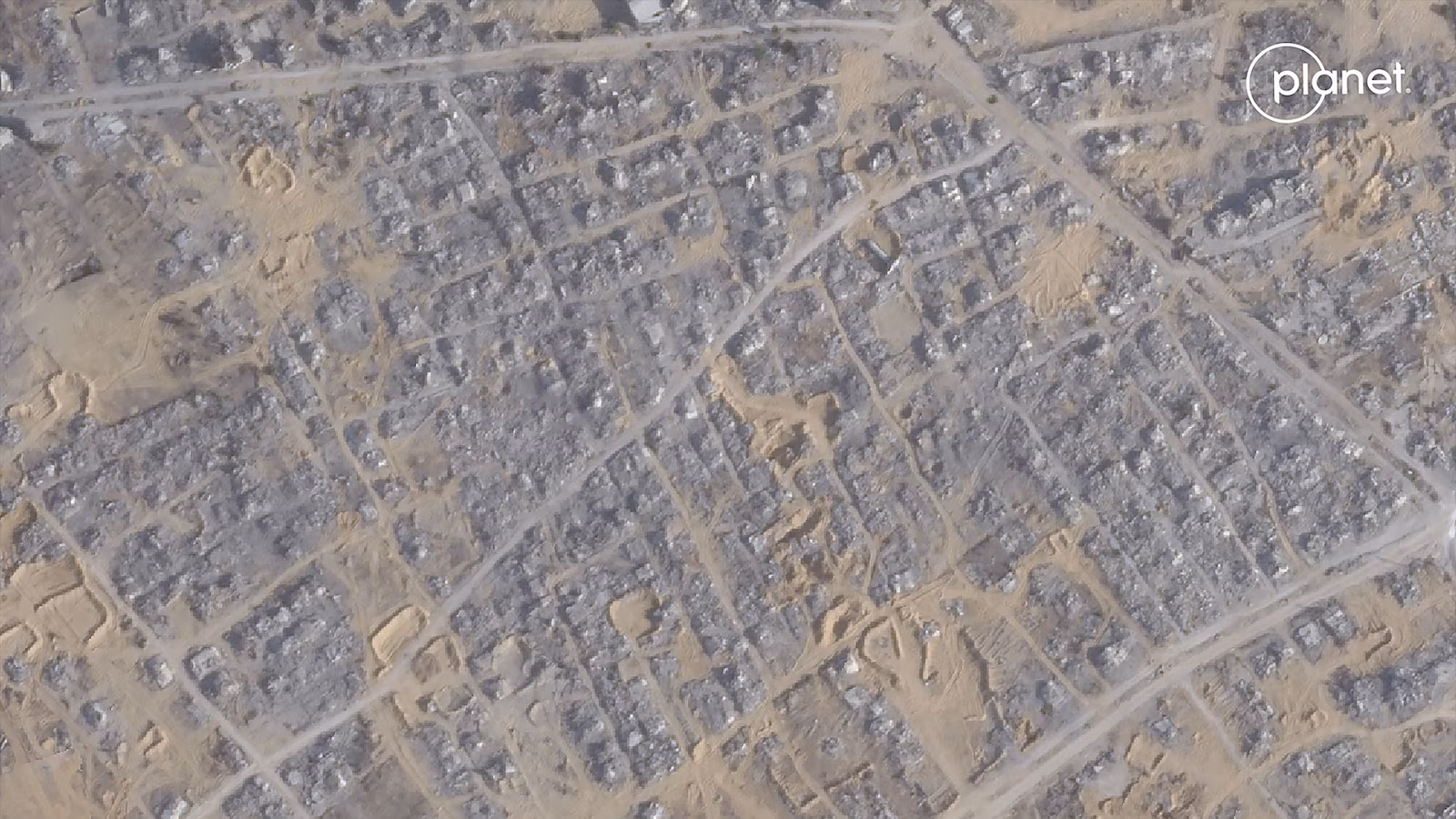
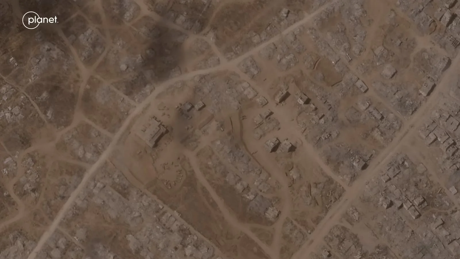
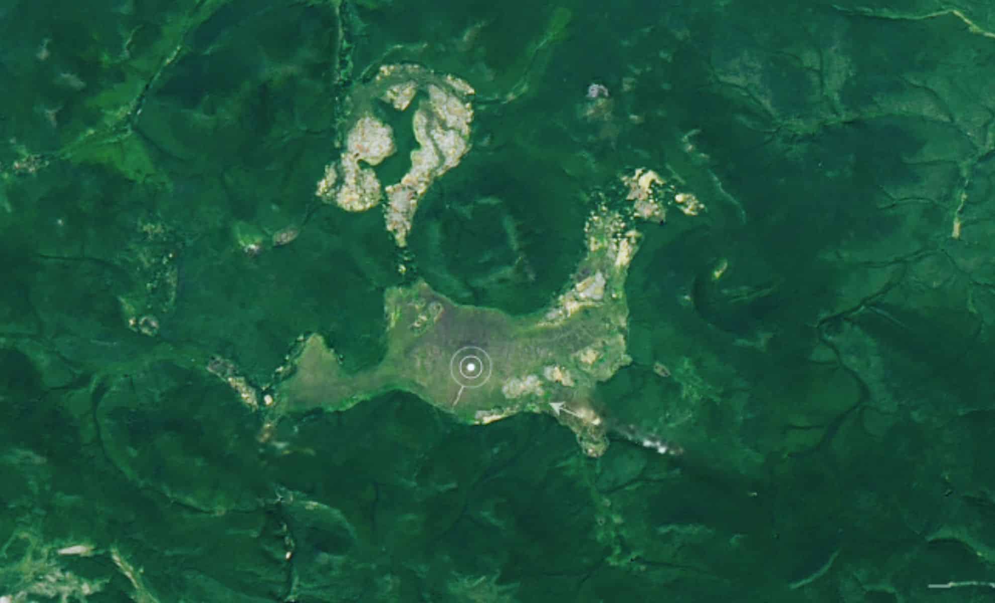
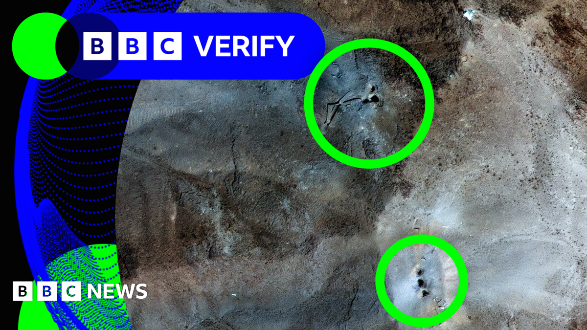
Satellite images suggest paramilitary forces in Sudan are disposing of bodies and digging mass graves in el-Fasher, Darfur, amid ongoing violence. The conflict has caused thousands of deaths, mass displacements, and a severe humanitarian crisis, with limited aid reaching affected populations. A tentative humanitarian truce has been proposed, but violence and attacks continue, complicating efforts for peace and accountability.
Satellite images suggest ongoing mass burials in el-Fasher, Sudan, amid violent clashes involving the RSF and Sudanese military, with reports of casualties, drone attacks, and severe humanitarian crises in the region.
Hurricane Melissa, a Category 5 storm, caused extensive destruction in Jamaica, especially in Black River where over 76% of buildings were damaged, leading to widespread power outages, infrastructure damage, and loss of life, with satellite images revealing the scale of devastation and ongoing recovery efforts.
Hurricane Melissa, a Category 5 storm and the strongest to hit Jamaica on record, caused extensive destruction across the Caribbean, especially in Jamaica where satellite images reveal significant damage to towns like White House and Black River, resulting in at least four deaths in Jamaica and additional fatalities in Haiti and the Dominican Republic.
Satellite images reveal the complete demolition of the White House East Wing to make way for a new ballroom as part of Donald Trump's renovation plans, while in Mali, Russian paramilitary forces are actively fighting Islamist insurgents, with around 2,500 mercenaries now deployed in the country.
Satellite images over the past two years reveal extensive destruction across Gaza, including entire towns like Umm al-Nasser and Al-Mughraqa, with thousands of buildings damaged or destroyed, significant displacement, and the destruction of most schools, amid ongoing conflict between Israel and Hamas.
Satellite images reveal extensive destruction in Gaza City caused by Israeli military operations, including the demolition of high-rise buildings, neighborhoods, and infrastructure, leading to widespread displacement and a dire humanitarian situation.
Satellite images reveal that the Gaza neighborhood of Zeitoun has been largely destroyed due to ongoing Israeli military operations, with the area transforming from intact buildings to rubble as Israel prepares for a full-scale assault on Gaza City, raising concerns about widespread devastation and civilian impact.
A Chinese coast guard ship involved in a collision in the South China Sea is now under repair at Hainan Island, confirmed by satellite images showing the damaged vessel at a naval base, amid ongoing tensions over territorial disputes and international rulings.
Satellite images indicate that the IDF is expanding its military operation in Gaza City, with signs of displacement among residents and increased military presence, including tanks and armored vehicles, as part of the operation called 'Gideon's Chariots II' aimed at dislodging Hamas.
AI is increasingly being used to assist rescue teams in finding missing people faster by analyzing satellite and drone imagery, with potential for fully automated drone search systems, though ethical and privacy concerns remain, especially regarding surveillance and consent.
Commercial satellite images indicate Israel is preparing for a possible ground invasion of Gaza, with troop movements near the border, amid ongoing tensions and discussions about military and humanitarian strategies. Israeli Prime Minister Netanyahu has expressed intentions to take control of Gaza to remove Hamas, while recent US-Israel relations have been tense, involving debates over humanitarian aid and the potential for a broader military operation. The situation remains complex, with international pressure and the risk of escalation.
Recent NASA satellite images have revealed the current state of the Tunguska blast zone from the 1908 explosion, which remains largely untouched despite its massive destructive force, fueling ongoing debates about whether an asteroid or comet caused the event and highlighting the importance of monitoring near-Earth objects for planetary defense.
Satellite images suggest the US avoided targeting Iran’s key research reactors at Isfahan during recent airstrikes, raising concerns about the impact on Iran’s nuclear program and international diplomacy. Iran responded with missile fire, and the strikes have intensified tensions and damaged non-proliferation efforts, with potential environmental hazards from damaged nuclear sites.
Satellite images reveal extensive damage at Iranian nuclear sites, including Natanz and Fordo, following US strikes, amid ongoing Iran-Israel tensions; meanwhile, the UK plans to reduce energy costs for businesses through a new industrial strategy.