Tag

Radar Forecast

All articles tagged with #radar forecast

weather1 year ago

Weekend Snowfall Forecast: Wintry Conditions and Cold Return

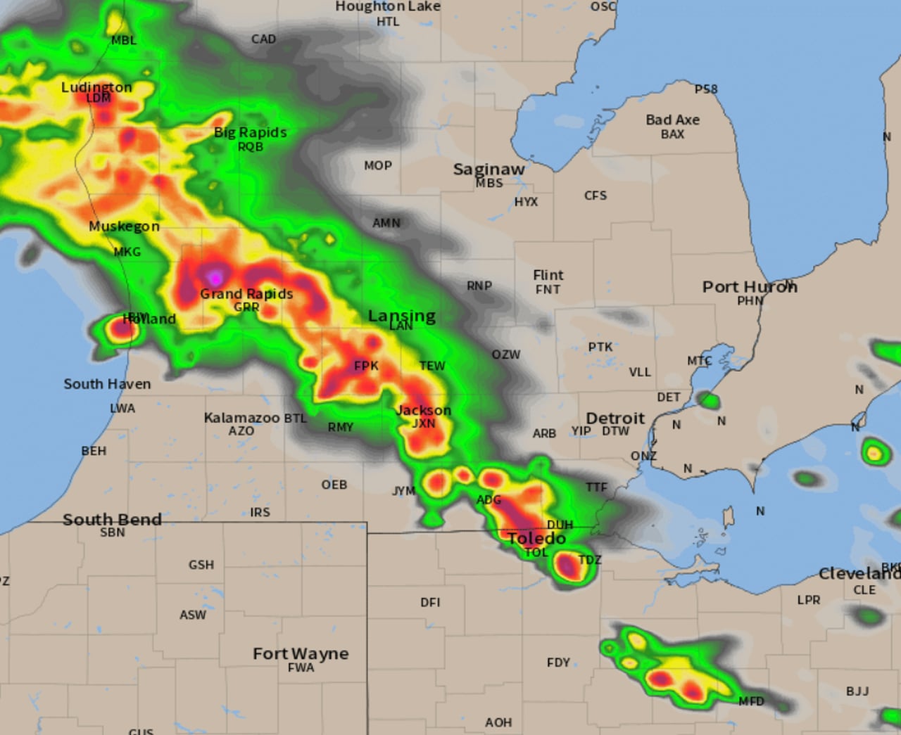
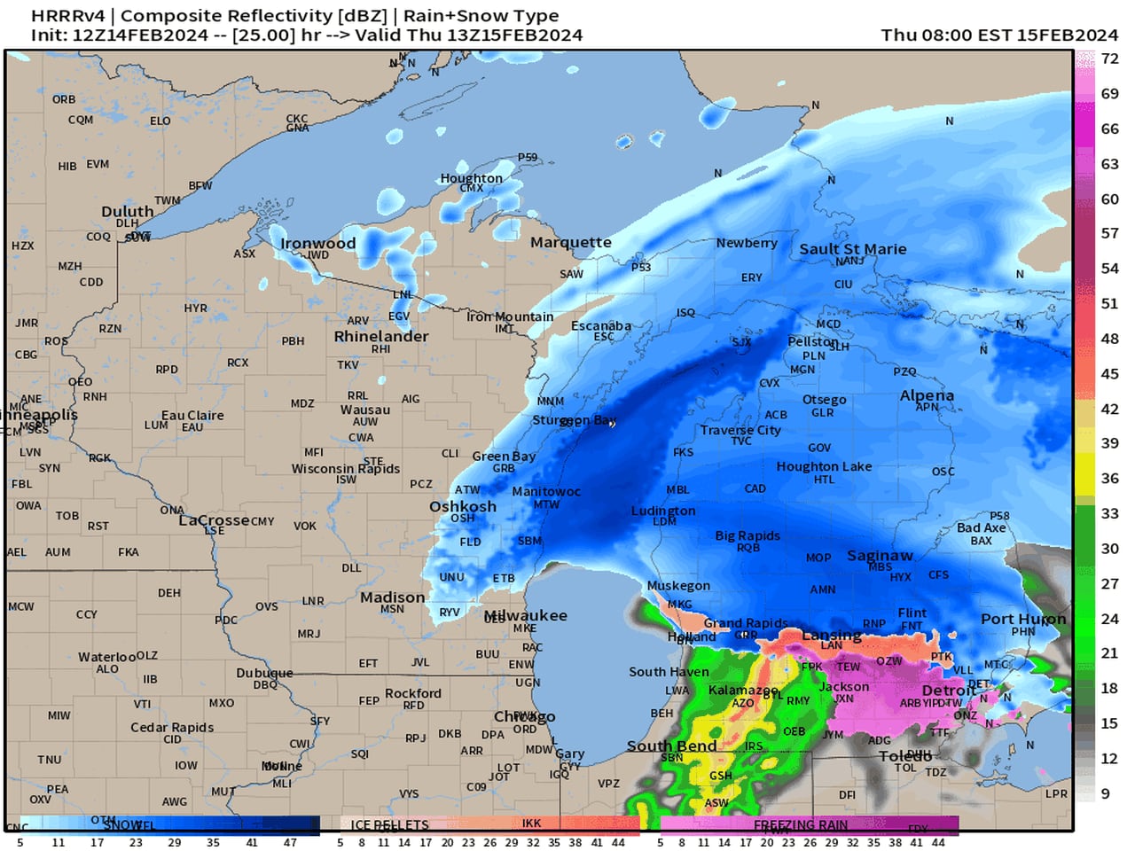
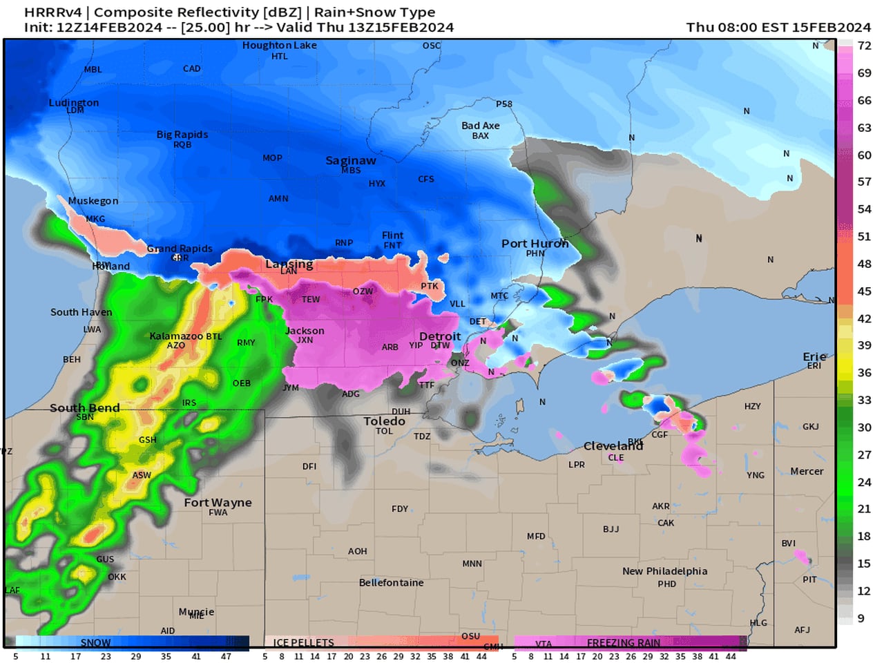
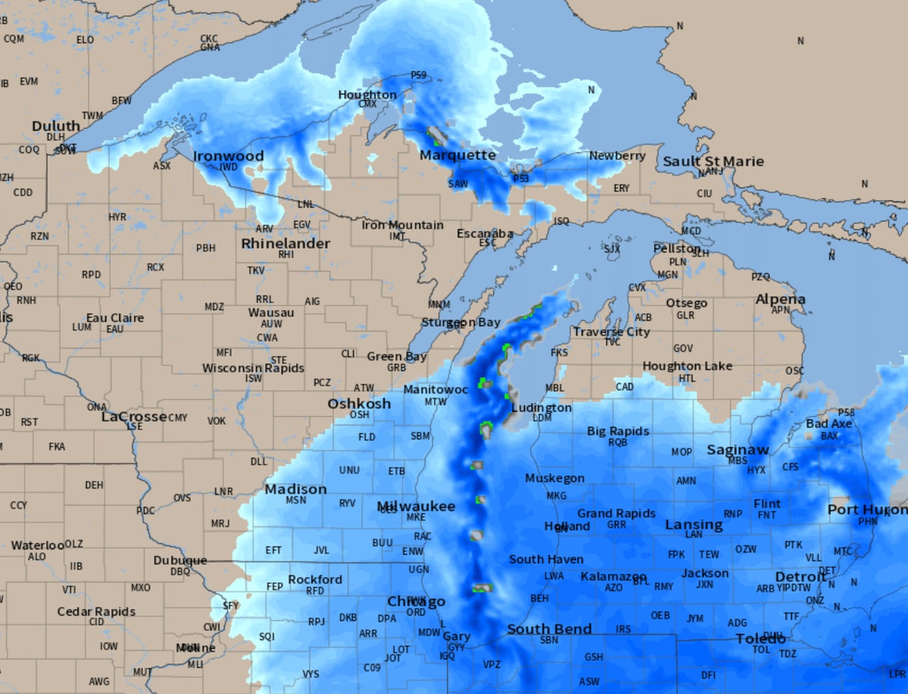
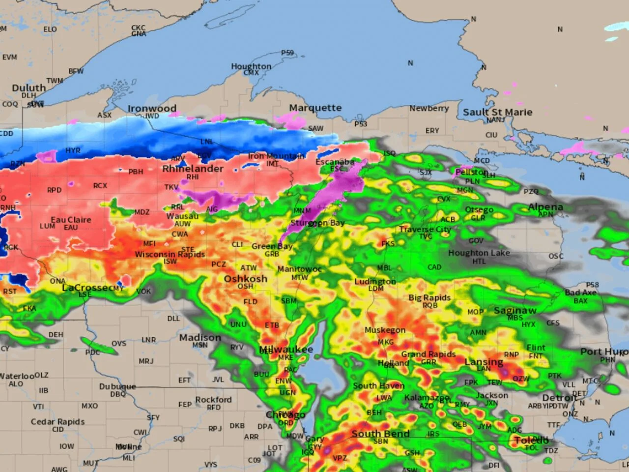
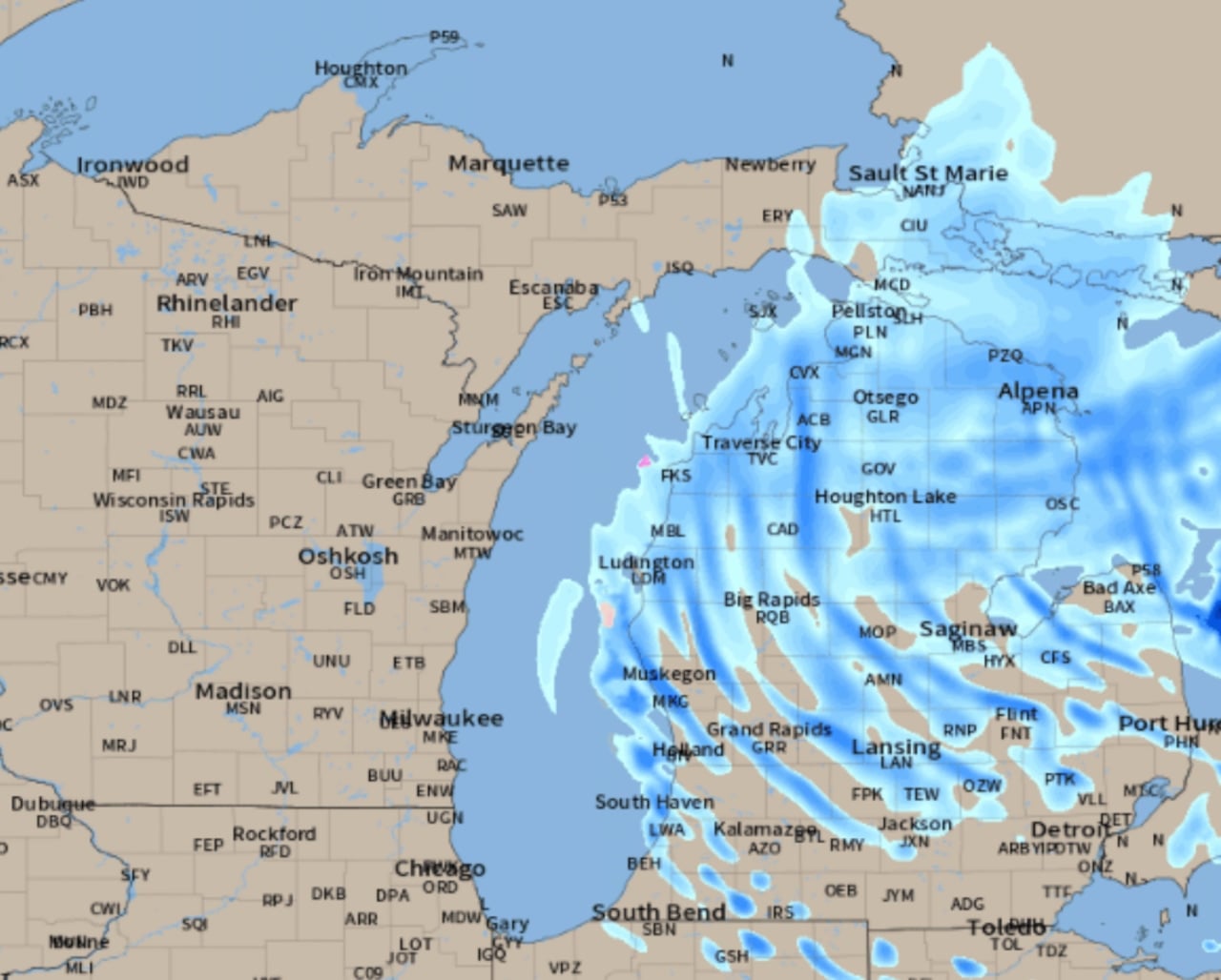
Widespread snow showers are expected across northern and southern Lower Michigan today and tonight, with accumulations ranging from two to five inches in the north and one to two inches in the south, potentially reaching up to three inches in the Thumb region. The snow is expected to melt on impact due to warm ground temperatures, but a wintry scene is still anticipated. However, warmer temperatures are forecasted for Monday and Tuesday, with highs reaching the 50s and 60s.

weather1 year ago

"Michigan Braces for Late Evening Severe Thunderstorms, Radar Forecast Warns"

Severe thunderstorms are forecasted to move across southern and central Lower Michigan late this evening and overnight, with the potential for large hail and isolated tornadoes. The storms are expected to hit southwest Michigan around 9 p.m. and move through other areas, including Grand Rapids, Kalamazoo, and Detroit, throughout the night. Residents are advised to take precautions, such as moving vehicles to shelter, keeping phones charged, and seeking safe shelter if necessary.

weather1 year ago

"Michigan's Winter Weather: Snow Accumulation and Rain/Snow Line Breakdown"

A fast-moving storm system is expected to bring a swath of solid snow across Lower Michigan, with the rain/snow line running from Grand Rapids to Flint. Areas north of this line, including Saginaw, Bay City, and Midland, are forecasted to experience several hours of heavy snow, with 2 to 5 inches of snow expected for most northern regions. Travelers are advised to wait until mid-afternoon for safer driving conditions, as intense snow rates and reduced visibility are anticipated in the morning.

weather1 year ago

"Michigan Storm System: Snowfall Breakdown by Region"

A fast-moving storm system is expected to bring a mix of rain and snow to southern Michigan, with the rain/snow line running from Grand Rapids to Flint. Areas south of this line, including Grand Rapids, Lansing, Flint, Kalamazoo, Jackson, Ann Arbor, and Detroit, are likely to see little to no snow accumulation as temperatures rise above freezing, causing the snow to melt. Meanwhile, areas north of the line could experience a few hours of accumulating snow, with the potential for 1-3 inches in Grand Rapids and Flint.

weather2 years ago

"Michigan's Sneaky Snowfall: Unpredictable Weather Patterns Bring Challenging Conditions"

A "sneaky snowstorm" is expected to bring light to moderate snow to southern Michigan, with heavier snowfall in some areas, including the Thumb and parts of Bay City and Saginaw. The storm will also bring heavy lake-effect snow to southwest Lower Michigan and the shoreline counties. The southern half of the state can expect 1 to 3 inches of snow, while Berrien County may see over a foot. The Upper Peninsula will experience over a foot of lake-effect snow. Motorists should prepare for slick driving conditions, and residents should be aware of the potential snowfall in their areas.

weather2 years ago

"Michigan Braces for Multiple Rounds of Wintry Weather and Winter Storm Watch"

Saginaw, Bay City, and Midland will experience a mix of rain and snow, with temperatures warming above freezing in Saginaw County but remaining near freezing in Bay and Midland counties. A total of 2 to 4 inches of snow is expected early Tuesday morning, followed by a changeover to rain in Saginaw County and a mix of rain and snow in Bay County and Midland. The storm will then transition back to snow Tuesday night and Wednesday, resulting in a couple of inches of snow in Saginaw County and 3 to 4 inches in Bay City and Midland. Roads are expected to improve Tuesday afternoon as temperatures warm, but caution is advised for treacherous conditions in the morning.

weather2 years ago

Rainy Weekend Ahead: Soaking Showers Expected to Persist

Rain will gradually shift south and out of Michigan, with steady rain expected in southeastern parts of the state while other areas see the rain taper off. As the storm moves east, another batch of rain will form due to the lake-effect process. The radar forecasts show a gradual tapering down of the first rain and an increase in the second rain area. Additional rainfall is expected in the Detroit and Ann Arbor areas, while most of the meaningful rain is done for the day in other parts of Michigan.

weather2 years ago

Rain Storm Update: Southward Adjustment and Timing for Heaviest Rain

A rain system is expected to move through Lower Michigan, with the heaviest rain falling across the southern half of the region, particularly in the southwest corner. Rain amounts will taper off quickly going northward, with areas like Traverse City, Grayling, Alpena, and northward potentially receiving little to no rain. The rain is forecasted to start in the southeast part of Lower Michigan in the late afternoon or evening and continue into early Tuesday afternoon. The rainfall forecast indicates at least an inch of rain south of a line from Grand Rapids to Flint, with potential for two to three inches in some areas. Northern Lower Michigan is expected to receive only a couple of tenths of an inch of rain at most.

weather2 years ago

Monday's Rain Forecast: What to Expect and Where

The storm system in Lower Michigan is breaking up, with the northeast part still experiencing significant rain while the rest of the region will only have occasional showers. A section of northwest Lower Michigan will remain dry. Monday will see sporadic light showers. The heavy rain in Illinois will track east and mostly stay south of Michigan. Northeast Lower Michigan will receive one to two inches of rain, while surrounding areas will see one-half inch to one inch of rain. The rest of southern Lower Michigan will have less than one-quarter inch of additional rain. Multiple storm systems lined up west of the current system are taking away some of its energy. The next rains are expected to arrive around Thursday and Friday or Saturday.

weather2 years ago

Michigan's Thursday Storm: Isolated Tornado and Severe Wind Gusts Timeline

A strong storm system is expected to move across Michigan on Thursday, with a chance of severe thunderstorms and isolated tornadoes. The Storm Prediction Center has identified southeast Lower Michigan as an area where severe thunderstorms could intensify, with a 15% chance of damaging winds and isolated large hail. There is also a 2% chance of a tornado in the Detroit metro area. The timing of the thunderstorms is forecasted to be between 8 a.m. and 6 p.m., with the strongest storms expected between 2 p.m. and 6 p.m. Grand Rapids, Kalamazoo, and Muskegon may experience a quick blast of gusty rain.

weather2 years ago

Unpredictable Weather: Weekend Forecast for Metro Detroit

A fast-moving upper-air disturbance is expected to bring showers and low-end thunderstorms to at least the southern half of Lower Michigan on Saturday morning. While the rain may linger into the afternoon for eastern Lower Michigan, the northern half of the state will likely experience tapering off showers. The forecast models show varying degrees of rainfall, with the southern half having the highest chance of precipitation. Sunday is expected to be dry.

weather2 years ago

Severe storms and hail forecasted for Michigan and Metro Detroit.

A line of severe thunderstorms is developing over northern Indiana and southwest Lower Michigan, which is expected to expand over the next few hours. The squall line of thunderstorms should sweep east across southern Lower Michigan at the time of peak intensity. The radar forecast shows an expanding line of severe thunderstorms sweeping east and northeast across most of Lower Michigan, with the most fuel to become severe over the southern half of Lower Michigan. The severe weather reports indicate very large hail occurring in the storms as they move through Indiana. Some of the severe thunderstorm warnings have been "considerable damage" warnings, meaning the storm could produce a lot of damage.

weather2 years ago

Michigan Braces for Severe Storms and Tornadoes.

Severe thunderstorms and tornadoes are moving east-northeast and tracking toward southern Michigan. The Storm Prediction Center warns of a risk of isolated tornadoes, scattered damaging wind gusts, and large hail for at least half of southern Lower Michigan. The tornado risk this evening stretches from Grand Rapids to near Lansing to Jackson and into the southwest corner of Lower Michigan, including Kalamazoo and Battle Creek. The thunderstorms will become widespread and race across all of Lower Michigan this evening, with the storms being severe up to 9 p.m. and then may start to weaken.