Rain Storm Update: Southward Adjustment and Timing for Heaviest Rain
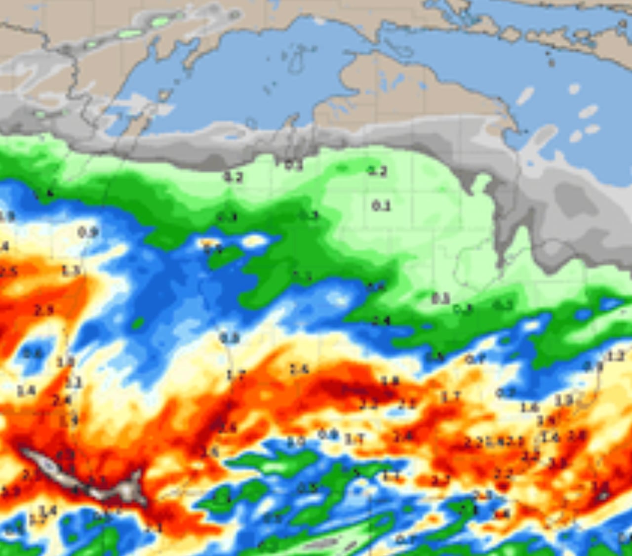
A rain system is expected to move through Lower Michigan, with the heaviest rain falling across the southern half of the region, particularly in the southwest corner. Rain amounts will taper off quickly going northward, with areas like Traverse City, Grayling, Alpena, and northward potentially receiving little to no rain. The rain is forecasted to start in the southeast part of Lower Michigan in the late afternoon or evening and continue into early Tuesday afternoon. The rainfall forecast indicates at least an inch of rain south of a line from Grand Rapids to Flint, with potential for two to three inches in some areas. Northern Lower Michigan is expected to receive only a couple of tenths of an inch of rain at most.
- Rain storm update: Southward adjustment to heaviest rain, timeline, amounts MLive.com
- Timing on 2 rounds of storms WJW FOX 8 News Cleveland
- A wet start to the week CBS4 Indy
- Rain likely to start the work week PennLive
- View Full Coverage on Google News
Reading Insights
0
7
1 min
vs 3 min read
71%
421 → 123 words
Want the full story? Read the original article
Read on MLive.com