Severe storms and hail forecasted for Michigan and Metro Detroit.
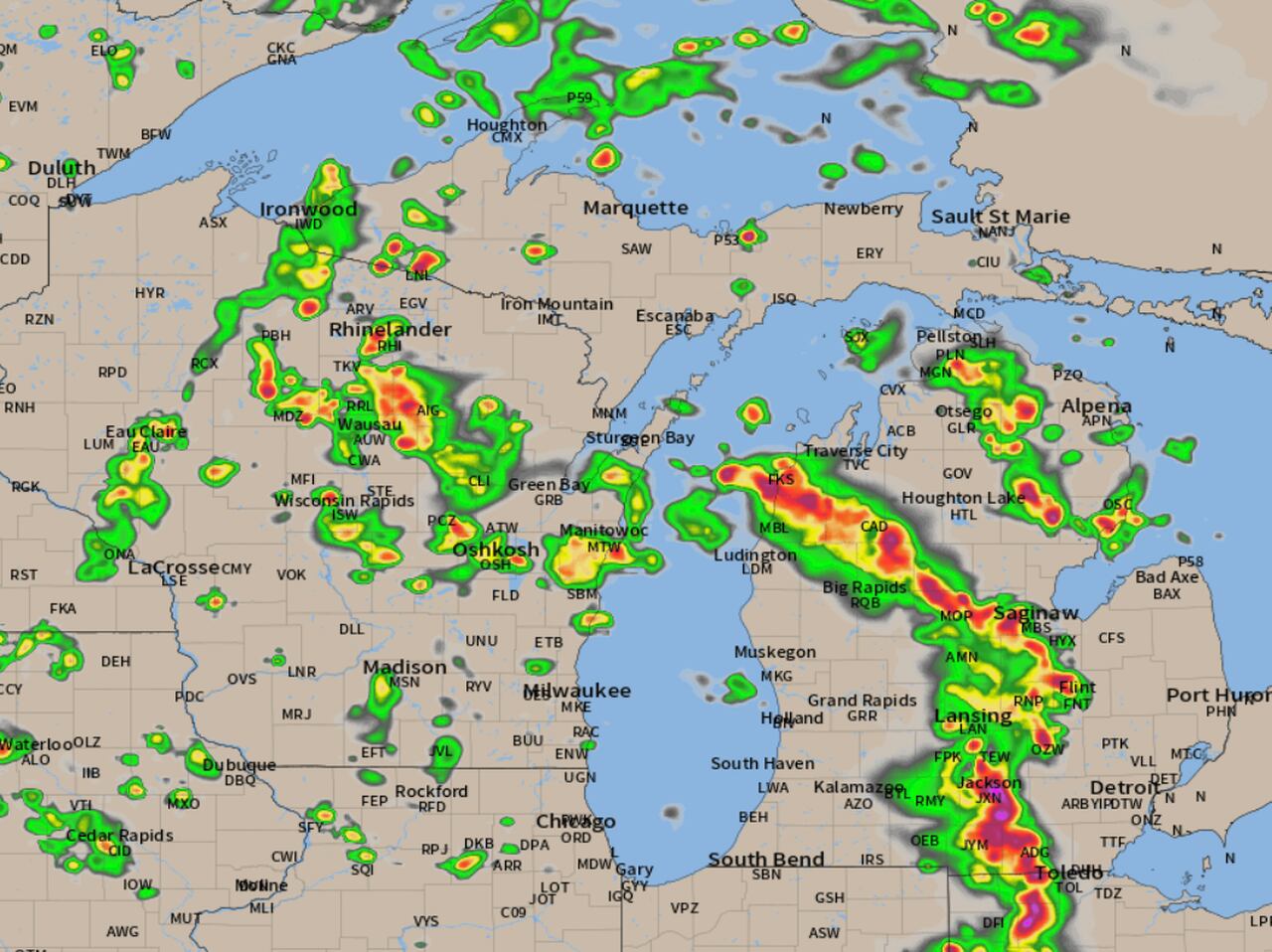
A line of severe thunderstorms is developing over northern Indiana and southwest Lower Michigan, which is expected to expand over the next few hours. The squall line of thunderstorms should sweep east across southern Lower Michigan at the time of peak intensity. The radar forecast shows an expanding line of severe thunderstorms sweeping east and northeast across most of Lower Michigan, with the most fuel to become severe over the southern half of Lower Michigan. The severe weather reports indicate very large hail occurring in the storms as they move through Indiana. Some of the severe thunderstorm warnings have been "considerable damage" warnings, meaning the storm could produce a lot of damage.
- Radar forecast shows timeline of possibly tornado producing, very large hail storms over Michigan MLive.com
- Possible severe storms could bring lightning, damaging winds, and large hail to Metro Detroit WDIV ClickOnDetroit
- Much needed rain and a few stronger storms return to the forecast Sunday WWMT-TV
- Scattered T-Showers Today into Monday morning then Nice Monday afternoon through Tuesday. KSTP
- Severe weather risk Sunday | WTHR Weather Blog WTHR
Reading Insights
0
0
2 min
vs 3 min read
81%
582 → 112 words
Want the full story? Read the original article
Read on MLive.com