SWOT Satellite Reveals Global River Flow From Space
TL;DR Summary
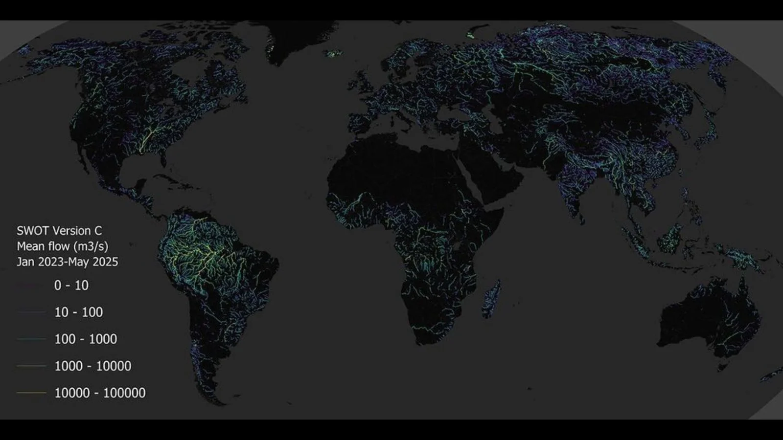
NASA and CNES’s SWOT mission has produced the first global, space-based estimate of river discharge and suspended sediment using the KaRIn radar. The global map, derived from SWOT data, highlights river networks around the world (rivers wider than ~50 meters) and fills gaps left by ground sensors, aiding flood forecasting, water management, and understanding how rivers transport nutrients and pollutants.
Reading Insights
Total Reads
0
Unique Readers
4
Time Saved
45 min
vs 46 min read
Condensed
99%
9,099 → 60 words
Want the full story? Read the original article
Read on Space