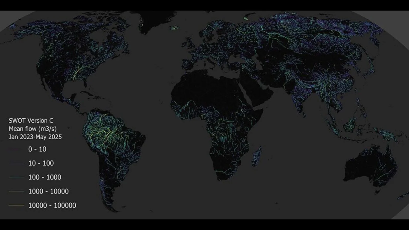
SWOT Satellite Reveals Global River Flow From Space
NASA and CNES’s SWOT mission has produced the first global, space-based estimate of river discharge and suspended sediment using the KaRIn radar. The global map, derived from SWOT data, highlights river networks around the world (rivers wider than ~50 meters) and fills gaps left by ground sensors, aiding flood forecasting, water management, and understanding how rivers transport nutrients and pollutants.