Mapping Arid Regions: NASA's Breakthrough in Surface Mineral Detection
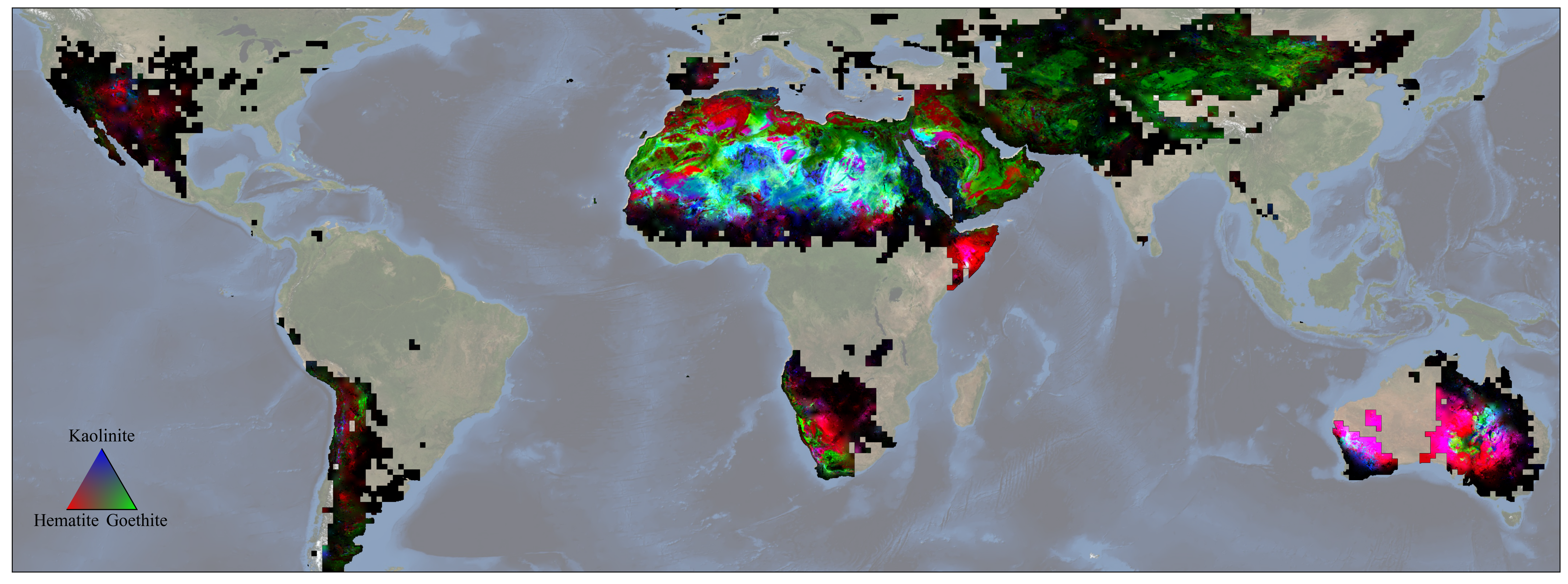
NASA's EMIT mission has produced the first global maps of surface minerals in arid regions, providing precise locations of 10 key minerals based on how they reflect and absorb light. These maps will help scientists model the role of fine particles in climate change and predict future climate impacts. EMIT, an imaging spectrometer, scans broad areas from the International Space Station, capturing detailed images of the Earth's surface. In addition to climate modeling, the mission's data can be used to study the impact of mineral dust on ecosystems and track the movement of nutrients across long distances. The mission also has the potential to discover new scientific insights and identify previously unknown substances on Earth's surface.
Reading Insights
0
1
4 min
vs 5 min read
88%
941 → 116 words
Want the full story? Read the original article
Read on NASA