Unveiling the Breathtaking Deep-Sea 'Grand Canyon' off the US Coast
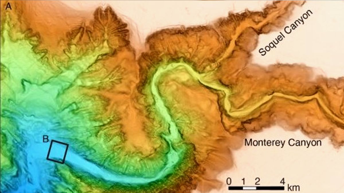
Researchers have created the clearest-ever maps of the Monterey Canyon, a massive deep-sea ravine off the coast of California. The maps, with centimeter-scale resolution, reveal the constantly changing topography of the underwater valley. The surveys conducted between 2015 and 2017 captured the canyon's seafloor in remarkable detail, providing valuable insights into the processes that shape it. The data showed that fast-moving turbidity currents and tides play a role in sculpting the seafloor, with their effects varying across the canyon. The high-resolution maps could also aid in studying deep-sea ecosystems and threatened species.
