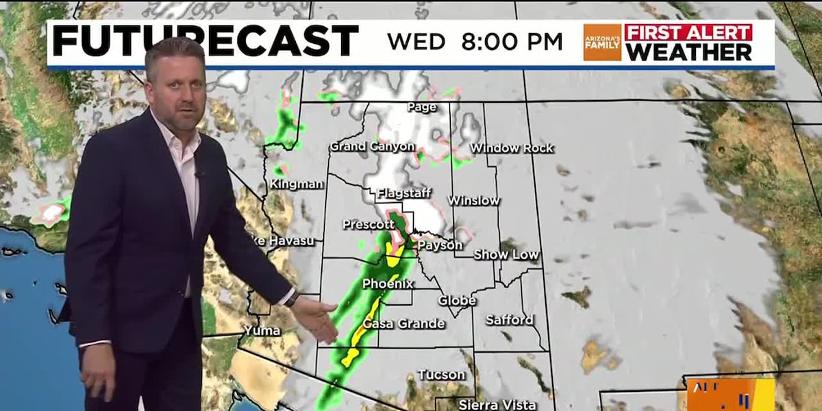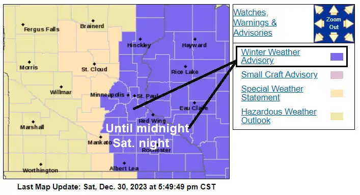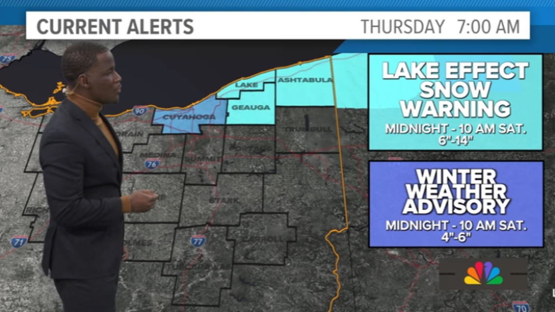
Lake Effect Snow Warning Issued for Northeast Ohio
The National Weather Service has issued a Lake Effect Snow Warning for Lake, Geauga, and Ashtabula Counties in Northeast Ohio, predicting heavy snowfall of 6-18 inches and poor visibility due to snow falling at 1-2 inches per hour. A Winter Weather Advisory is also in effect for Cuyahoga County. The snow is expected to impact travel on major interstates and last through the weekend, with residents and services preparing for challenging conditions.