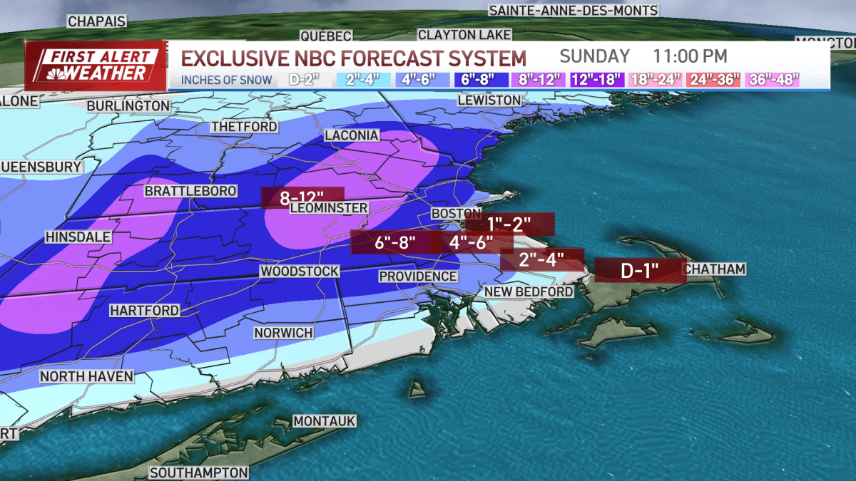
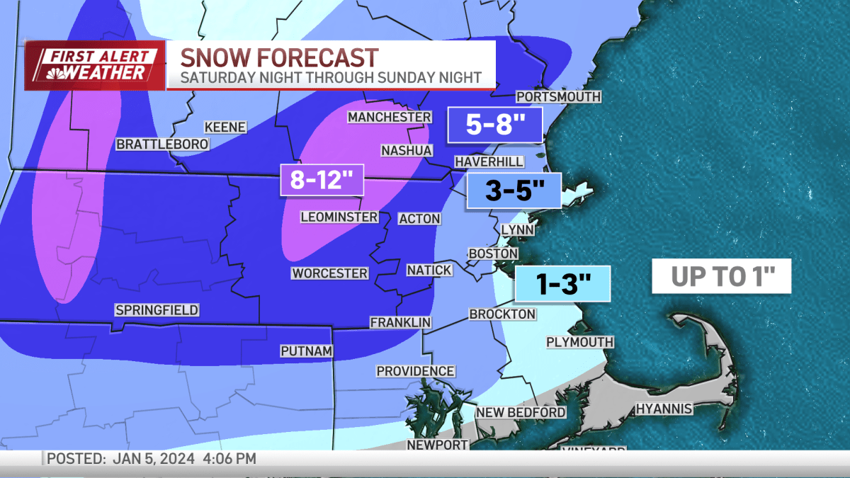
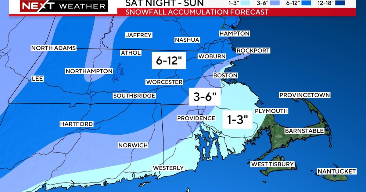
Massachusetts and southern New Hampshire are experiencing their first significant snowstorm in nearly two years, with a Winter Storm Warning in effect for Sunday. Snow accumulation is expected to vary, with 6-12 inches north and west of I-95 and Route 128, 3-6 inches in areas just northwest of Boston, and 1-3 inches from Boston to the South Shore. Coastal areas may see mainly rain until winds turn northerly. Winds could cause outages in heavy/wet snow areas, and a flash freeze is expected as temperatures drop rapidly in the evening. Another storm is forecasted for late Tuesday, potentially bringing heavy rain and flooding. Cleanup is advised between 4-8 p.m. tonight.
Southern New England, particularly Massachusetts, is bracing for its first significant snowstorm of the season, with up to a foot of snow expected in some areas. The National Weather Service has issued a Winter Storm Warning, with snow starting this evening and continuing into Sunday afternoon. Coastal regions may see lower snow totals due to mild ocean waters and gusty easterly winds, but a flash freeze is possible as temperatures drop. The storm will also bring strong winds, with gusts up to 50 mph. After this system, the region faces a cold start to the week and another potential storm mid-next week.
Boston is bracing for a significant winter storm this weekend, with snowfall totals ranging from an inch or two in the city to around 6 inches inland. The storm will bring wet snow, making snow removal challenging, and will affect travel with reduced visibility and slippery roads. Coastal areas may experience gusty winds. After a brief respite on Monday, another multifaceted storm is expected Tuesday, potentially bringing snow, rain, and strong winds.