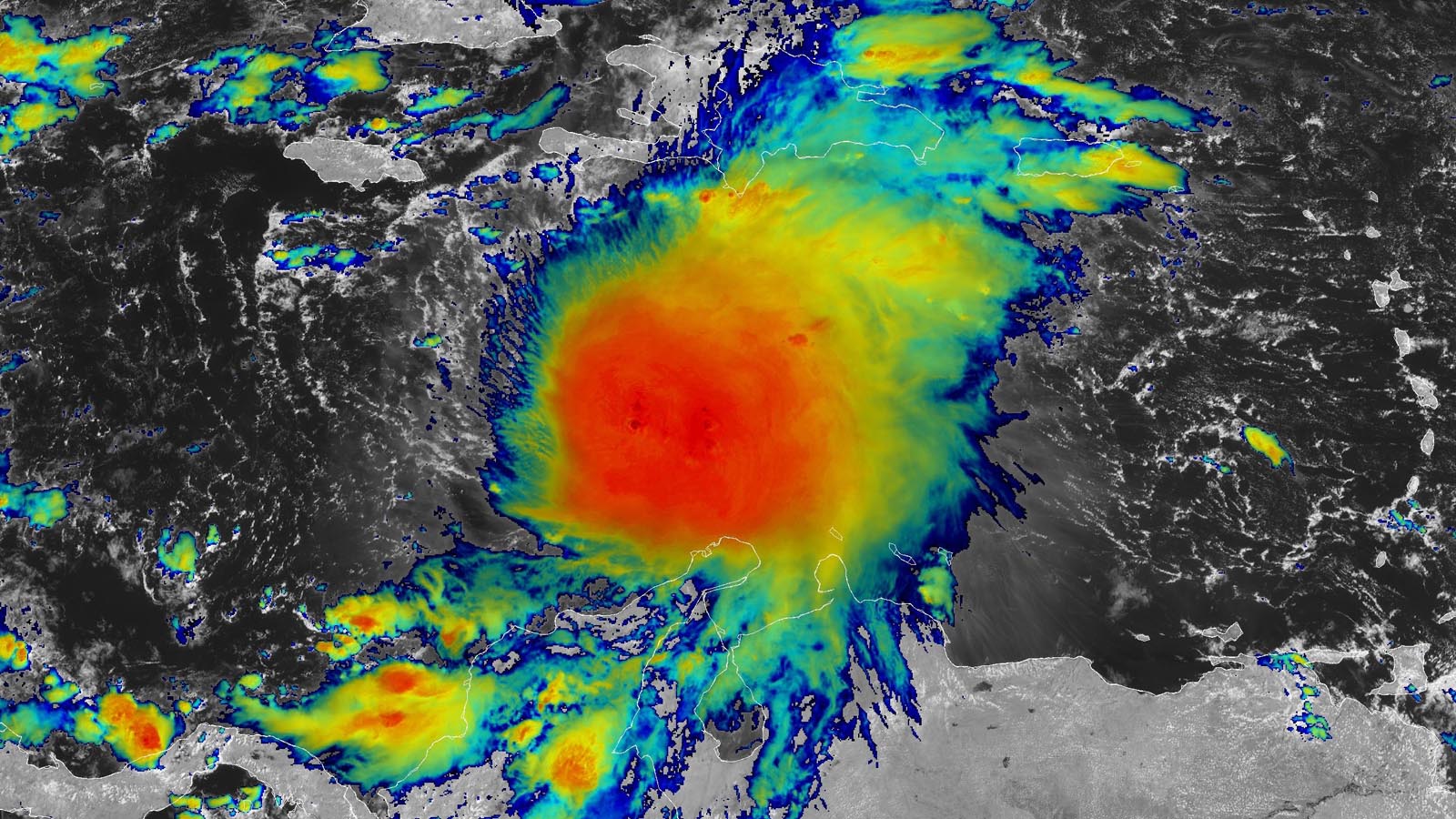
Tropical Storm Melissa is currently not strengthening but is expected to become a dangerous hurricane in the Caribbean, with potential for heavy rainfall, flooding, and mudslides in Haiti, the Dominican Republic, Cuba, and Jamaica, fueled by near-record warm waters and climate change impacts. Its future track is uncertain, but it may intensify into a major hurricane and pose threats mainly to Caribbean islands, with minimal risk to the U.S. for now.
A frontal boundary over Minnesota and Wisconsin will cause multiple rounds of thunderstorms and heavy rain over the weekend, with eastern Minnesota and western Wisconsin most likely to experience significant rainfall, potentially exceeding two inches per hour in some areas.
Fort Collins is experiencing a drastic weather change from hot and dry to chilly and rainy, with a 90% chance of rain and a temperature drop from 92 degrees to 66 degrees on Friday. The incoming weather system, fueled by remnants of Tropical Storm Harold and a strong cold front, is expected to bring heavy rainfall and potential flash flooding to the area. The National Weather Service forecasts rainfall amounts ranging from 0.90 inches in Denver/DIA to 2.24 inches in Fort Collins. While the exact location and intensity of the heaviest rain are uncertain, confidence is increasing for a significant rainfall event.
A rain system is expected to move through Lower Michigan, with the heaviest rain falling across the southern half of the region, particularly in the southwest corner. Rain amounts will taper off quickly going northward, with areas like Traverse City, Grayling, Alpena, and northward potentially receiving little to no rain. The rain is forecasted to start in the southeast part of Lower Michigan in the late afternoon or evening and continue into early Tuesday afternoon. The rainfall forecast indicates at least an inch of rain south of a line from Grand Rapids to Flint, with potential for two to three inches in some areas. Northern Lower Michigan is expected to receive only a couple of tenths of an inch of rain at most.
Lingering showers will continue in southern Minnesota on Monday, accompanied by below-normal temperatures. However, Tuesday will bring a return of sunshine and seasonable temperatures. Midweek will see a temporary warm-up, with the possibility of showers and thunderstorms in northern Minnesota. This will be followed by a slight drop in temperatures on Thursday.