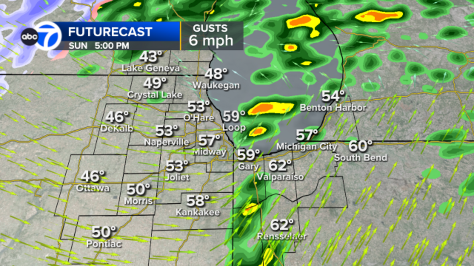
A weather alert in Chicago reports heavy rain, thunderstorms, dense fog, and strong winds, with a cold front bringing wind gusts up to 55 mph, potential power outages, and cold temperatures, impacting holiday travel and airport conditions.
South Carolina is bracing for plummeting temperatures in two waves, with the first wave hitting on Tuesday and the second on Saturday. Temperatures are expected to drop throughout the week, with Wednesday morning seeing the coldest temperatures so far this winter. Thursday and Friday will be slightly warmer, but another cold blast is expected on Saturday, with lows dipping to single digits and teens.
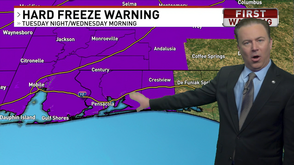
Northwest Florida is bracing for a cold blast with a hard freeze warning in effect Tuesday night into Wednesday morning, prompting alerts from the National Weather Service to protect sensitive vegetation and outdoor plumbing. Inland areas are expected to see temperatures dip into the teens, while coastal areas will experience lows in the low 20s. Parts of Alabama are under a winter weather advisory with the possibility of freezing rain and minor ice accumulation, leading to hazardous road conditions. Wind chill advisories have also been issued due to cold and breezy conditions.
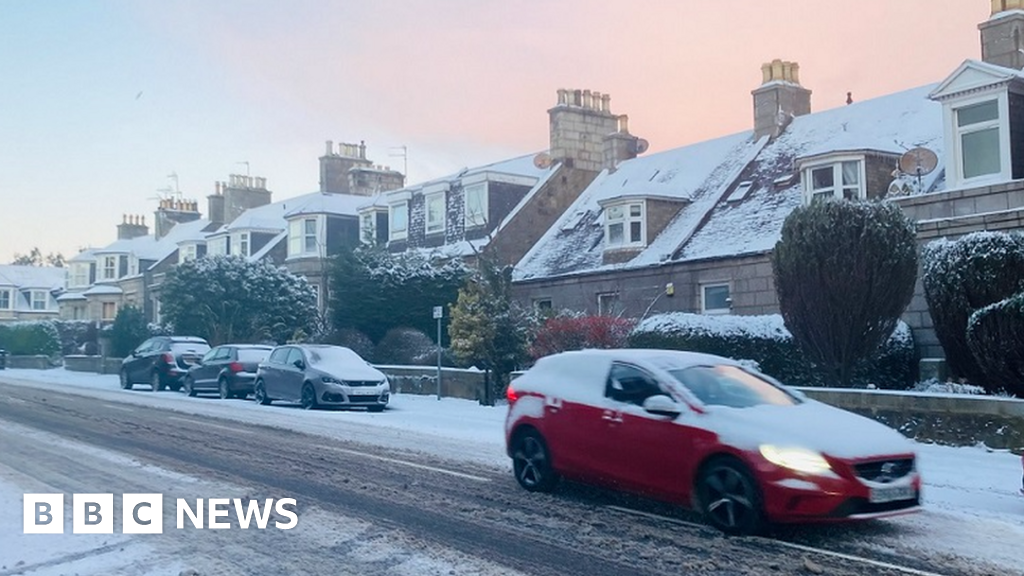
Arctic winds are bringing cold weather and potential snow showers across the UK, with yellow weather warnings for snow and ice issued for Northern Ireland, Scotland, and parts of England. Heavy snow has already hit northern Scotland, leading to school closures and travel disruption. Temperatures are expected to feel below freezing in most places, with some of the coldest weather this winter. The cold weather has triggered automatic payments for heating costs for eligible households in certain areas. An amber cold weather warning has been issued for the whole of England, emphasizing the importance of checking on vulnerable individuals.
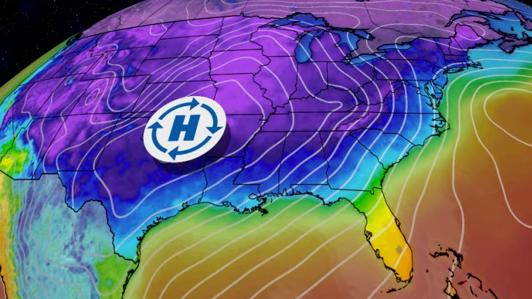
A widespread cold snap is moving across the Lower 48, bringing the coldest air of the season so far. Many areas could experience their first frost or freeze, and several cities may break daily record lows, particularly on Wednesday and Thursday. The cold air is originating from a strong high-pressure system stretching from western Canada to the Plains, and it has already reached as far south as Texas and as far east as the Great Lakes. Frost and freeze alerts have been issued for parts of the Southwest, Midwest, Southeast, and interior Northeast, with more alerts expected. Over four dozen locations could be within a few degrees of daily record lows.