"Beating the Heat: Smart Strategies for Cities, Power Grids, and Individuals"
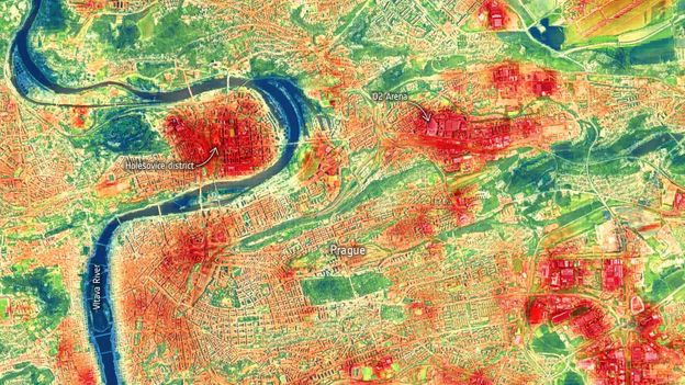
Satellite images captured by the International Space Station reveal the impact of green spaces, white road surfaces, and water features in helping cities cool down during heatwaves. These images are valuable assets for city planners as heat-related deaths continue to rise. The data can be used to identify hotspots, vulnerable regions, and assess the cooling impacts of heat mitigation approaches. Simple adjustments such as installing more green spaces, planting trees, and painting concrete surfaces white have proven effective in combating trapped heat. Cities like Paris, Seville, Rotterdam, and Athens have implemented innovative strategies to combat heatwaves, including creating cool islands, installing awnings and fountains, and planting vegetation on rooftops. Future satellite technology aims to provide even higher resolution images for more detailed planning.
Reading Insights
0
1
7 min
vs 8 min read
92%
1,468 → 123 words
Want the full story? Read the original article
Read on BBC