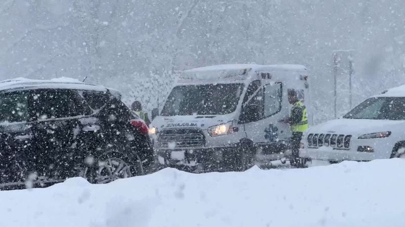
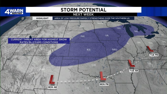
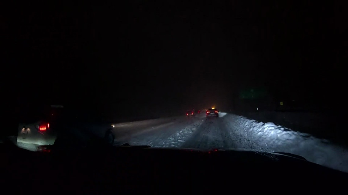
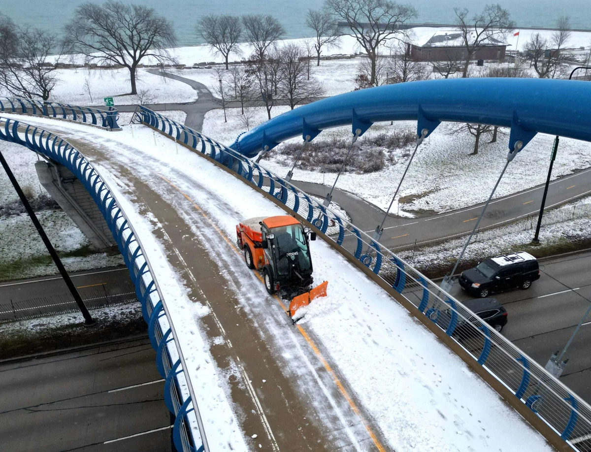
Western New York is experiencing severe winter weather, prompting travel advisories and bans in several areas, including Erie, Genesee, Wyoming, Chautauqua, and Cattaraugus counties. A Lake Effect Snow Warning is in effect, and a State of Emergency has been declared by Governor Kathy Hochul. Specific travel bans and advisories are in place for various towns and routes, with updates expected as conditions change.
A new Arctic blast is set to bring frigid temperatures, snow, and hazardous travel conditions to 30 states from North Dakota to Georgia, raising concerns about the potential severity of the upcoming winter season.
A frigid Arctic air mass has descended on the eastern United States, bringing the coldest temperatures since last winter and triggering a major lake-effect snow event in the Great Lakes region. Temperatures are expected to drop 15 to 25 degrees across a wide area, with nearly 70% of the US population experiencing freezing conditions. Winter weather alerts affect nearly 10 million people, with snow accumulations potentially reaching 4 to 6 feet in some areas. The severe weather has led to dangerous travel conditions and road closures, particularly in New York and Pennsylvania.
The first snow of the season is expected on Saturday, with the KOMU 8 First Alert Weather Team placing the Storm Mode Index at 2 out of 5 due to potential travel disruptions. Snow will start in the morning, becoming widespread after daybreak and exiting by afternoon, with most areas seeing 2-4 inches. A Winter Weather Advisory is in effect from 6am to 6pm, particularly along and north of I-70, where heavier snow bands may develop. Cold conditions are expected for the Mizzou gameday, with temperatures in the 30s and wind chills in the 20s. A warming trend is anticipated early next week.
Oregon and Washington are bracing for impactful snow and ice by Saturday, with Portland likely to see snow accumulation ranging from 1 to nearly 10 inches. The timing of moisture and cold air will determine the locations and accumulation, with rain potentially creating a sheet of ice before the snow. Icy conditions are expected to increase power outage risk and make travel near impossible, especially south of Wilsonville along the Willamette Valley. Portland is expected to stay clear of the iciest conditions due to cold easterly winds, with scattered snow showers starting Friday morning and persisting through Saturday. Sub-freezing temperatures will keep any snow or ice on the ground through the start of next week.
Maine is experiencing significant snowfall, leading to challenging travel conditions across the state. Coastal areas are facing low visibility due to winds up to 20 mph, and heavy snowfall is expected, with 12 to 18 inches in areas from Kennebunk to New Hampshire, 8 to 12 inches from northern York County through the midcoast including Portland, and 2 to 8 inches in the mountains. Residents are advised to be cautious if traveling.
Upstate New York is experiencing its largest snowstorm of the season, with more snow expected before the storm moves out to sea tonight. Central New York has received over 7 inches, with an additional 2 to 4 inches forecasted. The Hudson Valley has been hit hardest, with up to 14 inches of snow. Winter storm warnings are in effect, and hazardous driving conditions are expected throughout the day. A new storm system is anticipated to bring heavy rain and high winds by Tuesday night, raising concerns for power outages and flooding, especially in the Hudson Valley.
Massachusetts and southern New Hampshire are experiencing their first significant snowstorm in nearly two years, with a Winter Storm Warning in effect for Sunday. Snow accumulation is expected to vary, with 6-12 inches north and west of I-95 and Route 128, 3-6 inches in areas just northwest of Boston, and 1-3 inches from Boston to the South Shore. Coastal areas may see mainly rain until winds turn northerly. Winds could cause outages in heavy/wet snow areas, and a flash freeze is expected as temperatures drop rapidly in the evening. Another storm is forecasted for late Tuesday, potentially bringing heavy rain and flooding. Cleanup is advised between 4-8 p.m. tonight.
A significant nor'easter brought heavy snowfall to parts of the Northeast, with some areas receiving over half a foot of snow. The storm affected 35 million Americans, with winter storm warnings in place for the interior mid-Atlantic, Northeast, and New England. Cities like Boston and Worcester are expected to see substantial snowfall, while New York City and Philadelphia experienced minimal accumulation due to warmer temperatures. The snow, which is wet and heavy, could lead to downed trees and power outages. Snow plow crews are working to clear roads, and residents are advised to stay home if possible.
Metro Detroit is bracing for significant winter weather next week, with a storm system expected to bring rain, snow, and gusty winds starting late Monday night or early Tuesday. Light snow and foggy conditions will persist over the weekend, potentially leading to slick roads and black ice. The weather will also affect Michigan fans traveling to Houston for the College Football Playoff National Championship, with rain and thunderstorms predicted. The severity of the weather in Southeast Michigan will depend on the track of the low-pressure system and temperatures, with greater snow chances north and west of Metro Detroit. Residents are advised to stay updated with forecasts and to download the Local4Casters weather app for the latest information.
Chicago is bracing for a significant winter storm system predicted by the National Weather Service to hit Monday night, following a lighter snowfall over the weekend. The storm is expected to come in two main rounds, potentially impacting travel with heavy, wet snow and gusty winds, especially near and south of I-80. While the exact storm track remains uncertain, officials urge residents to stay updated on forecasts and prepare for changing travel conditions. This comes after Chicago's notably warm December, capping off the city's third warmest year on record.
A nor'easter is impacting the mid-Atlantic to Northeast regions, bringing a mix of rain, sleet, and snow. In Maryland, families are enjoying the snow with activities like making snow angels and sledding, while snow plow drivers anticipate business from the storm. However, the snow also poses dangers, causing vehicle accidents and road closures. Public works departments are preparing to tackle the slippery conditions to ensure safety.
Interstate 80 over Donner Summit has reopened after a closure caused by severe winter weather and multiple vehicle spinouts. Chain controls are now in effect along the route from the Nevada-California state line to Alta in both directions. The closure affected both eastbound and westbound lanes, with westbound lanes reopening earlier in the day and eastbound lanes remaining closed for a period. Authorities had advised staying home due to the deteriorating conditions.
Chicago is bracing for a significant winter storm system predicted to hit Monday night, with the National Weather Service (NWS) forecasting two main rounds of snow that could impact travel. Scattered flurries have already created slick conditions, and more than two inches of snow are expected, particularly near and south of I-80. The storm's exact path remains uncertain, but heavy snow with gusting winds is anticipated, potentially transitioning to rain near Lake Michigan. Officials advise residents to stay updated on the forecast and prepare for possible travel disruptions.
Northeast Ohio is expecting a minor snow event over the weekend as a strong storm system passes mainly to the east, with higher impacts anticipated in Pennsylvania, New York, and the northeastern United States. Snow will spread north on Saturday, with scattered snow continuing into Sunday, especially east of Cleveland. Most areas in Ohio will see less than 2 inches, with isolated spots receiving slightly more. No major advisories are in effect, but caution is advised on the roads due to potential slick spots and reduced visibility. Conditions are expected to improve by late Sunday, with dry weather on Monday before another system arrives on Tuesday.