Tag

Wgal

All articles tagged with #wgal

weather2 years ago

"Anticipating a Snowy Blanket: Winter Storm Forecast"

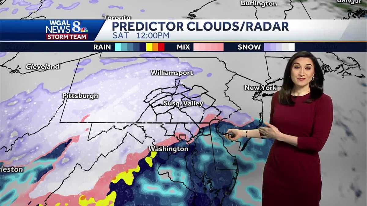
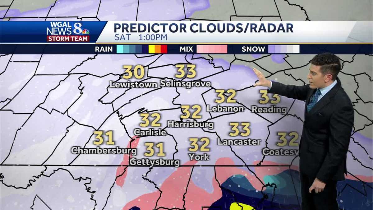
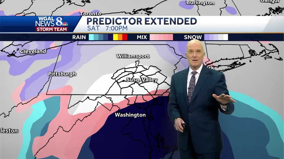
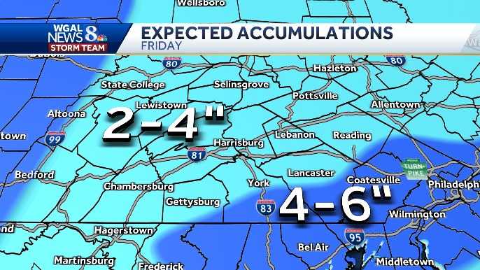
A winter storm is expected to bring 2-4 inches of fluffy snow to South-Central Pennsylvania, with slightly higher totals of 4-6 inches in some areas. The snow is anticipated to start between 3 a.m. and 8 a.m. on Friday, leading to a slow morning commute and continuing through the afternoon before tapering off by evening. Wind chills on Saturday morning will be near zero, with potential blowing and drifting snow due to 15-25 mph northwesterly winds. Travel impacts are expected throughout the day, and residents are advised to stay updated with WGAL for the latest weather alerts and information.

weather2 years ago

Pennsylvania's Friday Snowstorm: Hourly Projections and Impact on Commute

Hour-by-hour snow projections for Friday in South-Central Pennsylvania indicate light snow throughout the day with 2 to 4 inches of accumulation and snow-covered roads, impacting Friday evening commutes. The forecast also includes a Winter Weather Toolkit and ways to stay weather aware, as well as instructions for sharing weather photos and videos with WGAL.

weather2 years ago

"Predicting Snowfall: South-Central Pennsylvania Braces for Winter Storm"

South-central Pennsylvania is bracing for a winter storm set to begin Saturday morning, with snowfall expected to start in the southernmost counties and spread across the area by lunchtime. The storm may bring a mix of snow, sleet, and freezing rain, particularly in York and Lancaster counties, before changing to rain in southeastern counties. Accumulations of 2 to 5 inches are expected for most of the area, with 5 to 8 inches possible north and west of Harrisburg. Winter storm watches are in effect, and residents are advised to complete errands early and exercise caution while traveling. The storm is predicted to conclude by Sunday evening, followed by a brief break before another system arrives midweek.

weather2 years ago

"Snowfall Variability in Pennsylvania: Weekend Projections and Regional Expectations"

South-central Pennsylvania is bracing for a winter storm with hour-by-hour snow projections available for the Susquehanna Valley. The forecast indicates snow starting around noon with increasing intensity into the evening, potentially affecting travel with slick roads, especially in untreated areas. The storm is classified as an Impact Day due to its potential to disrupt normal routines. Residents are encouraged to stay informed through WGAL's various weather tools and to share weather photos and videos. The storm is expected to taper off Saturday night, followed by light snow and flurries on Sunday, with another system quickly approaching thereafter.

weather2 years ago

"Preparing for the Weekend: Snow Predictions and Projections Across the Mid-Atlantic"

South-central Pennsylvania is bracing for a snowstorm expected to bring plowable snow from Saturday into Sunday. The WGAL News 8 Storm Team has released hour-by-hour snowfall projections for the Susquehanna Valley. Residents are advised to stay informed through various tools and services provided by WGAL, including interactive radar, school and business closings, road closures, and personalized weather alerts. The forecast distinguishes between Impact Days, which may disrupt daily routines, and Alert Days, which pose extreme weather threats. Community members are encouraged to share their weather photos and videos with WGAL.