Tag

Weatheradvisory

All articles tagged with #weatheradvisory

weather2 years ago

"Impending Winter Storm to Bring Snow and Travel Disruptions to Central Iowa Early Next Week"

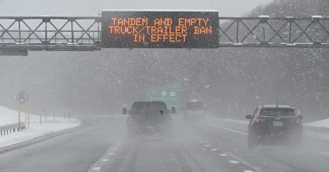
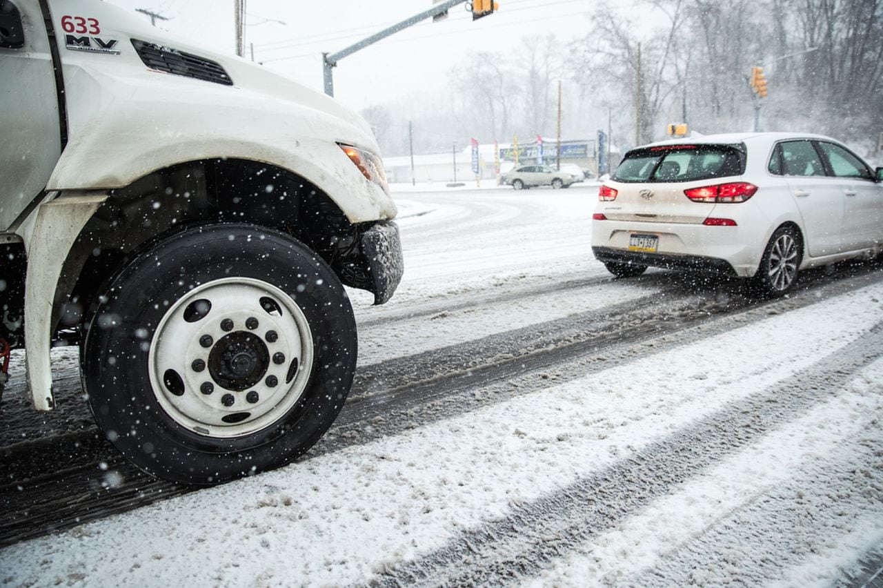
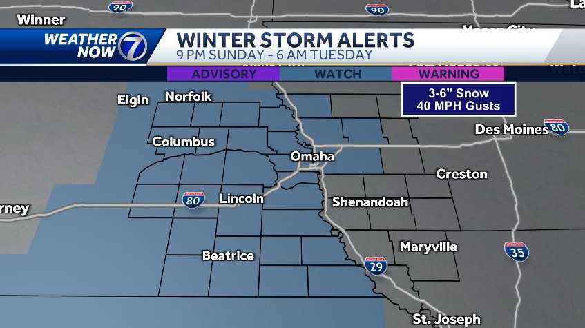
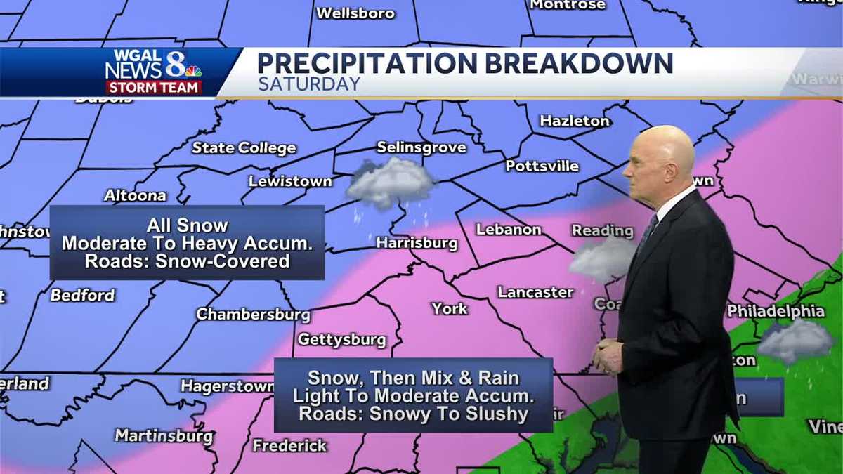
Iowa is bracing for a significant winter storm expected to bring heavy snowfall, with accumulations ranging from 1-9 inches across the state, and strong winds leading to blowing and drifting snow. The storm will impact travel, making conditions dangerous Monday into Tuesday. A winter storm warning is in effect for western Iowa counties, while a watch covers the rest of the state. The weather pattern suggests more snow and colder temperatures towards the end of the week, with potential for another impactful system around Friday or Saturday. Residents are advised to prepare for slippery roads and difficult shoveling conditions due to the wet nature of the snow.

weather2 years ago

"Connecticut Braces for Second Wave of Winter Storm Aspen with Hour-by-Hour Updates"

Connecticut is experiencing a second round of snowfall, with northern parts of the state receiving the highest accumulations, including a foot of snow in Norfolk. Additional snow is expected throughout Sunday, with northern Connecticut potentially seeing over 4 inches more. The snow has caused numerous closings, cancellations, and flight disruptions, along with over 2,200 power outages. Temperatures will drop, leading to freezing conditions by Sunday evening. Weather is expected to clear up on Monday, but another storm is forecasted to bring rain midweek.

weather2 years ago

"Winter Storm Havoc: Airlines Brace for Cancellations as Snow Pummels East Coast"

Winter Storm Ember is causing significant disruptions in the Northeast, with heavy snowfall leading to airport delays, travel warnings, and power outages, particularly in New York and Massachusetts. Over a foot of snow has been reported in some areas, and authorities are urging residents to stay off the roads. Meanwhile, Winter Storm Finn is also on the radar, bringing the potential for severe weather in the South and flooding along the East Coast.

weather2 years ago

"New Hampshire Braces for Heavy Snowfall with Upgraded Winter Storm Alerts"

New Hampshire is under a winter storm warning with several inches of snow expected across the state, particularly in southern and central regions where 6 to 12 inches are forecasted. Travel will be challenging on Sunday, but conditions are set to improve with sunshine on Monday. Another storm system is anticipated to arrive on Tuesday, potentially bringing more snow, rain, or a mix, along with stronger winds. Residents are advised to stay updated with the Storm Watch 9 team and download the WMUR app for weather alerts.

weather2 years ago

"Impending Weather Shift: From Snow to Slush, Ice, and Freeze in Storm's Second Phase"

The ongoing snowstorm has brought varying snowfall totals, with over 10-12 inches in some areas and 2-4 inches in the Capital Region. Moderate snow is expected to continue into the afternoon, with an additional 1-3 inches. A break in the weather is anticipated Monday into Tuesday before a major storm hits Tuesday night into Wednesday, bringing heavy rain, wind, and potential flooding, with rainfall potential of 1-2 inches, locally up to 3 inches. Temperatures could rise to the upper 40s to mid 50s. The weather pattern remains active with more systems forecasted towards the end of the week.

weather2 years ago

"Preparing for the Northeast Winter Storm: Closures and Snow Accumulation Alerts"

A major winter storm swept through the northeastern United States, delivering heavy snowfall, freezing rain, and strong winds, leading to hazardous travel conditions. Areas in Pennsylvania and New Jersey experienced intense snowfall rates, while New York's Central Park recorded its first significant snow in nearly two years. Officials urged residents to avoid travel and prepare for potential power and fuel supply issues. The storm's impact varied across the region, with some areas receiving more snow than others. Another storm system is forecasted to bring warmer temperatures and the potential for heavy rain and flooding later in the week.

weather2 years ago

"New Jersey Braces for Up to 12 Inches of Snow Amid Warnings and Preparations"

Northern New Jersey is experiencing significant snowfall, with totals reaching up to 10.5 inches in some towns as a winter coastal storm continues to impact the area. The heavy snowfall, accompanied by strong wind gusts and creating hazardous road conditions, has led to over 6,300 power outages across the state. The National Weather Service reports snow falling at a rate of 1 to 2 inches per hour in some areas, indicating that this could be the biggest snowstorm New Jersey has seen in over a year.

weather2 years ago

"Major Snowstorm Set to Sweep the East Coast with a Wintry Weekend Blast"

A significant winter storm is forecasted to hit the Northeast over the weekend, bringing snow and rain to areas that have not experienced substantial snowfall in years. Regions like the Poconos, Hudson Valley, and parts of New England are expected to see the heaviest snow. Winter storm warnings and watches are in place, with schools and offices closing in anticipation. Transportation departments are urging caution and limiting travel. Record snowfall droughts in cities like Philadelphia, New York City, and Baltimore may end with this storm. The National Weather Service has issued advisories and warnings, with potential for snow-covered roads and power outages.

weather2 years ago

"Omaha Braces for Snowy Start to the Week with Intense Cold to Follow"

The Omaha area is under a winter storm watch from Sunday night to Tuesday morning, with expectations of 3 to 6 inches of heavy, wet snow in eastern Nebraska and 1 to 3 inches in western Iowa. The impending storm is likely to cause significant travel disruptions, including along Interstates 80 and 29, with potential for closures and infrastructure disruptions. Residents are advised to prepare for the storm and stay informed on weather updates.

weather2 years ago

"Northeast Braces for Weekend Blizzard as First Heavy Snowfall Looms"

New England is bracing for a significant snow event starting Saturday night, with heavy accumulations expected, particularly away from the coast. The snow will be wet and heavy inside I-495 with less than 6 inches expected, while other areas will see fluffier snow. Sunday will offer a brief window for cleanup before temperatures drop sharply in the afternoon, leading to a flash freeze and hazardous travel conditions. The weather will clear up after midnight, but a cold Monday morning awaits, with a warming trend before another storm brings potential flooding rain and power outages on Wednesday. Another precipitation-heavy storm is forecasted for next weekend. Residents are advised to stay safe and keep updated on the storm's progress.

weather2 years ago

"Comprehensive Update on Pennsylvania's Impending Winter Storm and Snowfall Predictions"

South-central Pennsylvania is bracing for a winter storm today with an advisory in effect from the morning. Snow will develop between 10 AM and 12 PM, with potential snowfall rates of an inch per hour, leading to reduced visibility and deteriorating road conditions. The snow will be moderate to heavy northwest of I-81, with a mix of snow and rain, especially southeast of I-81. Precipitation is expected to taper off between 6 and 10 PM. Accumulations of 5 to 8 inches are expected in the majority of the Susquehanna Valley, with 2 to 5 inches in southern areas, potentially reduced by rain. The Pennsylvania Farm Show is advised against today due to weather, and the forecast for the following days includes improving conditions.

weather2 years ago

"Precautions and Preparations as Wintry Mix Threatens Outages and Hazardous Travel in WNC and Upstate"

Western North Carolina experienced freezing rain on Saturday morning, leading to slick conditions and power outages, particularly in Henderson County with over 1,200 customers affected. A Winter Storm Warning and Weather Advisory were in effect until 1 p.m. for multiple counties. Ice accumulation was reported in various locations, with the National Weather Service providing specific totals. Conditions were expected to improve by the afternoon with rain moving out and temperatures rising to near 50 degrees.

weather2 years ago

"DC and Midwest Brace for First Major Winter Storm in Two Years This Weekend"

Washington D.C. is preparing for its first significant winter storm in two years, with snow, rain, and sleet expected to begin on Saturday morning. The storm may start with snow but will likely transition to rain as warmer air moves in, limiting snowfall potential near the I-95 corridor. Higher elevations could see 4-8 inches of snow. Winter storm warnings and weather advisories have been issued for various regions. A powerful blizzard is forecasted to hit the Midwest next week, with cities like Kansas City and Chicago bracing for heavy snow, while the East Coast should expect strong winds and heavy rain. The National Weather Service warns of potential flooding, and another storm is anticipated by the end of next week. Residents are advised to avoid travel during the storm and stay updated with the latest weather information.

weather2 years ago

"DC Braces for 2024's First Major Winter Storm with Preparations Underway"

The Washington D.C. area is expected to experience a wintry mix on Saturday morning, transitioning to rain in the afternoon. Winter weather advisories are in place west of Interstate 95, with a winter storm warning for northwest Virginia and parts of Maryland. The morning may start with snow, sleet, and freezing rain, especially west of I-95, but will likely change to rain by midday. Areas south and east of downtown Washington are not expected to see accumulation, while the far north and west suburbs may see up to 2 inches of snow before it turns to rain. Winds will be gusty, and Sunday is forecasted to be partly to mostly sunny and breezy.

weather2 years ago

"South-Central Pennsylvania Braces for Major Winter Storm with Varied Precipitation Forecasts"

South-central Pennsylvania is bracing for its most significant winter storm in nearly three years, expected to hit on Saturday. The storm will bring varying snowfall, with areas north and west of Harrisburg potentially receiving 5 to 8 inches, while most of the Susquehanna Valley is forecasted to get 2 to 5 inches. Southern York and Lancaster counties may see up to 2 inches. The WGAL News 8 Storm Team has declared Saturday an Alert Day due to the potential for severe weather conditions. Residents are advised to stay updated on the storm's progress and prepare for winter weather conditions.