"Northeast Braces for Weekend Blizzard as First Heavy Snowfall Looms"
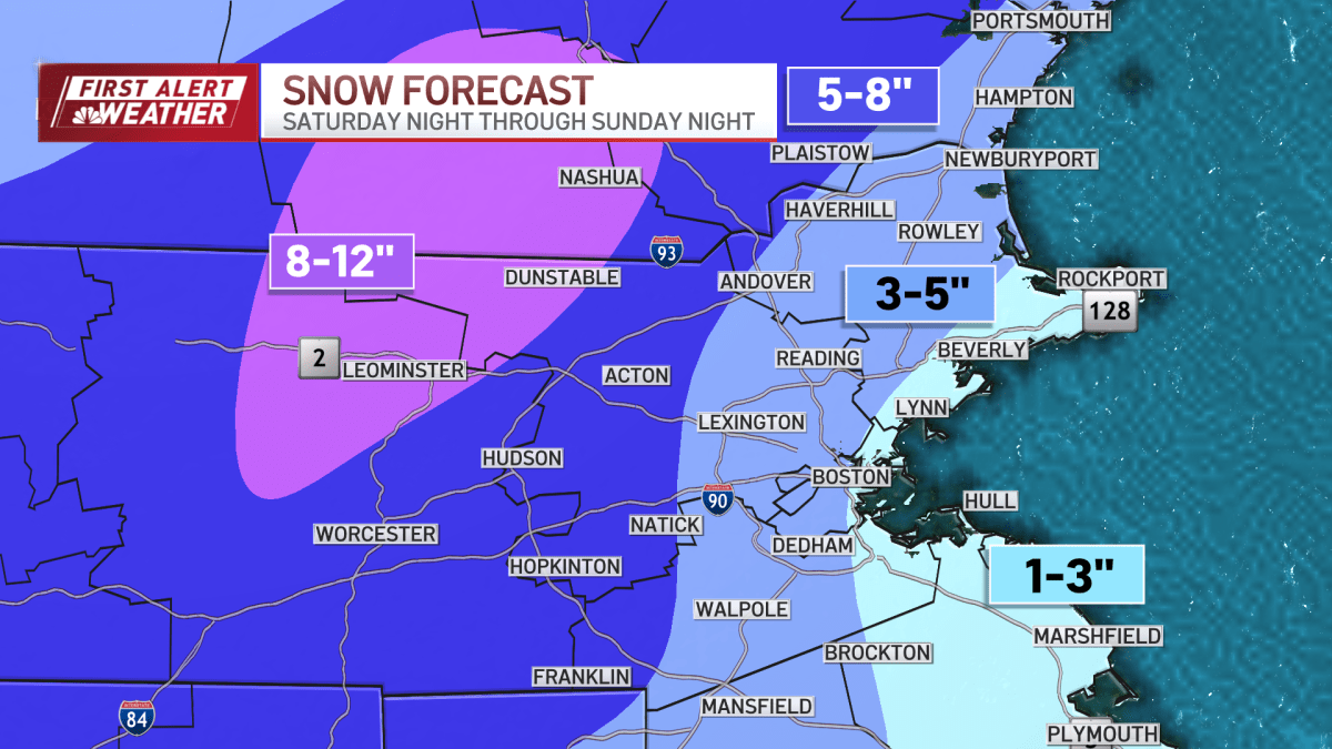
New England is bracing for a significant snow event starting Saturday night, with heavy accumulations expected, particularly away from the coast. The snow will be wet and heavy inside I-495 with less than 6 inches expected, while other areas will see fluffier snow. Sunday will offer a brief window for cleanup before temperatures drop sharply in the afternoon, leading to a flash freeze and hazardous travel conditions. The weather will clear up after midnight, but a cold Monday morning awaits, with a warming trend before another storm brings potential flooding rain and power outages on Wednesday. Another precipitation-heavy storm is forecasted for next weekend. Residents are advised to stay safe and keep updated on the storm's progress.