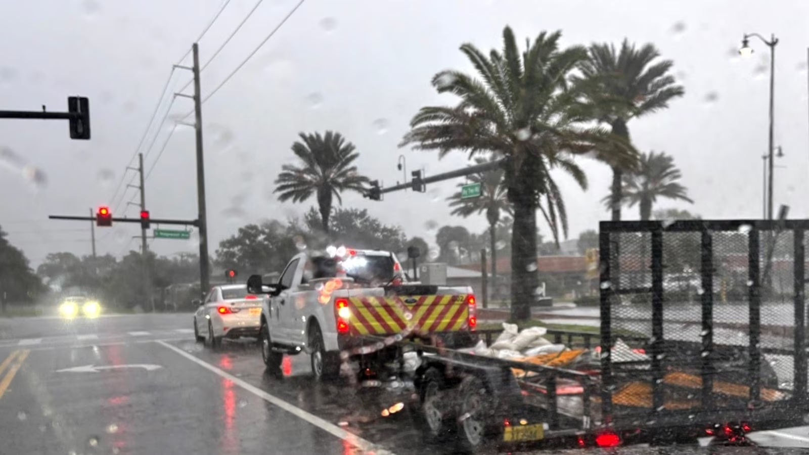
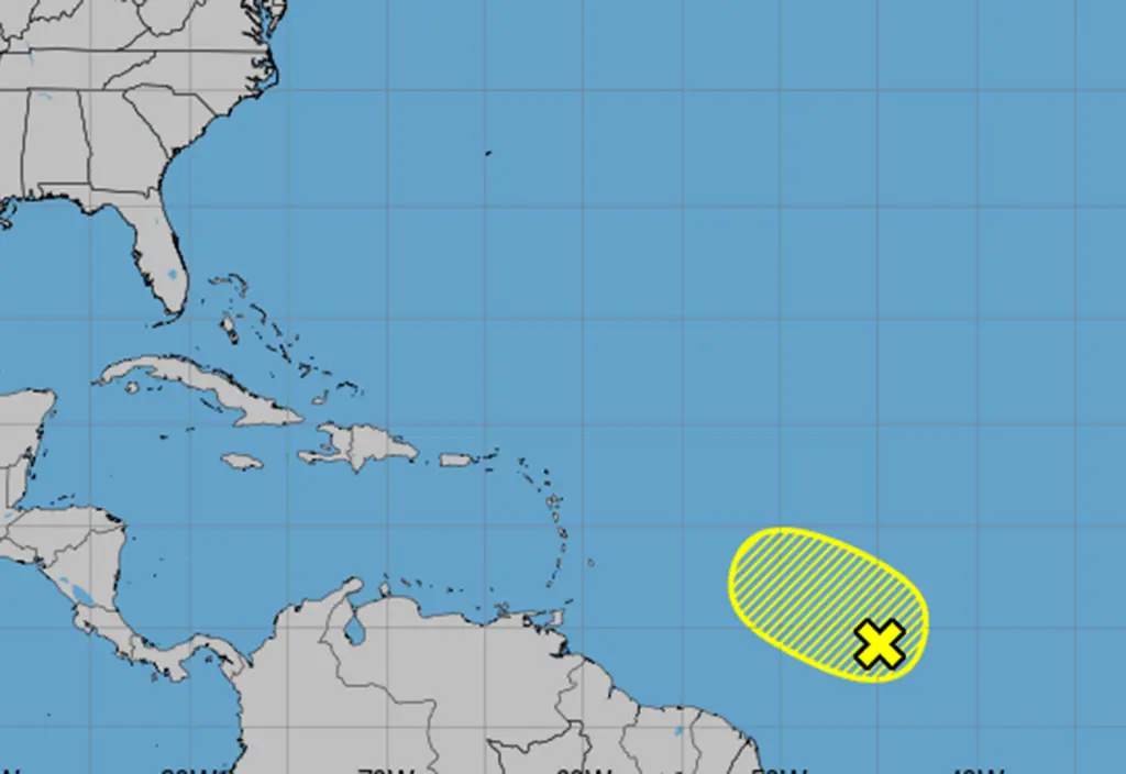
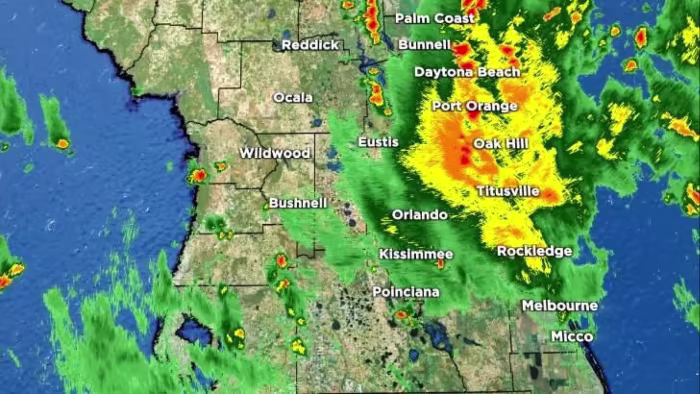
A Flood Watch is in effect for east-central Florida with expected heavy rain and coastal flooding through Monday, exacerbated by offshore winds and a stalled front, while a tropical wave off Africa has a 50% chance of developing into a tropical disturbance next week.
The National Hurricane Center is monitoring a tropical wave in the Atlantic with a 10% chance of developing into a tropical storm, potentially named Tropical Storm Dexter, but environmental conditions are expected to become unfavorable for further development later in the week. The hurricane season has so far seen three tropical storms, with forecasts indicating a slightly less active season than initially predicted.
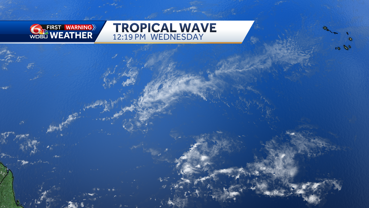
The National Hurricane Center is monitoring the first tropical wave of the 2024 hurricane season, identified in the Central Atlantic. Although the official season starts on June 1, early formations in May are not uncommon. The wave is expected to bring heavy rain and gusty winds. NOAA will release its official forecast for the season on Thursday, with expectations of a very active season. The WDSU First Warning Weather Team will provide updates as the situation develops.
Tropical wave 94L is expected to bring heavy rains and strong winds to the Lesser Antilles by Friday and Saturday, with a high chance of becoming at least a tropical depression by Thursday. Meanwhile, Tropical Storm Norma is rapidly intensifying and is likely to impact Mexico's Baja Peninsula by the weekend. In the North Indian Ocean, both the Bay of Bengal and the Arabian Sea are being closely monitored for potential tropical cyclone development.
Tropical Storm Sean has formed, located 780 miles west-southwest of the Cabo Verde Islands. It has maximum sustained winds of 40 mph and is moving west-northwest at 13 mph. The storm is expected to maintain its strength for the next few days. Additionally, a tropical wave off the coast of Africa has a 20% chance of formation in 48 hours and a 30% chance of development in seven days.
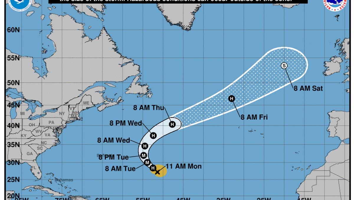
Hurricane Nigel, the fifth hurricane of the 2023 Atlantic hurricane season, is forecast to strengthen and reach near major hurricane status before curving out to sea, away from the U.S. coast. The National Hurricane Center is also monitoring two other developing systems in the Atlantic, including one near the Southeast U.S. coastline that could bring heavy rains and coastal flooding. Additionally, a tropical wave is expected to move off the west coast of Africa and has the potential to develop into a tropical depression while moving westward across the eastern and central tropical Atlantic.
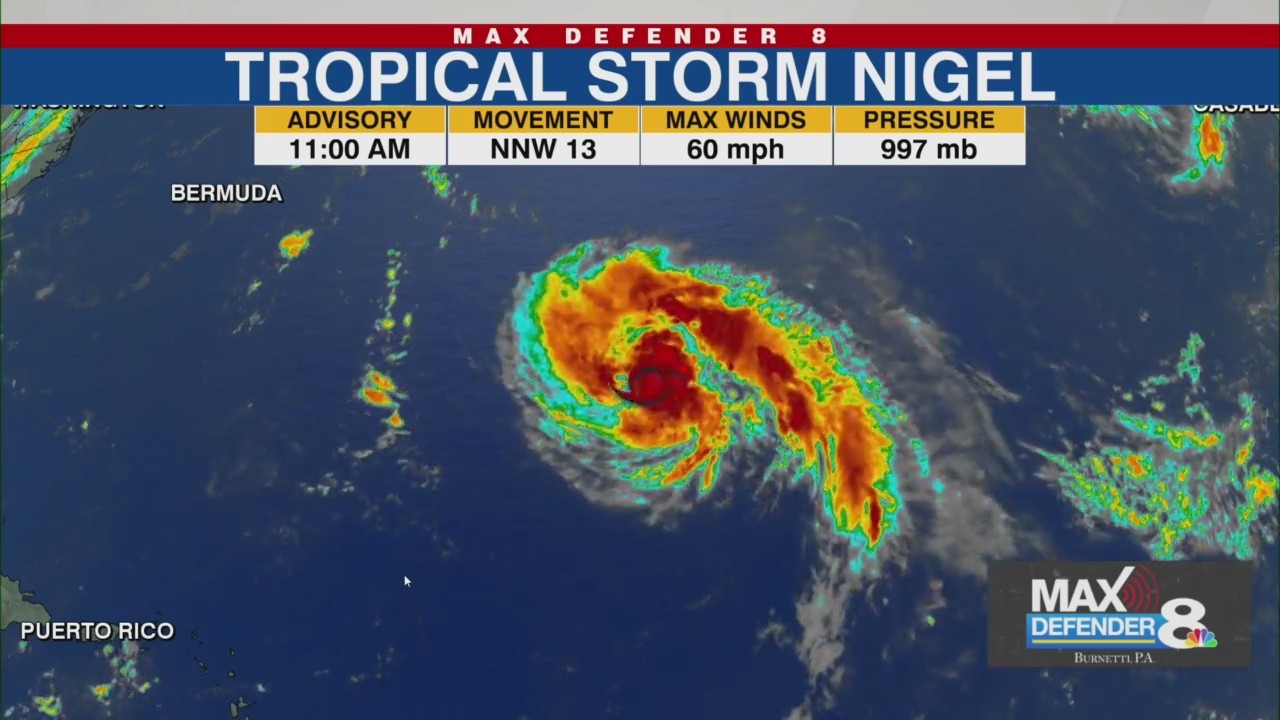
Tropical Storm Nigel is forecasted to become the next hurricane of the 2023 Atlantic season, with maximum sustained winds of 60 mph. It is expected to strengthen further and become a major hurricane by the middle of the week, but is projected to move northward and not pose a threat to land. The National Hurricane Center is also monitoring a tropical wave off the west coast of Africa, which could develop into a tropical depression later this week.
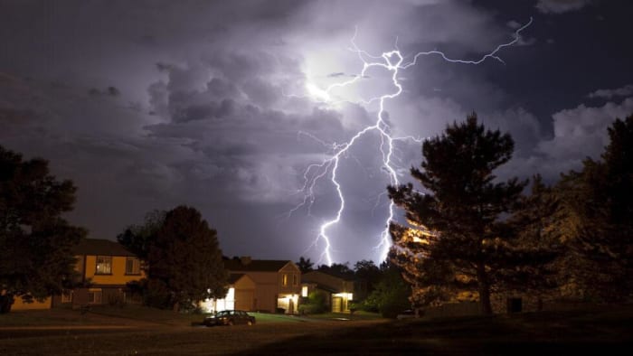
Central Florida can expect an increase in rain chances, with a risk of severe storms, including strong winds, heavy rain, and lightning. The temperature will reach a high near 93 degrees, with rain chances up to 40% through the early evening. The chance of rain will continue throughout the week, with high temperatures in the low 90s. In the tropics, Hurricane Lee will bring high rip currents and high seas, while a tropical wave in the eastern tropical Atlantic has a 50% chance of developing into a tropical depression by the weekend.
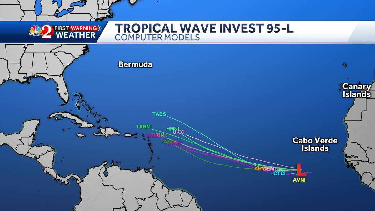
Models indicate that Invest 95-L is approaching the southeast coast of the United States this week, with a 90% chance of formation in the next seven days. The system is expected to become a tropical depression in two or three days, potentially impacting the Caribbean islands and the US east coast. The National Hurricane Center is also monitoring a tropical wave near western Africa, which has a 30% chance of development in the next seven days.
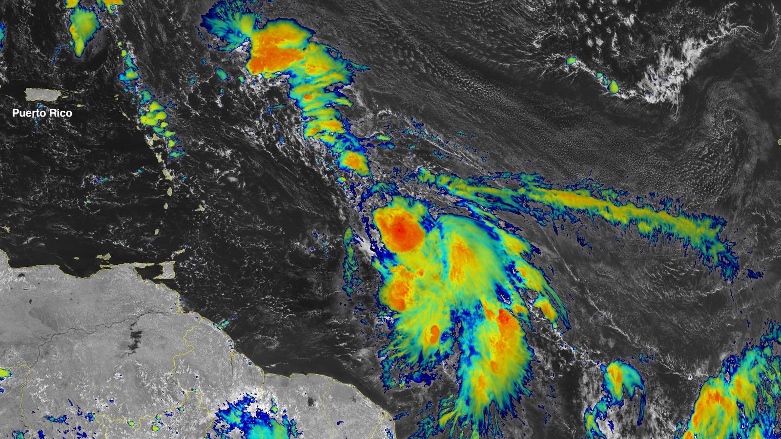
The National Hurricane Center is monitoring a tropical wave in the western Caribbean Sea that has a 70% chance of developing into a tropical depression over the weekend or early next week. Forecasters are advising those in the Yucatan Peninsula, western Cuba, and Florida to keep an eye on this system. Tropical Storm Franklin is expected to strengthen into a hurricane over the weekend, while two other tropical waves in the Atlantic are also being monitored for potential development.
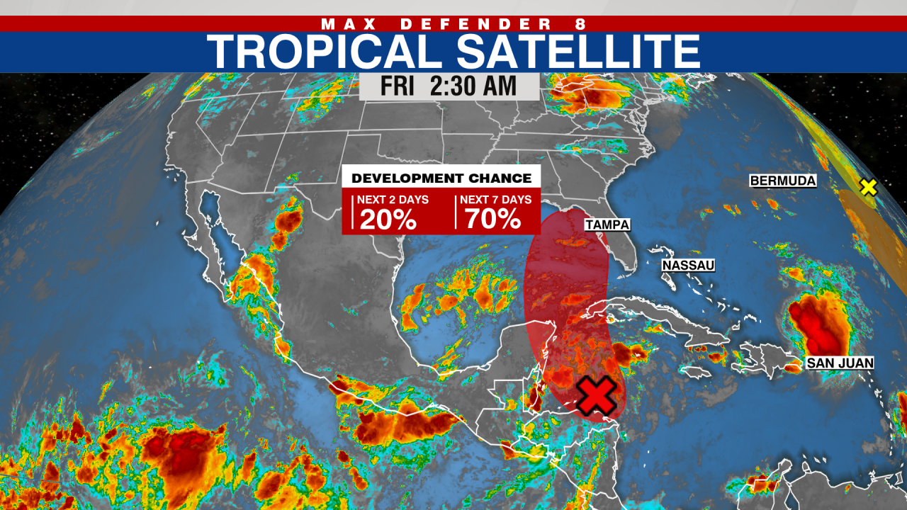
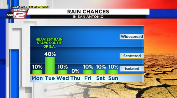
A tropical wave approaching South Texas is expected to bring rain to the region, with the heaviest rainfall likely to stay south of San Antonio. The National Hurricane Center has placed a high chance of tropical development over the Western Gulf of Mexico. While isolated to widely scattered downpours are possible in San Antonio on Tuesday, the more widespread and heavy rainfall is expected to be south of the city. Rain chances decrease later in the week, with temperatures rising again. The tropical wave is not expected to be a drought-busting event.
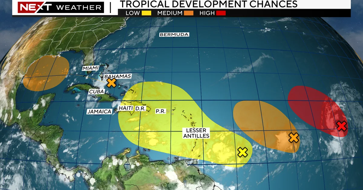
A tropical wave is set to move through South Florida this weekend, bringing heavy rain and storms. The wave is not expected to stay for long but will impact the weekend forecast. The National Hurricane Center is monitoring its evolution as it moves into the Gulf of Mexico, potentially bringing much-needed rain to Texas. While there are other waves in the Atlantic, the first wave in the conga line is the one to watch for potential development. The tropics can change rapidly, so vigilance is necessary during the peak of the hurricane season.
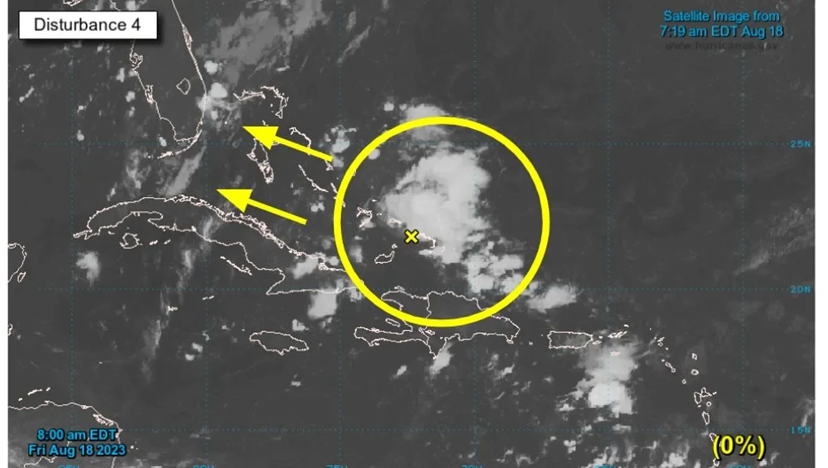
A tropical wave is expected to move across Florida over the weekend, bringing increased chances for showers and thunderstorms. The system, designated as disturbance 4, is located over the southeastern Bahamas and is forecast to move into the Gulf of Mexico by early next week. While the chances for development over the next two days are low, there is a medium chance for the system to become a tropical depression as it approaches the western Gulf of Mexico coastline. As the tropical wave moves across the state, localized flooding will be possible, particularly in urban, low-lying, and already saturated areas. Rainfall amounts of 2 to 4 inches are expected, with some areas potentially seeing higher amounts. The Weather Prediction Center has set a marginal risk for flooding across South and Central Florida over the next three days. Rain chances will begin to decrease as the tropical wave moves off into the Gulf of Mexico.
A weak tropical wave off the coast of Jacksonville is expected to bring heavy rain and lightning to Florida, with rain chances remaining high. Inland areas have a 60% chance of rain, while the coast has a 50% chance. The rain is likely to develop after 3 pm, with temperatures reaching the 80s along the beaches and 92 degrees inland. The wave will continue moving north across Florida, keeping moisture levels elevated and rain chances at 60% through Sunday. The FOX 35 Storm Team is also monitoring a tropical wave in the Eastern Atlantic with a 70% chance of development over the next 7 days.
A tropical wave is bringing waves of heavy rain, scattered showers, and thunderstorms to Central Florida through Friday. The weather may interfere with the double SpaceX launch scheduled for Thursday night. Storm chances continue on Saturday, but temperatures will return to the low-to-mid 90s. There are no immediate threats to Florida from the tropical wave southwest of the Cabo Verde Islands.