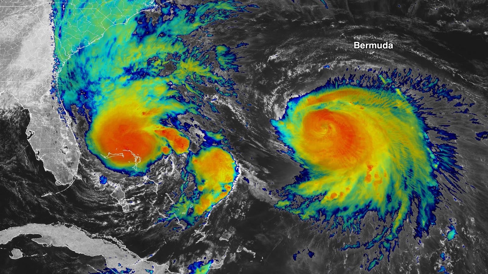
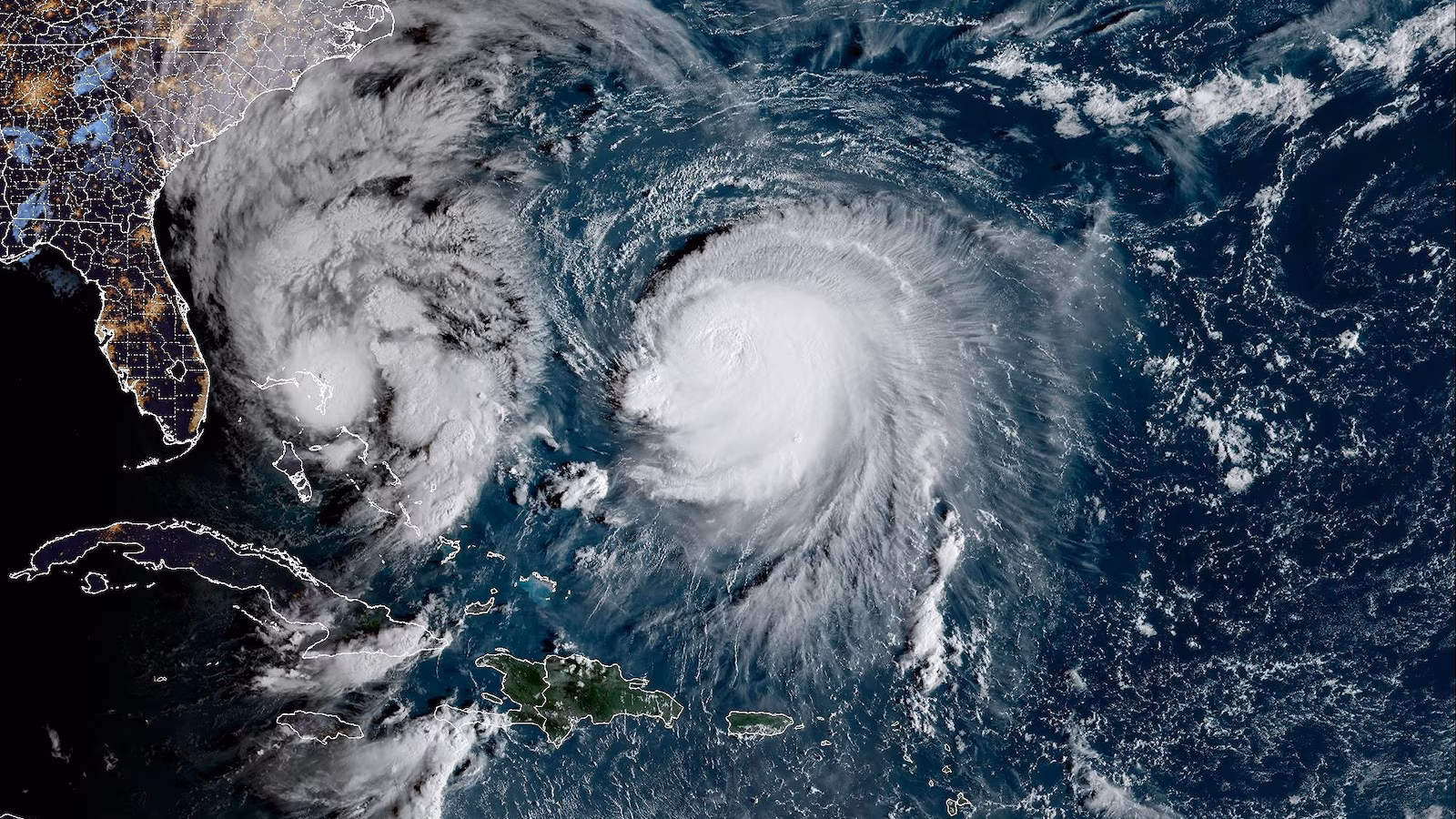
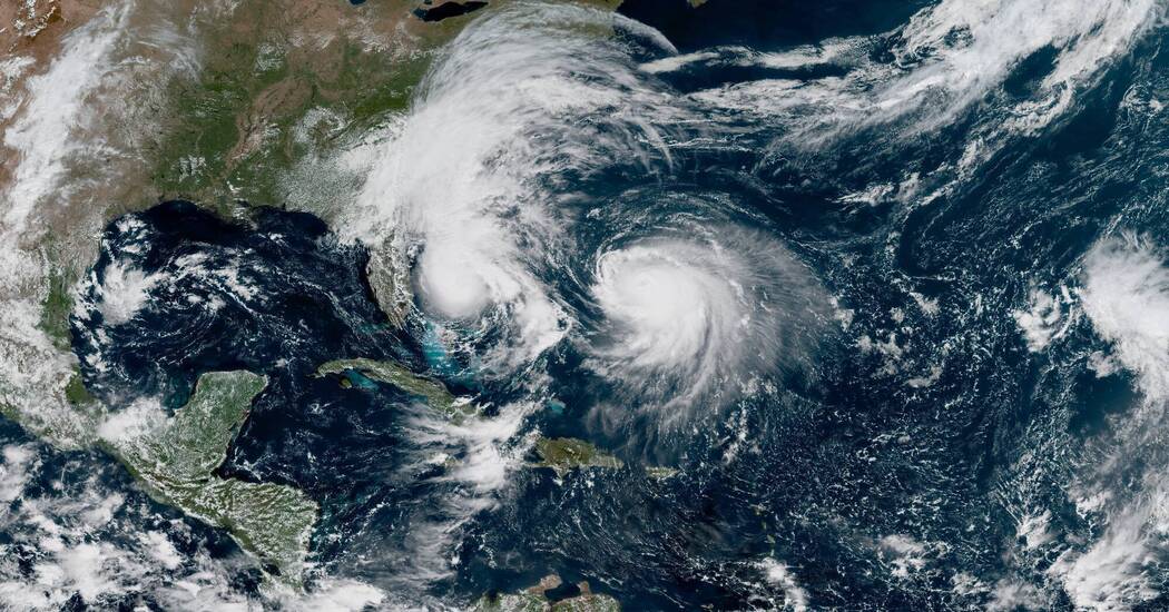
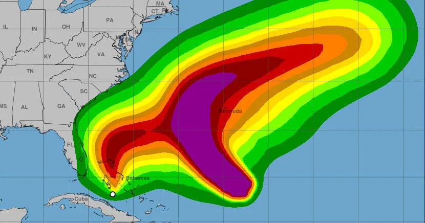
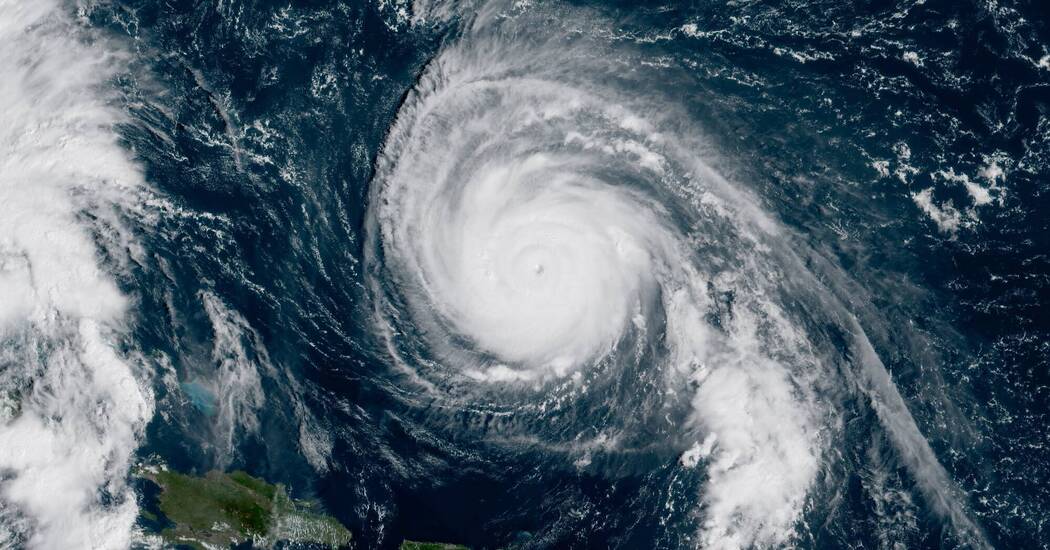
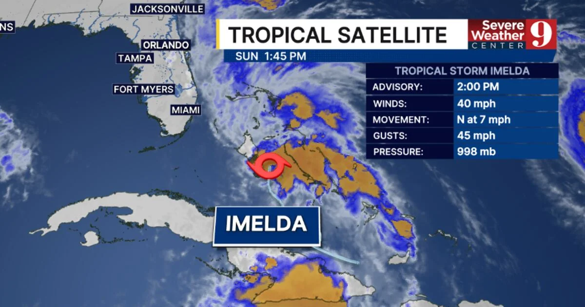
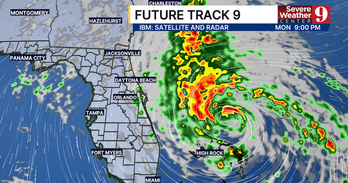
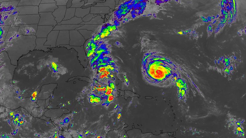
Tropical Storm Imelda is strengthening near the Bahamas but is turning eastward, sparing the US coast from a direct hit, though dangerous surf and rip currents persist. Meanwhile, Bermuda faces a rare double threat from Hurricanes Humberto and Imelda, with Humberto now a Category 2 storm and Imelda potentially making landfall, bringing heavy rain and winds. The US has avoided a direct hurricane landfall this season, but the storms have reached major strength early in the season, highlighting increased rapid intensification due to climate change.
Tropical Storm Imelda is impacting the Bahamas with heavy rain and winds as it moves northward, while Hurricane Humberto weakens near Bermuda. Meanwhile, Typhoon Bualoi causes significant damage and fatalities in Vietnam and the Philippines. The storms are part of an active hurricane season, with forecasts indicating potential strengthening and shifts in storm paths.
Tropical Storm Imelda is approaching the Southeast US coast but will not make landfall, bringing rain, strong winds, high surf, rip currents, and potential flooding from the Carolinas to Virginia, and possibly hitting Bermuda as a hurricane. Meanwhile, Hurricane Humberto is affecting Bermuda with heavy rain.
Two major Atlantic storms, Hurricane Humberto and Tropical Storm Imelda, are impacting the East Coast with high surf, rip currents, and heavy rain, but are not expected to make landfall in the U.S., though they pose risks of flooding and dangerous ocean conditions along the coast and nearby islands.
Tropical Storm Imelda has formed in the western Atlantic and is forecast to strengthen into a hurricane, bringing heavy rain, flooding, and potential impacts to the Bahamas, Cuba, and the southeastern US, especially South Carolina, which has issued a state of emergency.
Tropical Storm Imelda has formed near the Bahamas, joining Hurricane Humberto in the Atlantic, with both storms potentially impacting the Caribbean and US East Coast through heavy rain, storm surge, and rip currents. The interaction between the two storms, known as the Fujiwhara effect, adds uncertainty to their paths and intensities, but forecasts suggest Imelda may turn away from the US coast while still bringing heavy rain to the Carolinas. Humberto remains a powerful Category 5 hurricane, posing a threat to Bermuda and Atlantic shipping lanes.
Tropical Storm Imelda, the ninth named storm of the 2025 Atlantic hurricane season, has formed near the Bahamas and is expected to pass offshore Florida, bringing gusty winds and rain with minimal flooding risk, as it is forecasted to strengthen into a hurricane by early next week.
Florida is preparing for Tropical Depression 9, which is expected to become Tropical Storm Imelda, with the storm passing offshore and causing increased surf, wind gusts up to 40 mph, and up to 3 inches of rain along the coast, primarily impacting the wind conditions and surf rather than causing widespread flooding.
Tropical Depression Nine is expected to become Tropical Storm Imelda, with a less threatening path away from the Southeast coast, though impacts like rain and wind are still anticipated, especially in Florida, Georgia, and the Carolinas. Meanwhile, Hurricane Humberto has intensified to a Category 4, posing no direct threat to the US but potentially affecting Bermuda and the Bahamas. Authorities are preparing for possible storm impacts, and residents are advised to stay alert as forecasts may still change.
Tropical Depression 9 is expected to stay east of Western North Carolina, reducing landfall concerns, while Hurricane Humberto has intensified to a Category 5 but remains over open water and poses no threat to the U.S.