Tag

Travelconditions

All articles tagged with #travelconditions

weather1 month ago

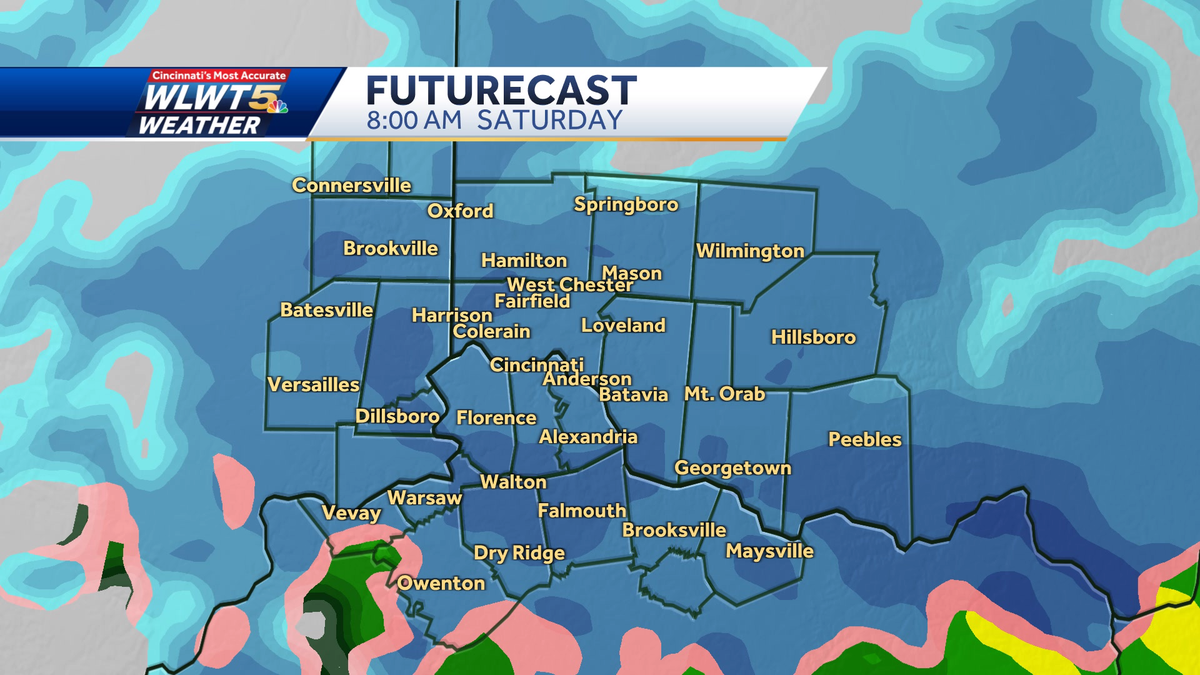
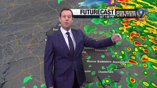
Charlotte Faces crippling ice storm as roads freeze and outages rise

An ice storm blanketed Charlotte with up to about half an inch of ice, bringing bitter wind chills near 10°F and dangerous travel conditions. More than 1,100 flights were canceled at Charlotte Douglas International Airport, power outages grew, and emergency resources were activated after President Trump approved Gov. Stein’s emergency declaration. Charlotte-Mecklenburg Schools and several area districts cancelled classes for Monday, a storm shelter opened, and officials urged residents to stay off the roads and prepare for outages as freezing rain continued.

Lake Effect Snow Warning Issued for Northeast Ohio
weather1 year ago

Lake Effect Snow Warning Issued for Northeast Ohio

The National Weather Service has issued a Lake Effect Snow Warning for Lake, Geauga, and Ashtabula Counties in Northeast Ohio, predicting heavy snowfall of 6-18 inches and poor visibility due to snow falling at 1-2 inches per hour. A Winter Weather Advisory is also in effect for Cuyahoga County. The snow is expected to impact travel on major interstates and last through the weekend, with residents and services preparing for challenging conditions.

"Impending Snow Showers Escalate to Major Storm Next Week"
weather2 years ago

"Impending Snow Showers Escalate to Major Storm Next Week"

Iowa is bracing for a series of snow events, with light snowfall expected overnight into Sunday, followed by a more significant system early next week. A Winter Storm Watch has been issued for parts of western and southern Iowa, with snow accumulations of 4-6 inches expected in the south and 2-4 inches in the Des Moines area. The snow, beginning as a rain/snow mix on Monday afternoon, will transition to snow by evening and continue into Tuesday morning. This could lead to slippery road conditions and strong winds with gusts up to 40 mph as the system moves out. Further snow chances are forecasted for late Wednesday into Thursday and again next weekend, with a notable drop in temperatures by the end of the week.

"St. Louis Braces for More Snow as Winter Storms Continue to Sweep Through the Region"
weather2 years ago

"St. Louis Braces for More Snow as Winter Storms Continue to Sweep Through the Region"

St. Louis has experienced a snowfall of up to 2.5 inches, with the highest amounts in St. Louis County. Following the snow, chilly temperatures and patchy fog are expected, with no significant additional accumulations. The weather will remain cold with a chance of rain and a rain/snow mix starting Monday afternoon, potentially transitioning to significant snowfall Tuesday afternoon and evening. St. Louis has a 30% chance of receiving over 5 inches of snow, but the storm's path is still uncertain, which could affect snowfall predictions and travel conditions due to gusty winds and blowing snow.

"Midwest Braces for Twin Blizzards: Cincinnati and Chicago Anticipate Potent Snowfall"
weather2 years ago

"Midwest Braces for Twin Blizzards: Cincinnati and Chicago Anticipate Potent Snowfall"

Cincinnati is expecting a storm system to bring a mix of rain and snow over the weekend. Light snow is anticipated early Saturday, with most areas seeing a coating to 1 inch, which will likely melt by the afternoon as temperatures reach the mid/upper 30s. Elevated surfaces may be slippery, but no major issues are expected. Rain and snow showers may continue into Sunday without significant accumulation. The weather will clear up on Monday before another storm brings rain and wind on Monday night and Tuesday.

"Winter Storm Alert: Advisory and Watch Issued for Carolinas, Impacts Expected"
weather2 years ago

"Winter Storm Alert: Advisory and Watch Issued for Carolinas, Impacts Expected"

A Winter Weather Advisory has been issued for several northern counties, with potential ice accumulation leading to slick travel conditions. The Charlotte metro area will experience rain, while light icing is possible in the foothills and mountains. Temperatures will rise throughout the day, alleviating icing concerns. Dry weather is expected to return Sunday and Monday, but a significant rain threat on Tuesday could cause flooding. Residents are advised to stay informed via the WSOC-TV weather app and follow updates from local meteorologists.

"Weekend Snow Forecast: Potential Disruptions in New Hampshire and Maine"
weather2 years ago

"Weekend Snow Forecast: Potential Disruptions in New Hampshire and Maine"

Southern New Hampshire is anticipating several inches of snow over the weekend, with the storm's track still uncertain. Snow showers may occur Thursday, with a significant snowfall likely late Saturday into Sunday. The storm's intensity and snow duration depend on its track, with a northern path suggesting plowable snow across the state and a southern path indicating lighter snowfall. Cold temperatures will ensure snow rather than mixed precipitation, and travel could be impacted on Sunday. Details on snowfall amounts and the exact storm track are being closely monitored and updated.

"Winter Weather Update: Snowstorms, Showers, and Advisories Across the US"
weather2 years ago

"Winter Weather Update: Snowstorms, Showers, and Advisories Across the US"

Minneapolis is expecting a light snowstorm on Saturday afternoon through the night, with less than one inch of snow accumulation but potential slick travel conditions. The National Weather Service forecasts a 40% chance of precipitation during the day, increasing to 100% at night. The following days will see a mix of cloudy and sunny weather, with temperatures hovering around the low 30s and occasional chances of flurries.