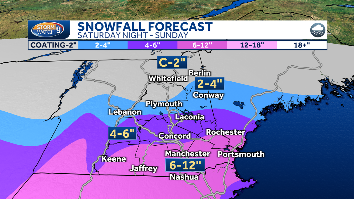
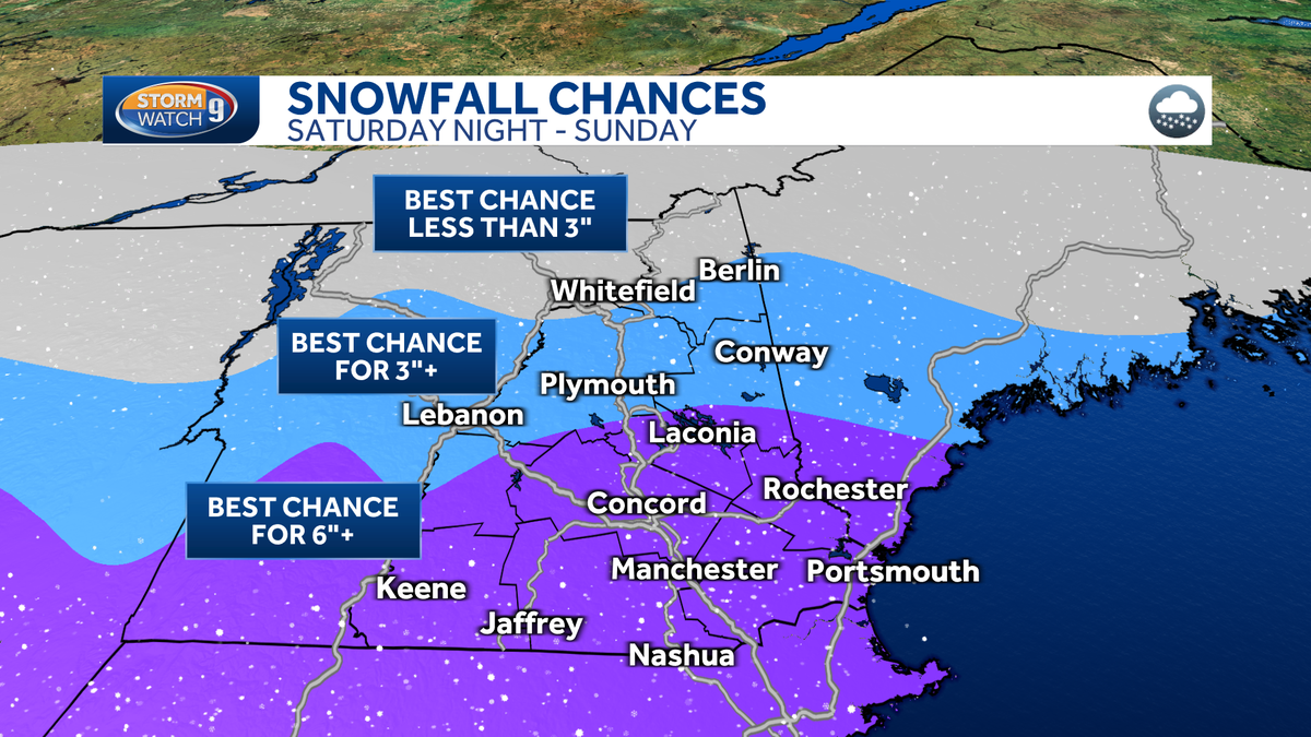
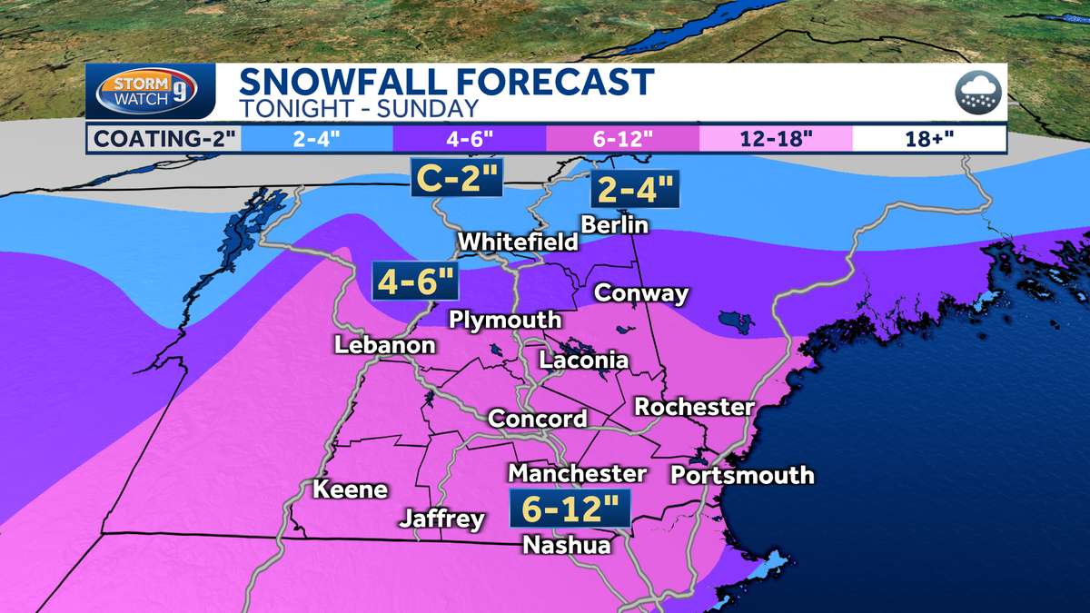
New Hampshire is bracing for a significant winter storm expected to deliver several inches of snow across the state by Sunday evening, with 6 to 12 inches anticipated in southern and central regions and lesser amounts to the north. A winter storm warning is in effect for multiple counties, and travel is expected to be challenging, especially on Sunday morning. The snow will taper off by Sunday night, followed by a break in the weather with sunshine on Monday. Another storm system is forecasted to arrive by mid-week, potentially bringing a mix of snow and rain with stronger winds. Residents are advised to stay updated and prepare for difficult travel conditions.
New Hampshire is bracing for a significant winter storm over the weekend, with the National Weather Service issuing a winter storm watch for several counties. The storm is expected to bring 6-12 inches of snow to southern parts of the state, with lesser amounts in the north. Conditions will start with cold temperatures and gusty winds, leading to moderate-to-heavy snowfall from Saturday evening through Sunday. Travel disruptions are anticipated, especially on Sunday morning. Another storm system is forecasted to arrive Tuesday evening, potentially impacting weather conditions on Wednesday. Residents are advised to stay informed and prepare for the snowy conditions.
Southern New Hampshire is bracing for a significant snowfall this weekend, with the potential for several inches up to a foot of snow, particularly in the southern regions. A winter storm watch is in effect from Saturday evening through Sunday evening, with the heaviest snow expected on Sunday. Travel could be difficult, and while the forecast could change, current models suggest lesser snow amounts to the north. Residents are advised to stay updated on the storm's progress and prepare for cold, snowy conditions.
Southern New Hampshire is anticipating several inches of snow over the weekend, with the storm's track still uncertain. Snow showers may occur Thursday, with a significant snowfall likely late Saturday into Sunday. The storm's intensity and snow duration depend on its track, with a northern path suggesting plowable snow across the state and a southern path indicating lighter snowfall. Cold temperatures will ensure snow rather than mixed precipitation, and travel could be impacted on Sunday. Details on snowfall amounts and the exact storm track are being closely monitored and updated.