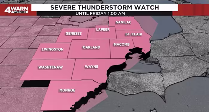
"Monday's Forecast: Potential for Severe Thunderstorms and Tornado Watch in Texas"
A Tornado Watch and Thunderstorm Watch have been issued for North Texas until 9 p.m., with the potential for strong to severe storms, including large hail and isolated tornadoes. The presence of a cap in the atmosphere may limit severe storm development, but a dryline moving in from the west could weaken the cap, leading to storm regrowth. The storm threat is expected to stretch into Central Texas near the I-35 corridor, with most storms anticipated to be north and east of the area by midnight. The weather is expected to be cool and breezy with mostly sunny skies in the coming days, but there is uncertainty regarding the weather for the Total Solar Eclipse next Monday.