A Marin County neighborhood experienced flooding due to king tides and an upcoming storm, with warnings of up to 2.5 feet of inundation in low-lying areas, road closures, and property damage expected across the San Francisco Bay Area.
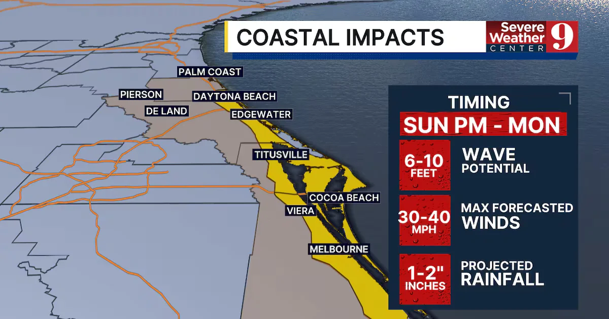
A tropical storm watch has been issued for coastal Brevard and Volusia counties as Tropical Depression 9 approaches the Bahamas, with expected impacts including 6-10 ft waves, wind gusts up to 45 mph, and 1-2 inches of rain starting tomorrow afternoon through early Monday.
A winter storm is expected to bring up to 10 inches of snow to parts of New Hampshire, with a Winter Storm Watch issued for southern areas. The snow is forecasted to start after midnight on Tuesday and continue through the morning and midday hours, with the potential for travel and school disruptions. Coastal areas may experience minor to moderate flooding during Tuesday's high tide. Residents are advised to stay updated on the storm through various weather alert platforms and social media channels.
After a snowy start to the week, Maine will experience pleasant weather on Monday before a powerful storm hits on Tuesday night, bringing rain, snow, and high winds. Winter storm, high wind, and flood watches are in effect for various counties. The storm is expected to bring potentially damaging winds and significant precipitation, with ski resorts likely to benefit from the snow. Residents are advised to stay updated on the forecast.
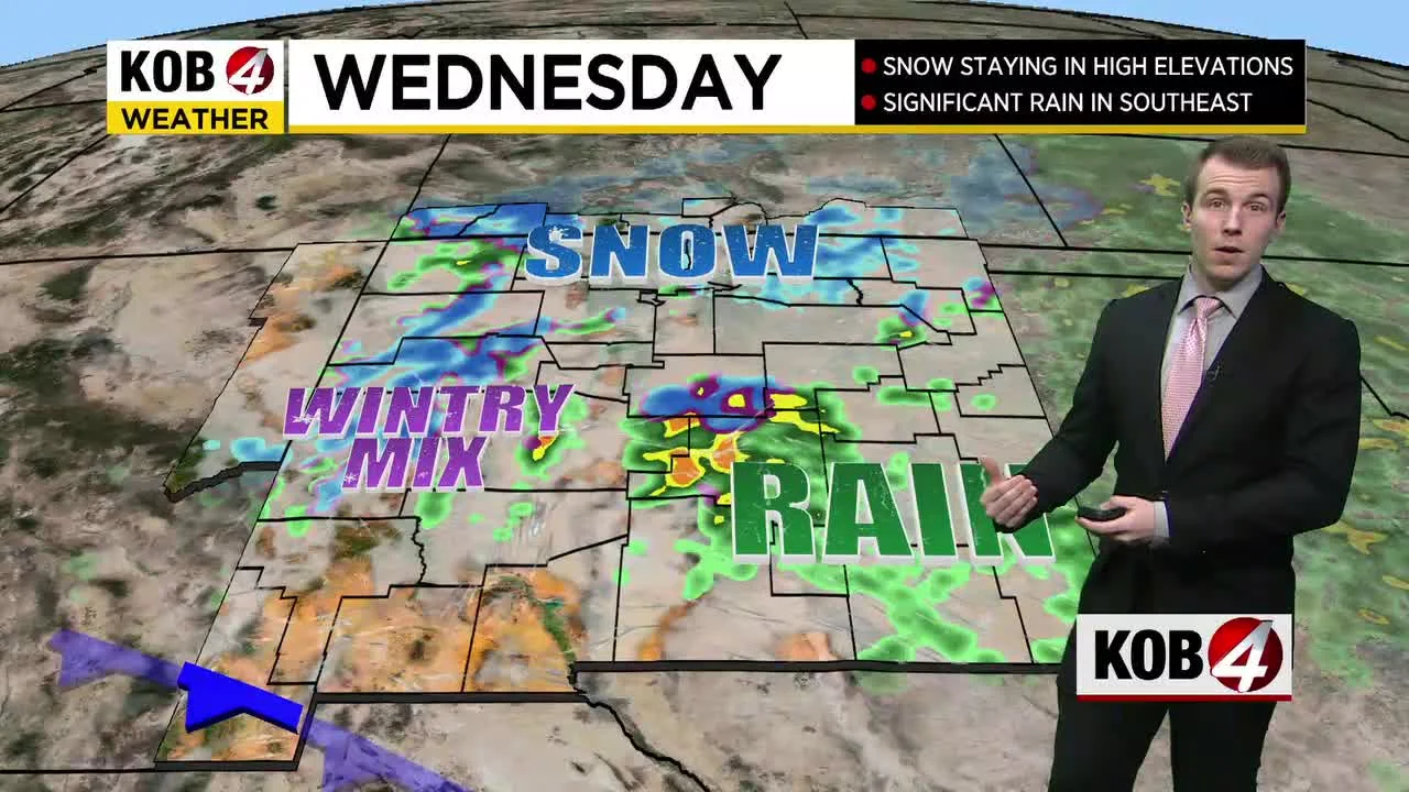
Heavy snowfall is possible for parts of New Mexico on Wednesday, with snowfall accumulation as high as 15 inches in places like Las Vegas and Raton. Santa Fe could see a few inches of snow, while Clovis and Gallup could get a couple of inches. The storm will also bring rainfall, with up to an inch or more of rain possible. Meteorologist Brandon Richards provides a full preview of the upcoming weather conditions.
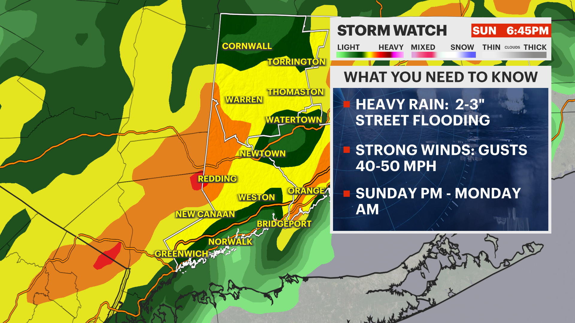
A storm watch has been issued for Western CT, with heavy downpours and strong winds expected on Sunday. Afternoon wind gusts of 20 to 30 mph are anticipated, with the possibility of thunderstorms bringing higher gusts. Steady rain and increased wind gusts of 30 to 40 mph are expected after 7 p.m., potentially causing wind damage and power outages. Road, stream, and creek flooding are also possible. Temperatures will drop on Monday morning, with rain changing to snow in Litchfield County. Chilly temperatures will persist through Thursday, with a few flurries possible on Wednesday.
The Storm Prediction Center has announced an 80% chance of issuing a severe thunderstorm watch for the midsection of Upstate New York, with the potential for damaging wind gusts and isolated tornadoes. A tornado watch has already been issued for six Upstate New York counties. The atmospheric conditions are favorable for severe storms, with high levels of instability and the presence of necessary ingredients for thunderstorms. The storms are most likely to develop this afternoon and could persist into Tuesday.