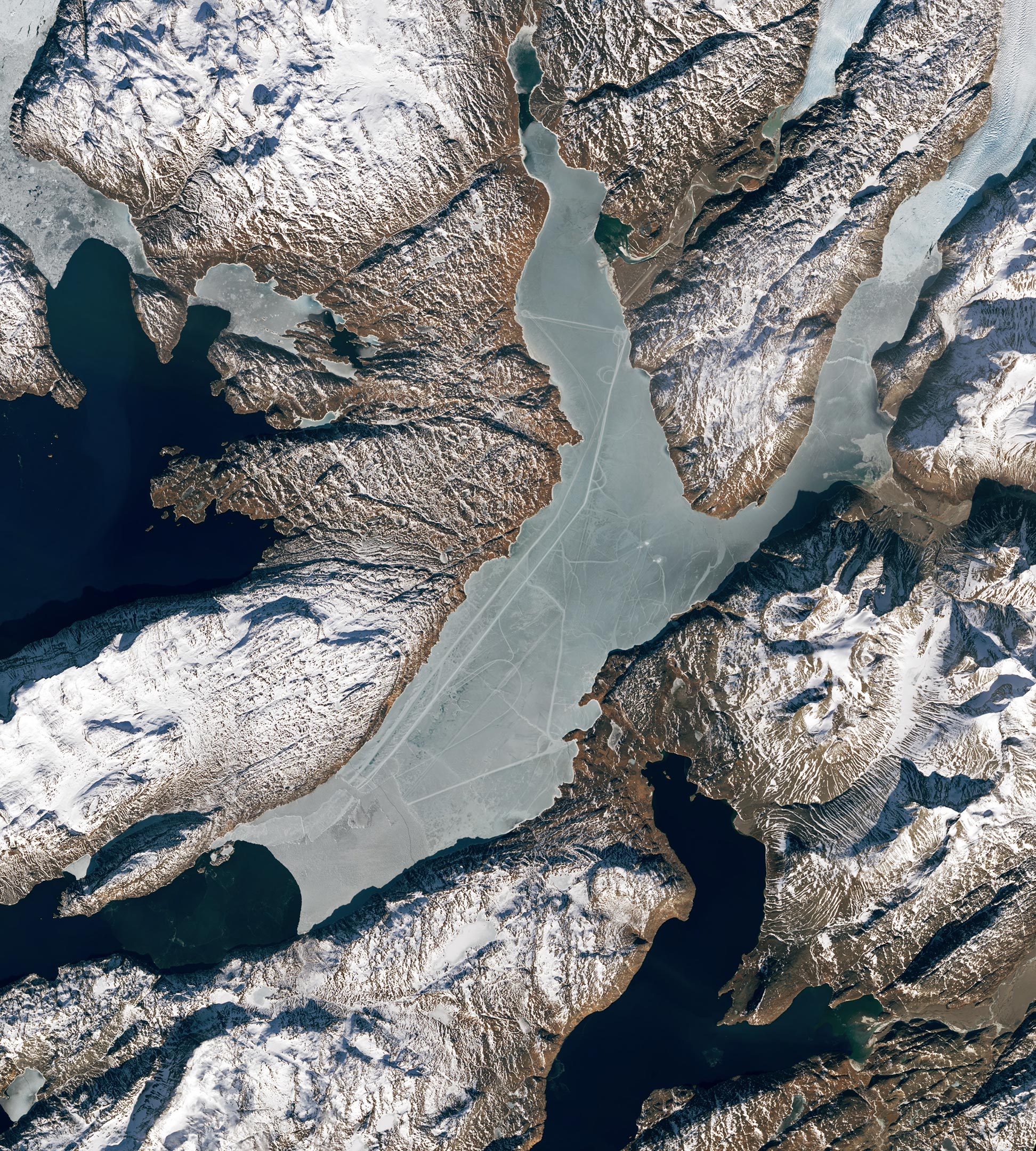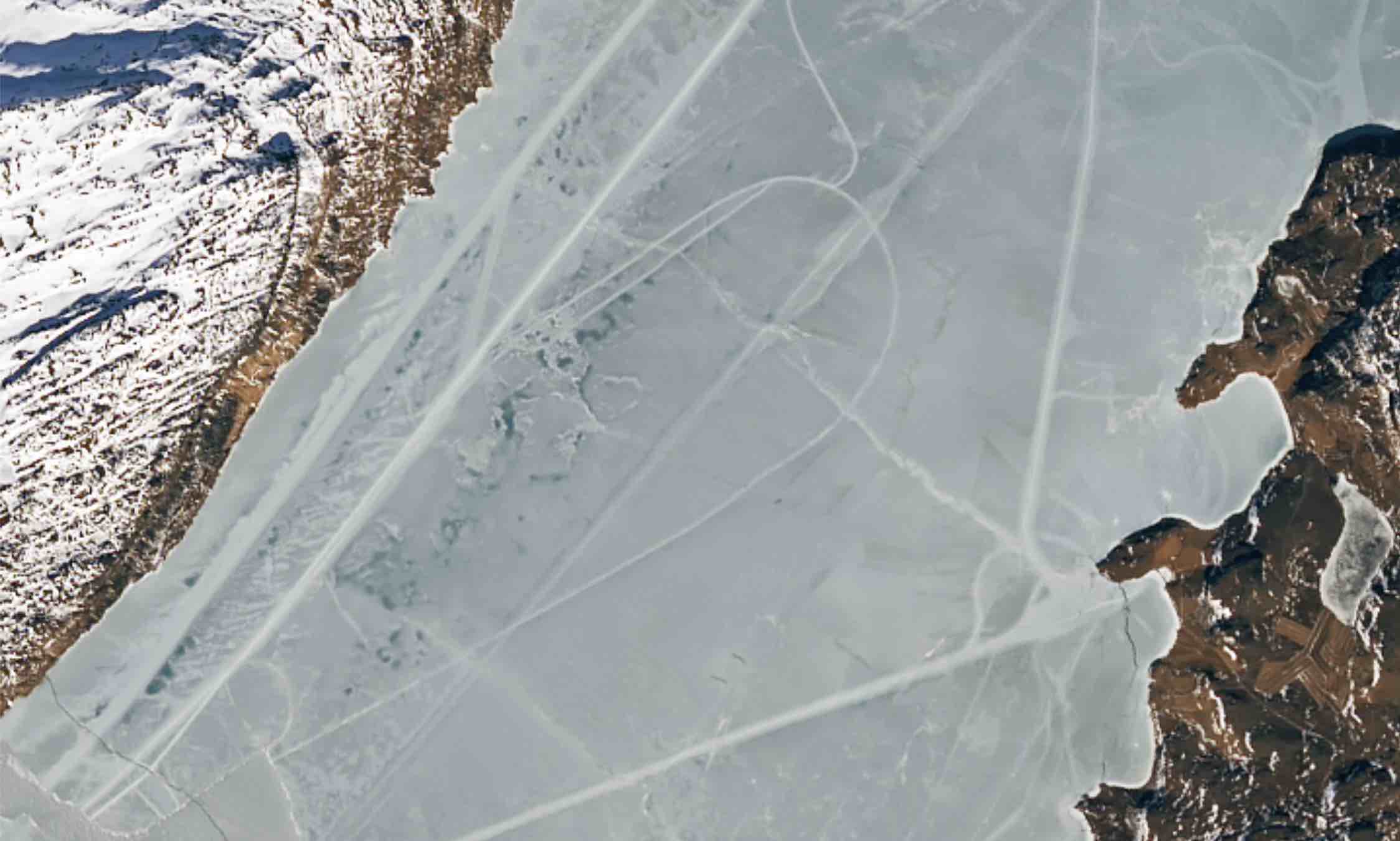
NASA Investigates Mysterious Tracks in Greenland's Tunulliarfik Fjord.
Landsat 9 satellite imagery detected mysterious tracks scoring the icy surface of a remote fjord in Greenland, prompting an investigation by scientists with NASA’s Cryospheric Science Laboratory. While some of the lines seen in the imagery look like natural ice deformation features, others were perfectly geometrical and likely caused by vehicles moving across the surface of the ice. The tracks appeared to originate from the towns of Qassiarsuk and Narsarsuaq, suggesting that residents were out on the ice, possibly hunting or traveling.