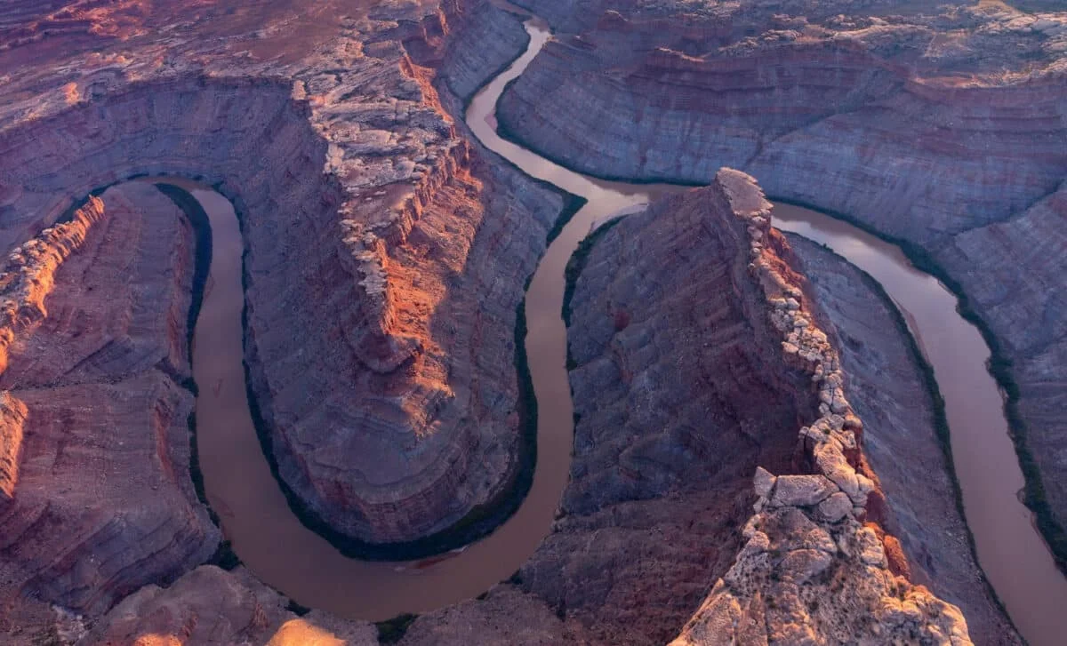
Mantle Drip Enables a River to Slice 100 Miles Through Utah's Uintas
Scientists propose that lithospheric dripping beneath the 13,000‑foot Uintas lowered the mountains, allowing the Green River to carve a continuous 100‑mile path through hard limestone and sandstone; seismic tomography reveals a deep mantle blob consistent with this process, and dating suggests the river’s current course formed about 2–5 million years ago, solving a long‑standing canyon puzzle.