Tag

Data Maps

All articles tagged with #data maps

science-and-technology2 years ago

"NASA Unveils Groundbreaking Images from New Pollution-Monitoring Tool"

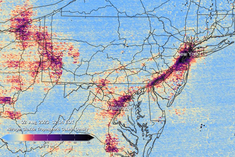
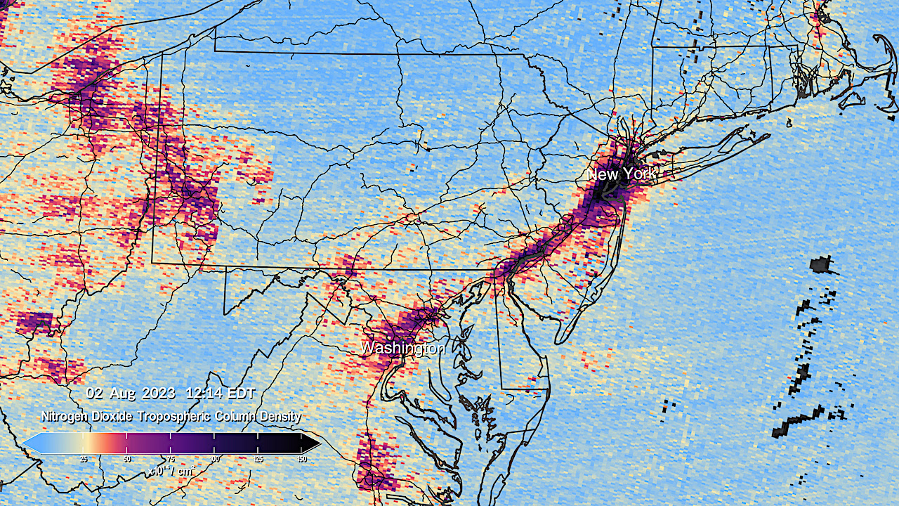
NASA has released the first data maps from its TEMPO instrument, which is designed to continuously measure air quality above North America. The instrument, launched earlier this year, will provide information about major air pollutants and help decision makers in achieving clean air goals. TEMPO's observations will improve studies of pollution caused by traffic, forest fires, and fertilizer application, as well as aid in evaluating health impacts and creating air pollution maps at the neighborhood scale. The data will be shared with partner agencies such as the EPA and NOAA.

science-and-technology2 years ago

TEMPO: Mapping North American Pollution with NASA's Latest Data

NASA has released the first pollution data maps from its TEMPO instrument, which orbits 22,000 miles above the equator. TEMPO provides visual representations of pollution and air quality over North America, allowing scientists to study pollution caused by traffic, forest fires, volcanoes, and fertilizer application. The data will help evaluate health impacts of pollutants and create air pollution maps at the neighborhood scale. NASA aims to make TEMPO data accessible to everyday Americans and decision-makers to monitor and improve air quality.