TEMPO: Mapping North American Pollution with NASA's Latest Data
TL;DR Summary
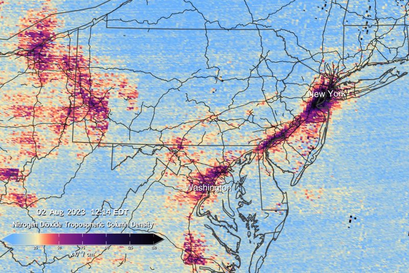
NASA has released the first pollution data maps from its TEMPO instrument, which orbits 22,000 miles above the equator. TEMPO provides visual representations of pollution and air quality over North America, allowing scientists to study pollution caused by traffic, forest fires, volcanoes, and fertilizer application. The data will help evaluate health impacts of pollutants and create air pollution maps at the neighborhood scale. NASA aims to make TEMPO data accessible to everyday Americans and decision-makers to monitor and improve air quality.
Reading Insights
Total Reads
0
Unique Readers
6
Time Saved
1 min
vs 2 min read
Condensed
78%
367 → 81 words
Want the full story? Read the original article
Read on Yahoo Canada Sports