AI-powered map uncovers deep groundwater across the U.S. at 30-meter resolution
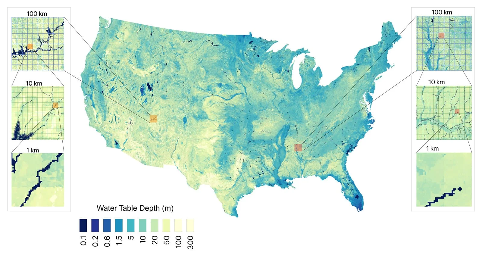
Researchers from Princeton and the University of Arizona created a high-resolution, AI-driven map of groundwater depth for the continental United States by combining over a million direct measurements with regional climate and geological data. The result estimates about 306,000 cubic kilometers of groundwater at a 30-meter grid (roughly 98 feet), revealing shallow supplies previously unknown and enabling more informed irrigation, conservation, and water infrastructure decisions. The model also quantifies uncertainty at each location and is designed for global expansion via the HydroFrame platform, signaling a shift toward data-driven, local-scale groundwater management.
Reading Insights
0
6
7 min
vs 8 min read
94%
1,432 → 91 words
Want the full story? Read the original article
Read on Princeton Engineering