"Study Shows Major US East Coast Cities Including NYC and DC Sinking Rapidly"
TL;DR Summary
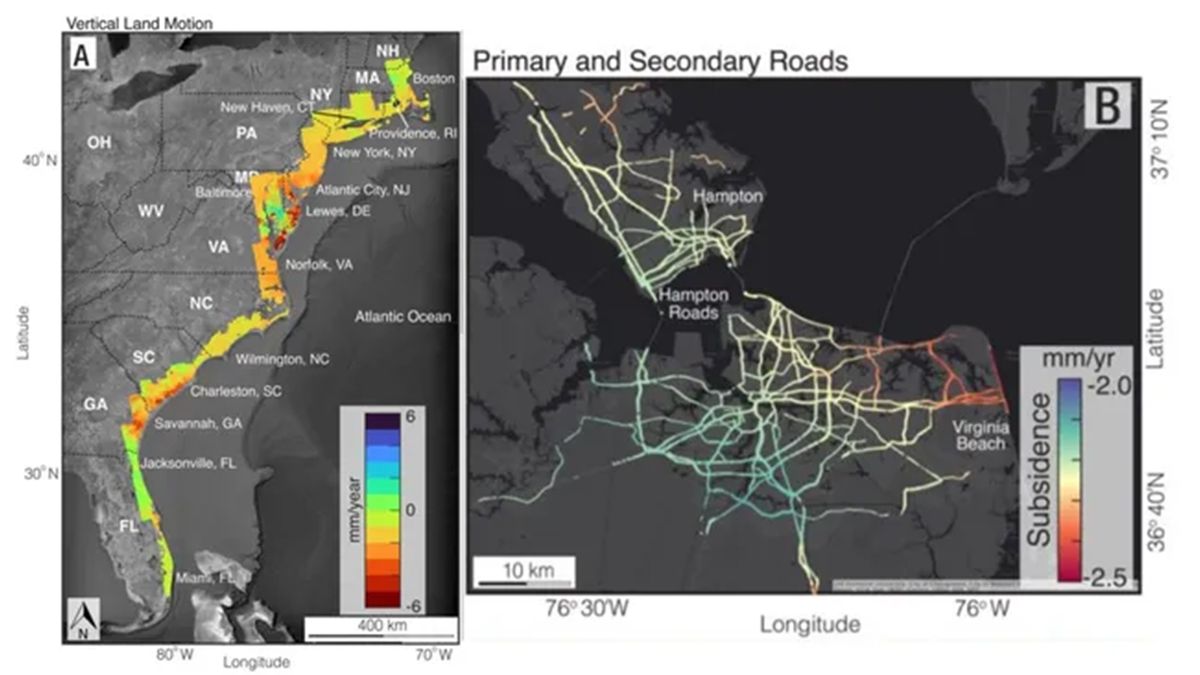
Satellite imagery has revealed significant subsidence, or land sinking, across major cities on the U.S. East Coast, with some areas sinking as much as 5 millimeters per year. This phenomenon poses a threat to infrastructure, including buildings, roads, and airports, and exacerbates flood risks when combined with sea-level rise due to climate change. The research, conducted by Virginia Tech and the USGS, highlights the urgency of addressing subsidence in densely populated and infrastructure-heavy areas to mitigate potential damage and increased flood risks.
Topics:science##climatechange#eastcoastsinking#infrastructurerisk#satelliteimagery#science-and-environment#subsidence
- Satellite images reveal just how much cities on the US East Coast are sinking Livescience.com
- Critical Infrastructure Is Sinking Along the US East Coast WIRED
- Submerging Skylines: Major East Coast Cities Including NYC and DC Rapidly Sinking SciTechDaily
- Cities on the U.S. coastline are sinking, a new study claims BGR
- US Cities Like New York and Washington Are Sinking, Shows Study! - Videos from The Weather Channel The Weather Channel
Reading Insights
Total Reads
0
Unique Readers
8
Time Saved
3 min
vs 4 min read
Condensed
88%
676 → 82 words
Want the full story? Read the original article
Read on Livescience.com