Space-borne lidar: Mapping US biodiversity from above
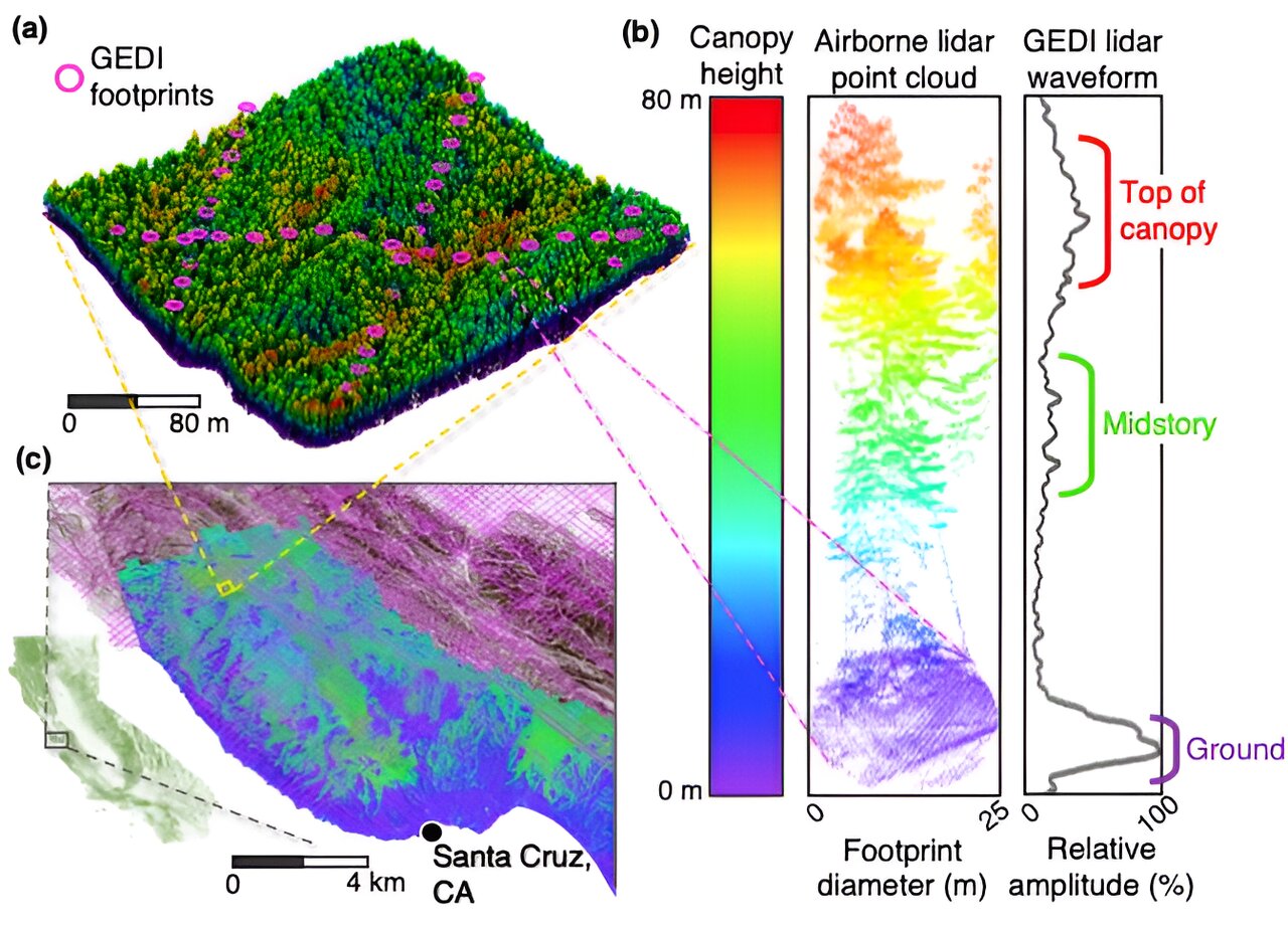
A recent study published in Environmental Research: Ecology demonstrates how NASA's Global Ecosystem Dynamics Investigation (GEDI) space-borne lidar can be used to monitor and map biodiversity across the United States. By utilizing the 3D structure of forests captured by GEDI, researchers can predict habitat for plants, animals, birds, and arboreal mammals. This innovative approach goes beyond traditional satellite imagery, providing a more accurate understanding of biodiversity and enabling the development of effective mitigation efforts to address biodiversity loss. The study highlights the urgency of mapping and monitoring biodiversity at large scales, similar to efforts made for climate change, to protect ecosystems and the future of Earth and humanity.
Reading Insights
0
0
4 min
vs 5 min read
89%
942 → 108 words
Want the full story? Read the original article
Read on Phys.org