"Explore Mars like never before with new high-res map archive"
TL;DR Summary
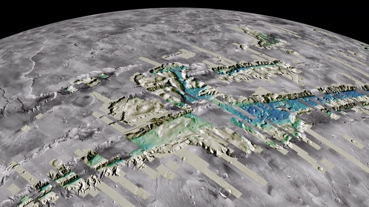
A new map of Mars has been generated using data collected by NASA's Mars Reconnaissance Orbiter, providing a high-resolution, three-dimensional experience of the planet's terrain. The map, compiled by the US Geological Survey's Astrogeology Science Center, consists of over 4,800 digital terrain models and more than 155,000 images of the Martian surface. The data is hosted by Amazon in the company's Open Data Registry, and it is free for anyone to use.
Reading Insights
Total Reads
0
Unique Readers
1
Time Saved
4 min
vs 5 min read
Condensed
92%
932 → 72 words
Want the full story? Read the original article
Read on Space.com