"Tracking Snow and Bitter Cold: First Alert for Frigid Temperatures and Minor Accumulation"
TL;DR Summary
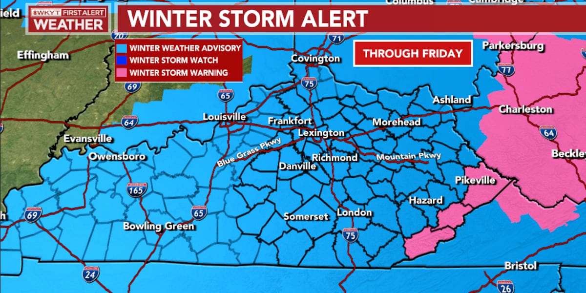
A Winter Weather Advisory is in effect for most of Kentucky, with a Winter Storm Warning in the southeast. Snow is expected to continue into Friday, with accumulations ranging from 1-5 inches. Bitterly cold temperatures will follow, with lows potentially dropping below zero and wind chills reaching -5 to -15. Warmer temperatures are forecasted for next week, but with a very wet pattern.
- FIRST ALERT WEATHER DAY | Chris Bailey Tracks Snow and Bitter Cold WKYT
- Bitter cold is expected to continue in the region JC Post
- FORECAST: FIRST WARN Thursday as flurries move in this afternoon, frigid temperatures resurface Friday KCTV 5
- Storm Mode: Snow showers and another bitter blast on the way KOMU 8
- First Alert due to minor snow accumulation and the return of the dangerous cold WGEM
Reading Insights
Total Reads
0
Unique Readers
3
Time Saved
0 min
vs 1 min read
Condensed
50%
126 → 63 words
Want the full story? Read the original article
Read on WKYT