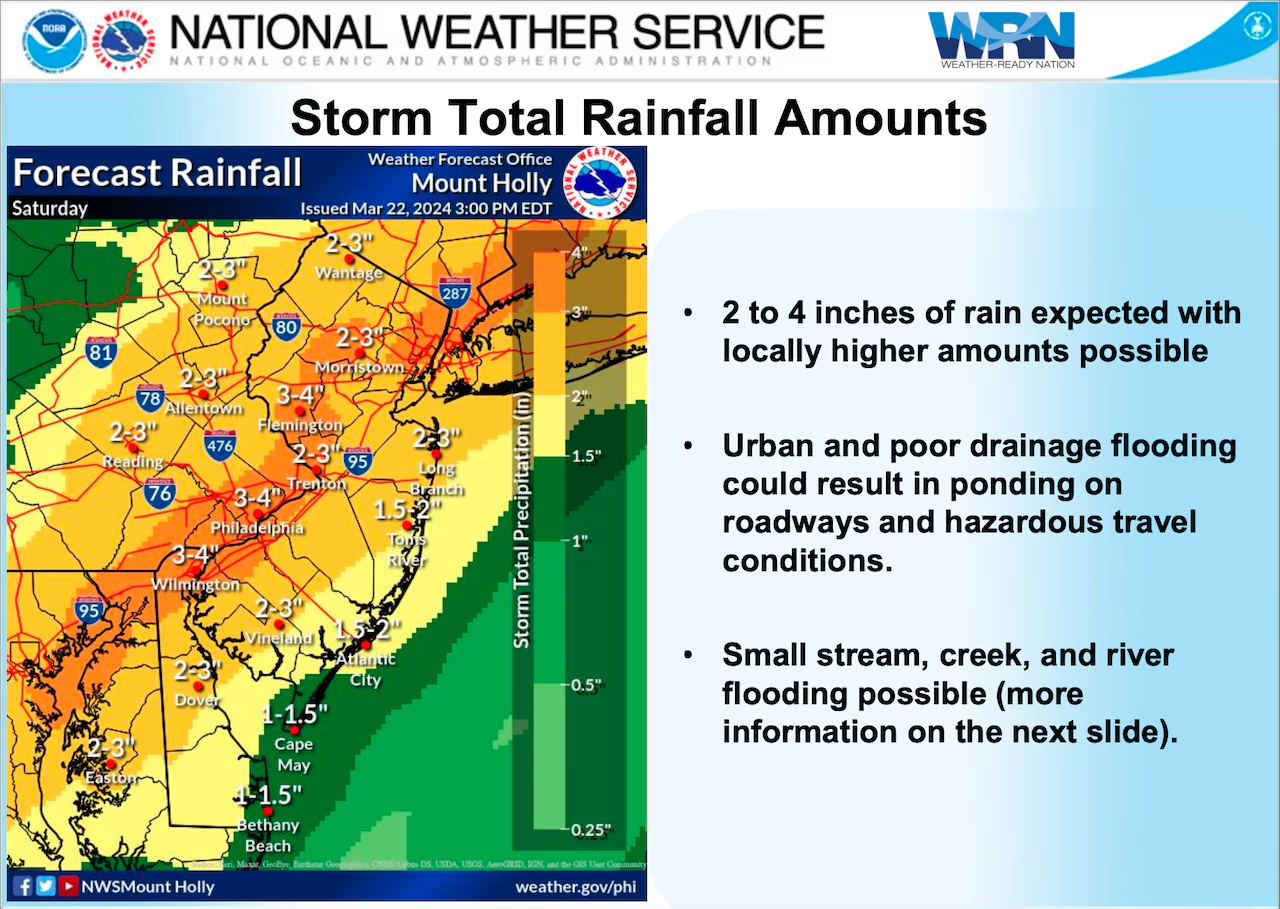
A severe weather system is threatening the Mid-Atlantic and Southeast regions of the US with heavy rainfall, flash floods, damaging winds, and isolated tornadoes, impacting major cities like Washington D.C., Philadelphia, Baltimore, and Richmond, amid ongoing catastrophic flooding in Texas and New Mexico.
New Jersey is experiencing a soggy Saturday with flood watches and high winds expected, leading to the postponement of St. Patrick’s Day parades in Keyport and the Highlands. The National Weather Service has issued a wind advisory for the entire state, with up to four inches of rain forecasted, posing a risk of flooding, particularly in coastal areas and urban streams. Wind gusts of 45 to 50 mph could lead to power outages, and mild temperatures are expected after the storm.
Nearly 50 million people across the eastern half of the U.S., including cities like Houston and Chicago, are at risk of severe weather and flooding as a parade of storms sweeps across the region. The Storm Prediction Center has issued Level 1 out of 5 severe thunderstorm risk for Monday, with large hail and strong wind gusts expected. Flash flood concerns persist through midweek in the South and Southeast, with heavy rain expected in areas of the Gulf Coast, Louisiana, Mississippi, and Alabama. The risk of flash flooding will then shift to the east, including cities like New Orleans, Atlanta, and Tallahassee.
Unusually warm waters in the Atlantic basin could cancel out the El Niño climate pattern, creating conditions that could fuel an active hurricane season. The outlook for tropical cyclone risks is significantly more complicated just ahead of this year’s season beginning June 1. The recent ocean warming is grabbing climate scientists’ attention because of both its timing and its widespread appearance. Even if El Niño forms as expected, weather forecasting models suggest wind shear may remain relatively limited even through the heart of hurricane season.