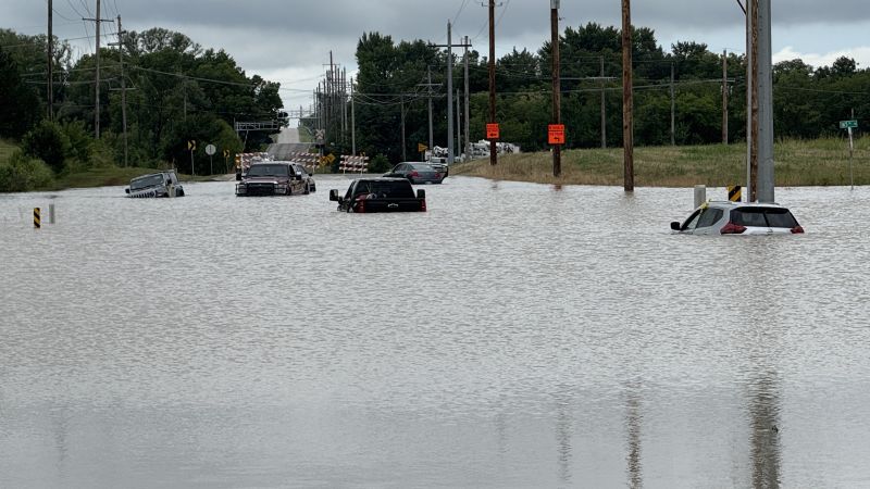
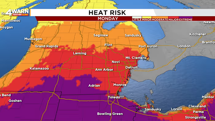
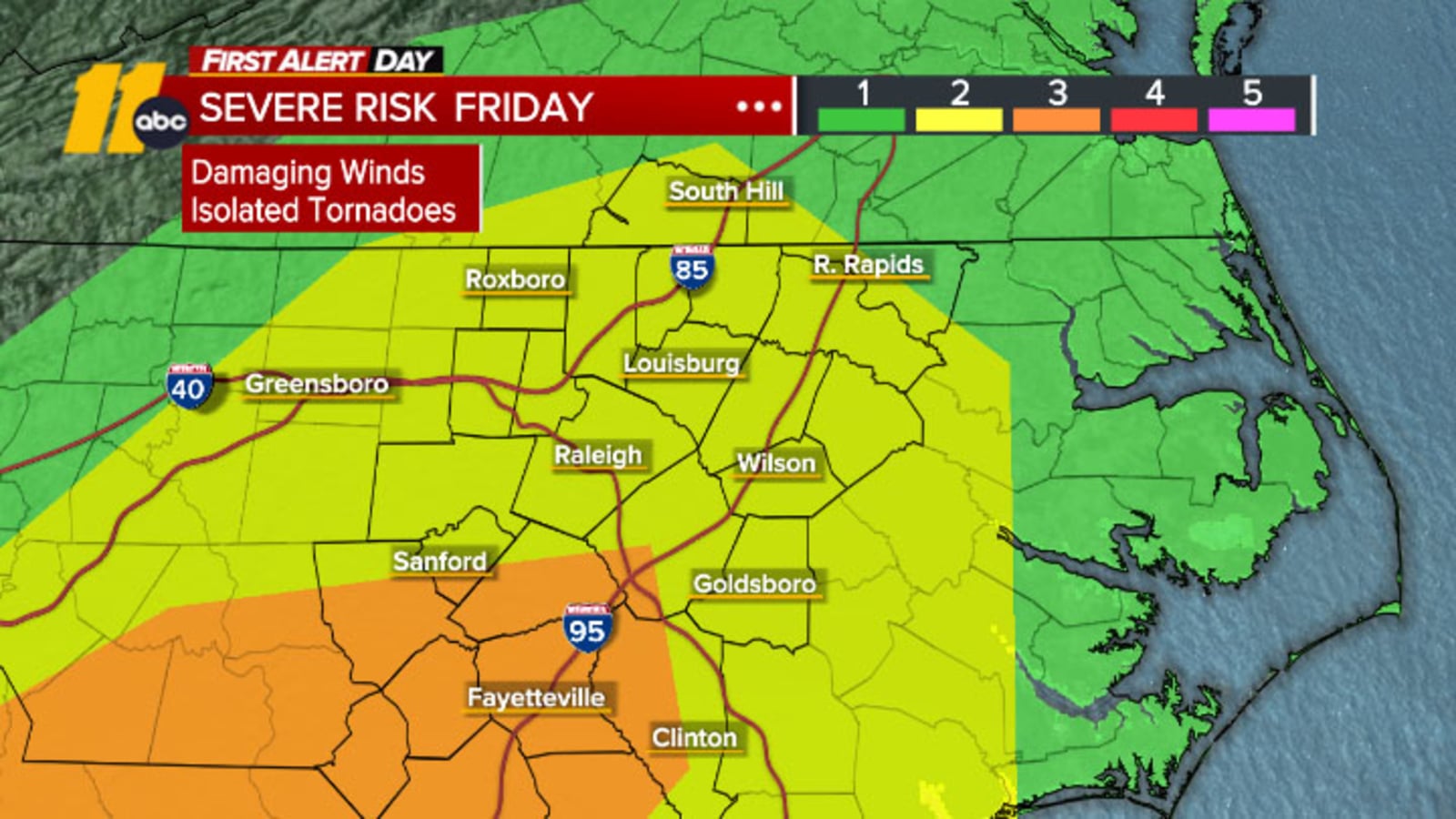
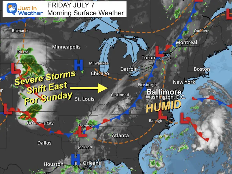
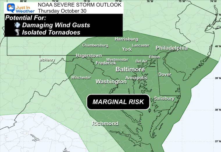
A strong storm system is moving through the Tennessee and Ohio River Valleys, increasing the risk of severe weather, including damaging winds and isolated tornadoes, particularly around the Chesapeake Bay and Delmarva area on Thursday, with heavy rain expected and potential for gusts over 60 mph.
A significant weather event is impacting the eastern US with a 'ring of fire' pattern causing heavy rainfall, flash floods, and severe storms across multiple states, with over 11 million people under flood alerts and warnings for damaging winds, hail, and potential tornadoes.
Tens of millions across the US face flash flood risks due to heavy, humid rain fueled by a stalled storm front, with areas from Virginia to the Midwest and Southwest experiencing potential record rainfall and flooding, exacerbated by climate change and recent wildfires.
An intense heat wave in Southeast Michigan is expected to break a 100-year-old record with temperatures nearing 100°F, high heat indices up to 105°F, and warm muggy nights, prompting heat warnings and advisories. The heat will persist through Monday and Tuesday, with a chance of thunderstorms and severe weather later in the week, urging residents to take safety precautions for themselves and pets.
A level 2 storm risk for most of the Triangle and a level 3 risk for the Sandhills is expected on Friday evening, with the potential for damaging winds, isolated tornadoes, and heavy rain. Another system is forecast to bring more rain on Monday and Tuesday, followed by potentially the coldest air of the winter season so far.
High humidity and scattered pop-up storms are expected today, with the storm risk shifting to the eastern half of the region over the weekend. Sunday poses a higher risk for severe storms, including damaging wind, large hail, flash flooding, and isolated tornadoes. Cooler temperatures and showers are expected on Sunday and Monday, followed by high pressure and sunshine for the middle of next week. Temperatures will reach into the 90s throughout the forecast period.