Explore the Roman Empire's Extensive Road Network with a New Digital Atlas
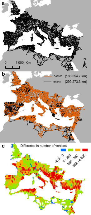
Itiner-e is a comprehensive, high-resolution digital dataset mapping nearly 300,000 km of Roman roads across the empire, created from archaeological, historical, and remote sensing sources, revealing significant gaps in certainty and coverage that can inform future research on ancient mobility and infrastructure development.