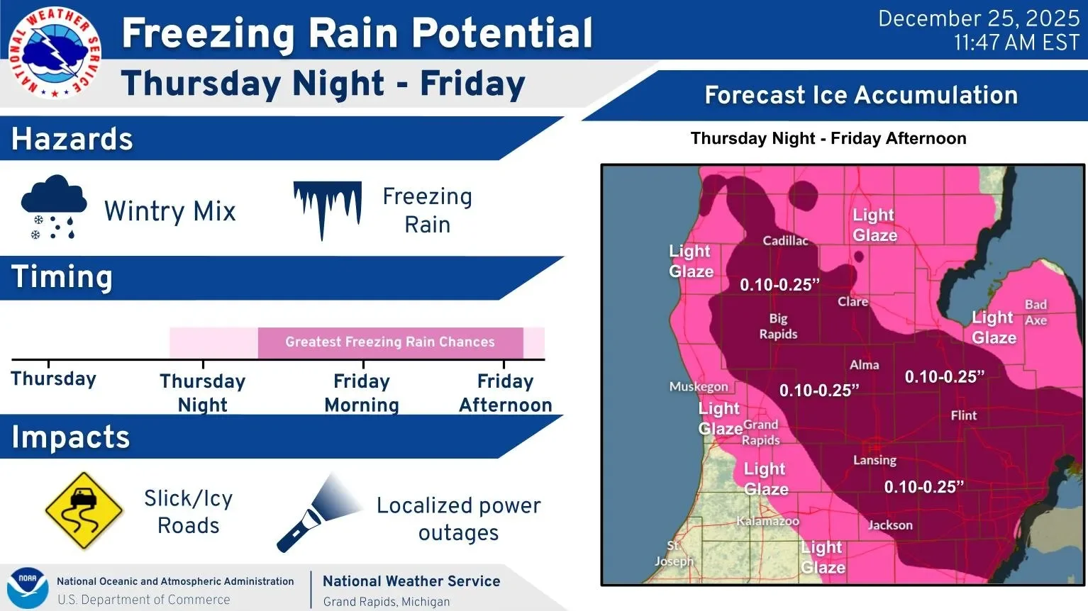
Forecasters have issued a winter weather advisory for Lansing and much of Lower Michigan for December 26, warning of widespread freezing rain and ice accumulation up to 0.25 inches, which will make travel hazardous throughout the day.
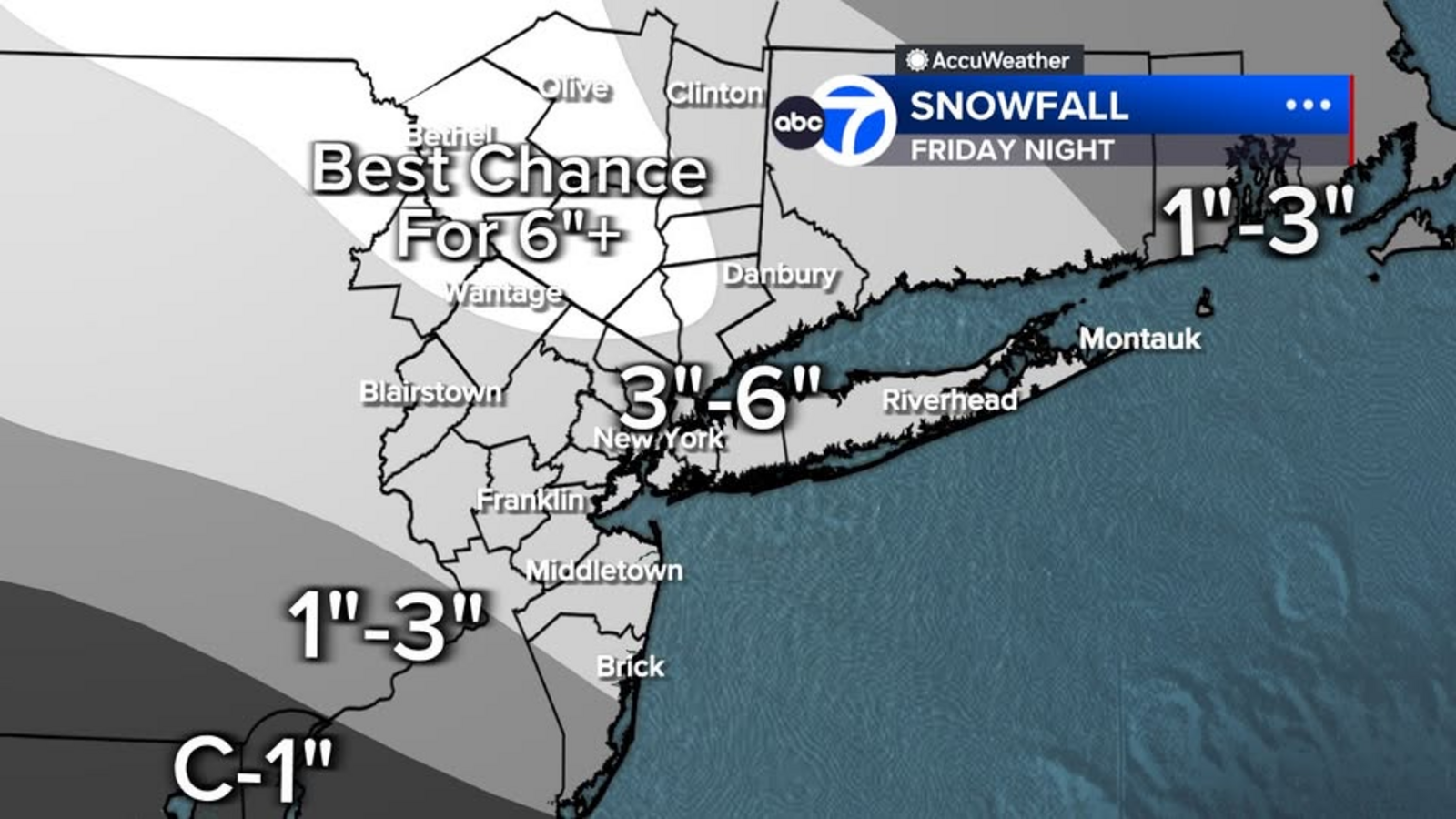
A storm from the Ohio River Valley is expected to bring widespread snow, with 3-6 inches likely in the Tri-State area, potentially exceeding six inches in some northern and western counties, and causing hazardous travel conditions from Friday afternoon through Saturday morning.
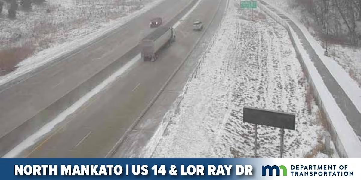
Strong winds and light snow are causing dangerous travel conditions across southern Minnesota and northern Iowa, with blowing snow and rapidly changing visibility, urging drivers to exercise caution and check real-time road updates.
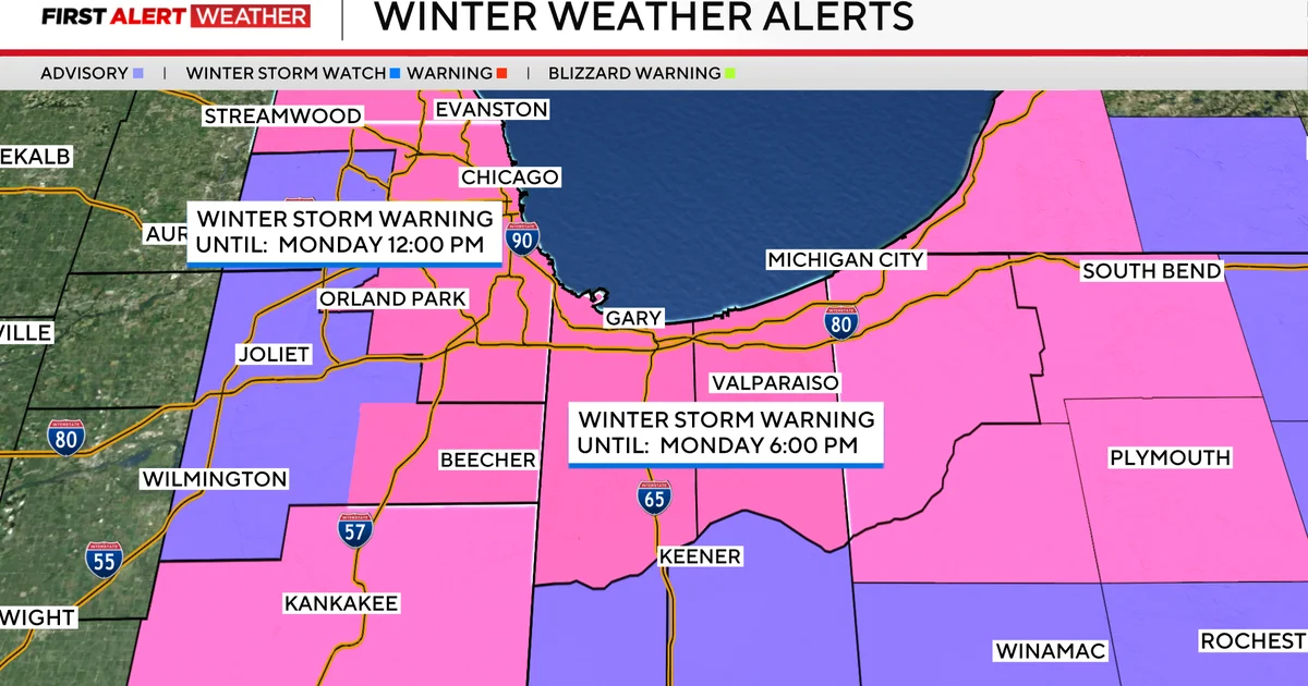
A severe winter storm warning has been issued for Chicago and surrounding areas, predicting intense lake-effect snow with snowfall rates of up to 3 inches per hour, potentially accumulating 8 to 18 inches, causing whiteout conditions and hazardous travel through Monday.
A winter storm warning is in effect for Chicago and Northwest Indiana, predicting over a foot of lake-effect snow and hazardous driving conditions from Sunday night through Monday, with snowfall rates of up to 3 inches per hour and localized totals reaching 12 to 18 inches.
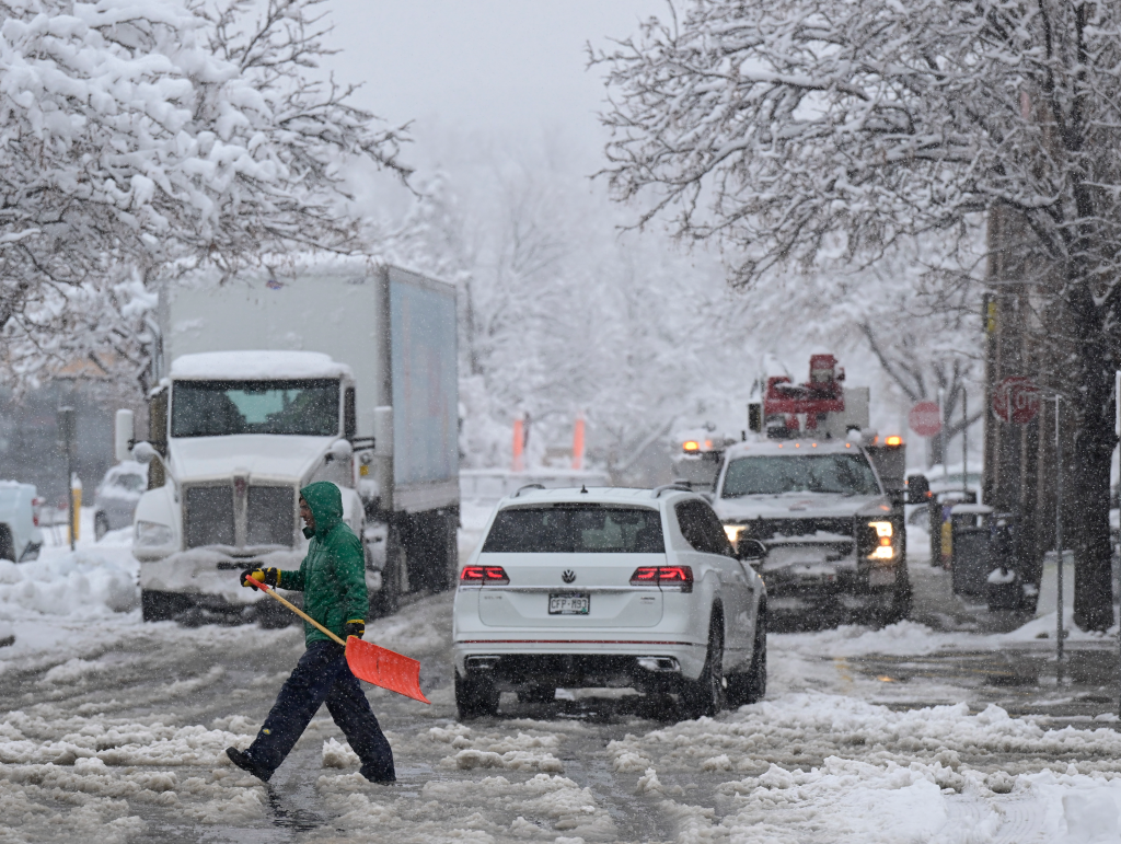
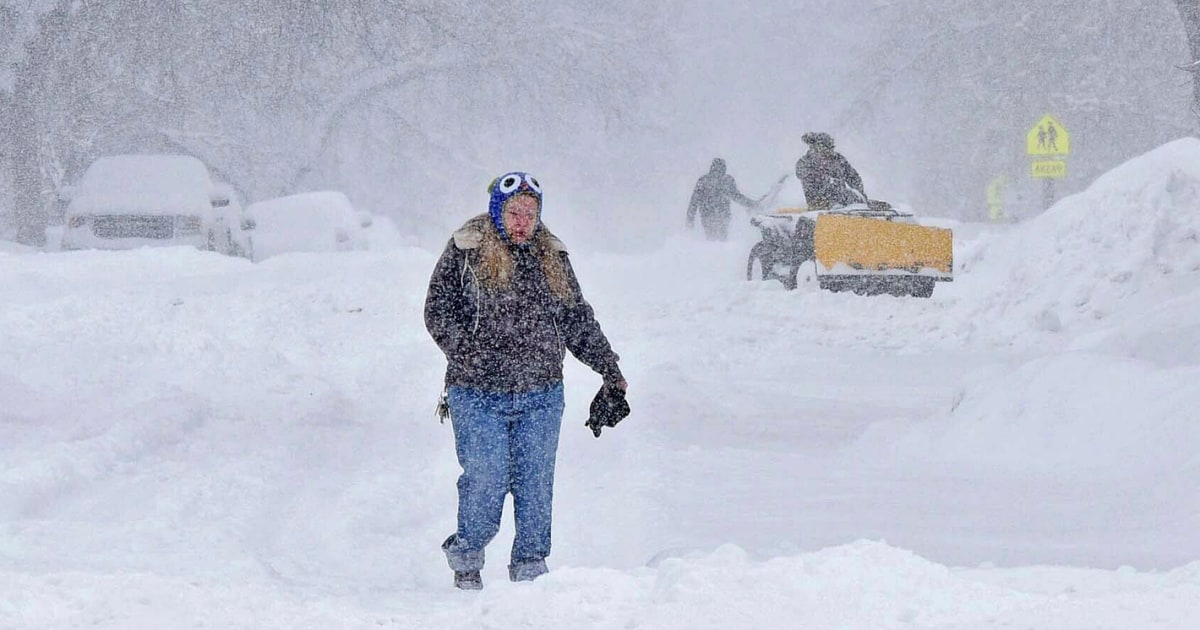
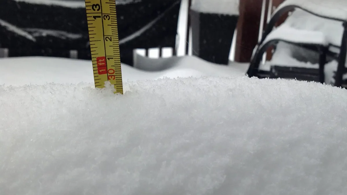
Hazardous road conditions persist in Colorado, particularly in mountain passes, following a significant snowstorm that left nearly 50 inches of snow in some areas. First responders and travelers continue to face challenges due to deep snow, prompting authorities to advise staying home if possible. Several road closures are in effect, including Colo. 46 between Colo. 119 and Golden Gate Drive near Central City.
Boston Mayor Michelle Wu has declared a snow emergency and closed schools for Tuesday due to an expected nor'easter with hazardous travel conditions, strong winds, poor visibility, and heavy snowfall rates. Parking restrictions and space savers are in place, and the city is preparing approximately 850 pieces of snow removal equipment. City staff not considered emergency personnel will work from home, and the snow emergency status takes effect at 10 p.m.
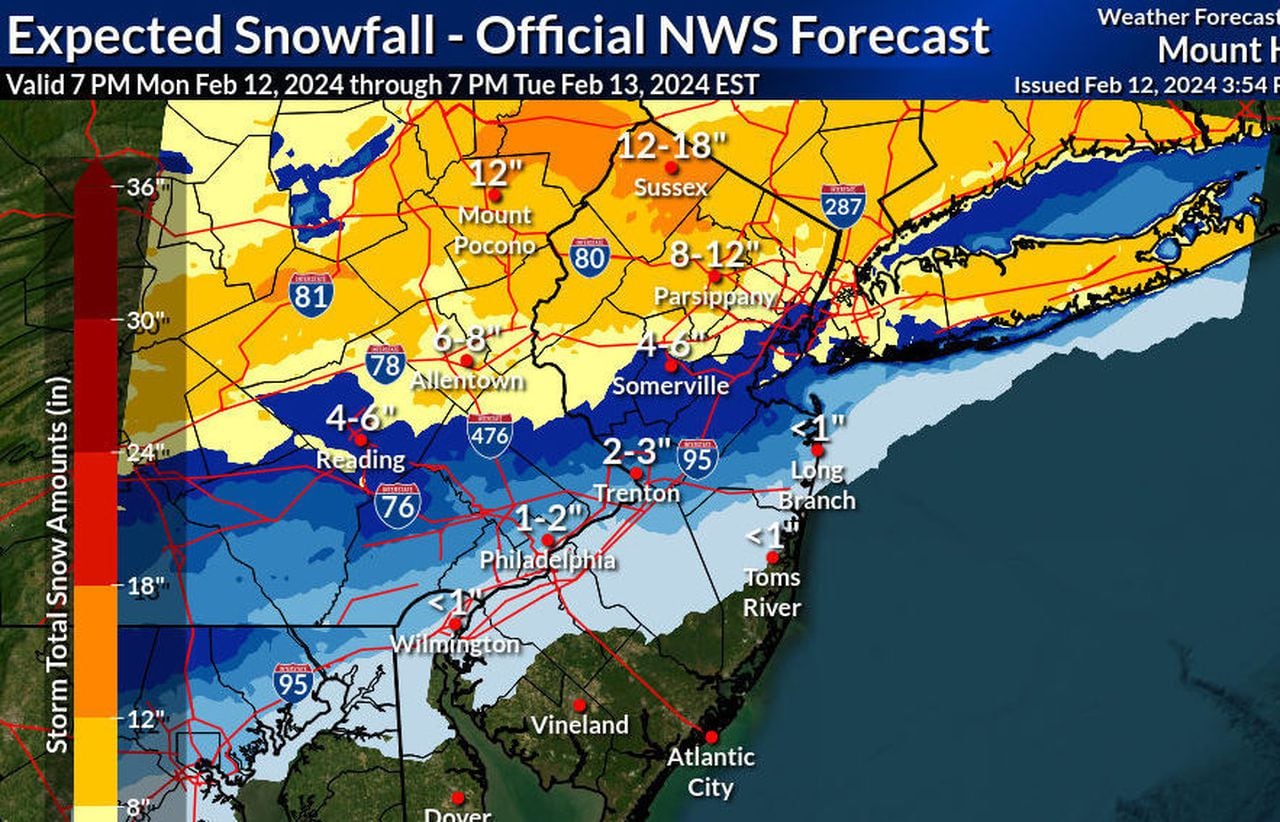
The National Weather Service has issued warnings for a strong winter storm in New Jersey, predicting heavy snow and strong winds that could lead to hazardous travel conditions. Gov. Phil Murphy advised residents to avoid driving during the worst of the storm and prepare for potential power outages. Winter storm warnings have been issued in 10 counties, with coastal flood warnings and wind advisories in effect. Forecasters are closely monitoring the storm's track and potential impacts on the region.
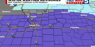
First Warn is in place for freezing drizzle/freezing rain overnight into Monday morning in Kansas City, with ice accumulation of 0.01 to 0.1". Hazardous travel is expected Monday morning, but temperatures will warm up, transitioning the precipitation to rain by Monday afternoon. A winter Weather Advisory is in effect, and another wave of rain showers is expected Monday afternoon through early Tuesday. Breezy conditions are forecasted for Sunday's Chiefs vs Bills game, with temperatures staying around average for the week and several chances for rain showers.
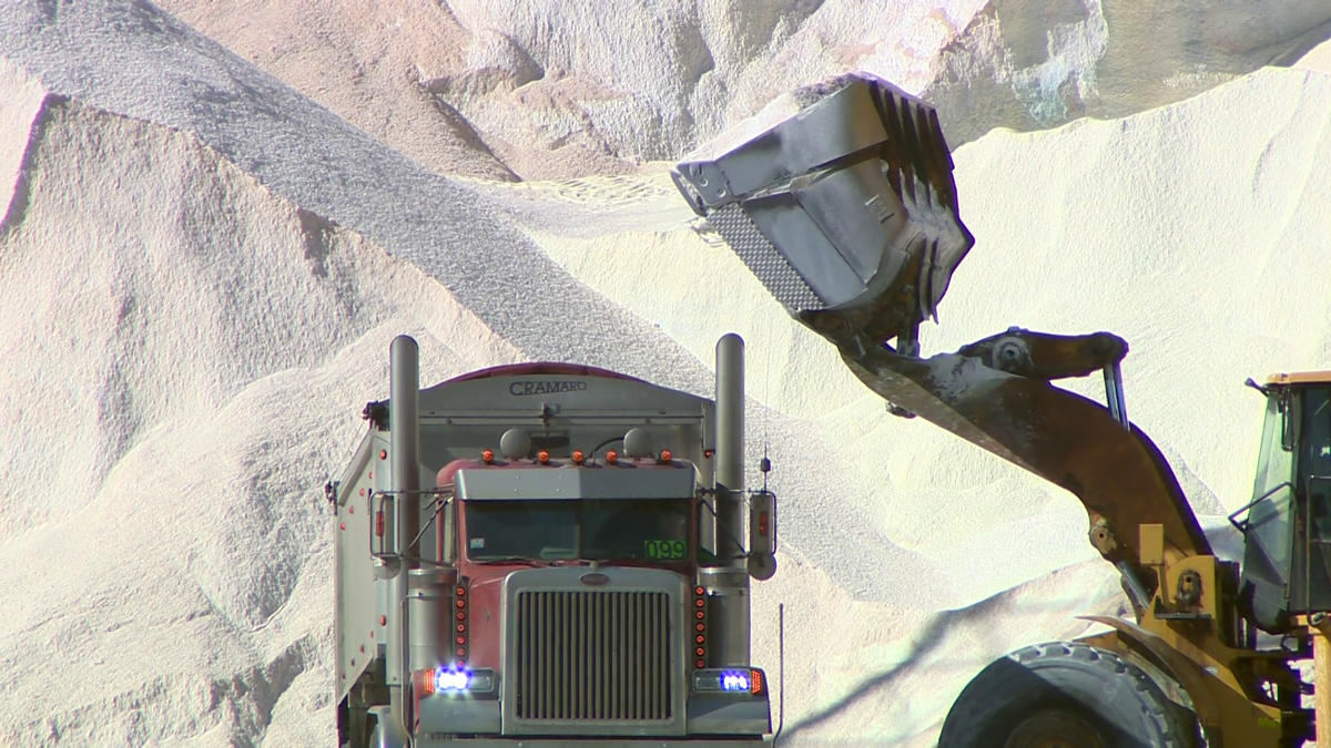
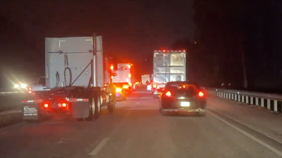
The Alabama Department of Transportation has cautioned against travel as wintry precipitation worsens conditions in north Alabama, leading to hazardous road conditions and multiple crashes. Non-essential travel is strongly discouraged, and drivers are urged to stay home as crews work to treat roads and bridges. ALDOT has reported weather-related closures and crashes, and is working to clear the affected areas. With icy conditions widespread and expected to persist, the department's crews are using various methods, including salt treatments, snow plows, and sand spreading, to address the adverse weather conditions.
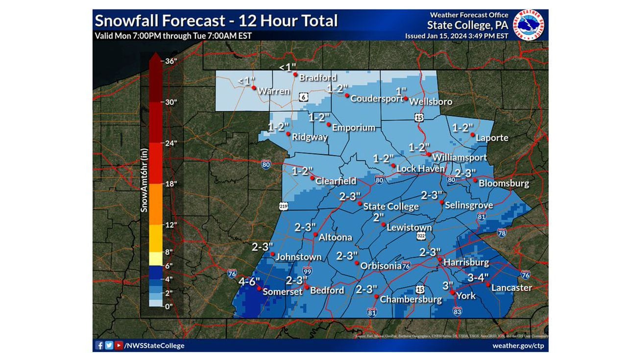
Central Pennsylvania is expected to receive 2 to 4 inches of snow, leading to slippery roads and hazardous travel conditions. A winter weather advisory is in effect until noon on Tuesday for several counties, prompting the Pennsylvania Department of Transportation and Pennsylvania Turnpike Commission to urge motorists to adjust speeds based on the wintry conditions. Temperatures are forecasted to remain low, with a high of 32 degrees on Tuesday and a real feel of about 16 degrees due to a stiff breeze. The best chance of breaking the freezing mark comes on Thursday, with a high of 34 degrees and a possibility of snow flurries in the afternoon.
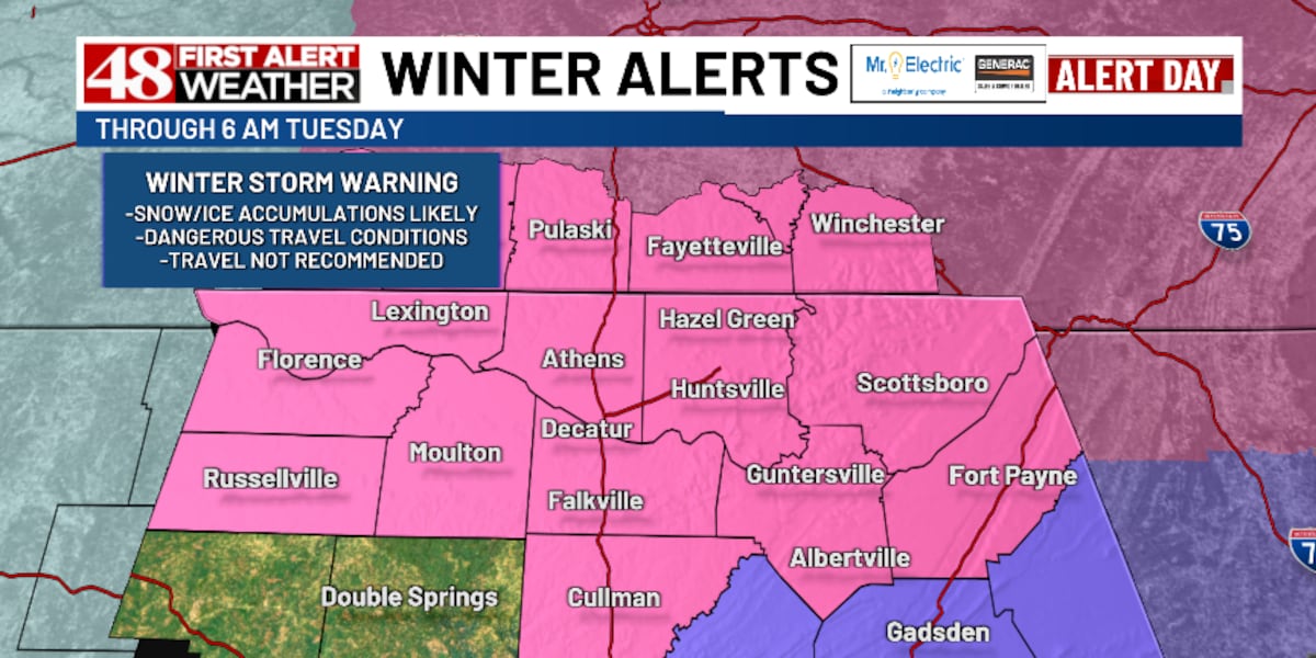
A Winter Storm Warning is in effect for North Alabama and Middle Tennessee, with snow, sleet, and freezing rain causing hazardous travel conditions. Accumulations of 2 to 5 inches of snow are expected, with concerns of freezing rain and ice in some areas. Frigid arctic air will bring dangerously cold wind chill values below zero, and another system on Thursday may bring cold rain showers and a possible wintry mix.
Lincoln Public Schools and several other Nebraska schools will be closed on Monday due to potential winter weather, with a Winter Storm Watch in effect from Sunday evening to Tuesday morning for central and eastern areas. Heavy snow, breezy conditions, and hazardous travel are expected, with eastern areas possibly seeing 5-8 inches of snow and central areas 2-5 inches. Western areas may see lighter accumulation.
The first major snowstorm of the season is expected to hit the northern Cascades, Rockies, and North Dakota, bringing hazardous travel conditions and significant snowfall amounts. Cold air from northwestern Canada combined with a moist Pacific weather system will result in freezing temperatures and snowfall of up to 18 inches in the mountains of Montana, with some areas potentially seeing over 2 feet of snow. Residents are advised to prepare for the storm by getting snow tires and winterizing their properties. The sudden change in weather follows a warm fall, with record-breaking temperatures in some areas.
A winter storm warning has been issued for two Chicago-area counties, with heavy snow and accumulations of up to 8 inches possible through a portion of the weekend. Sporadic power outages and downed tree limbs are possible due to the combination of heavy snow and gusty winds of up to 35 miles per hour. Conditions will likely make for hazardous travel conditions as untreated roads become covered with slushy snow and snow rates peak at around 1-2 inches per hour, particularly during the overnight and early morning hours.