"New Weather Satellite Captures Stunning Images of Earth from 36,000 km Away"
TL;DR Summary
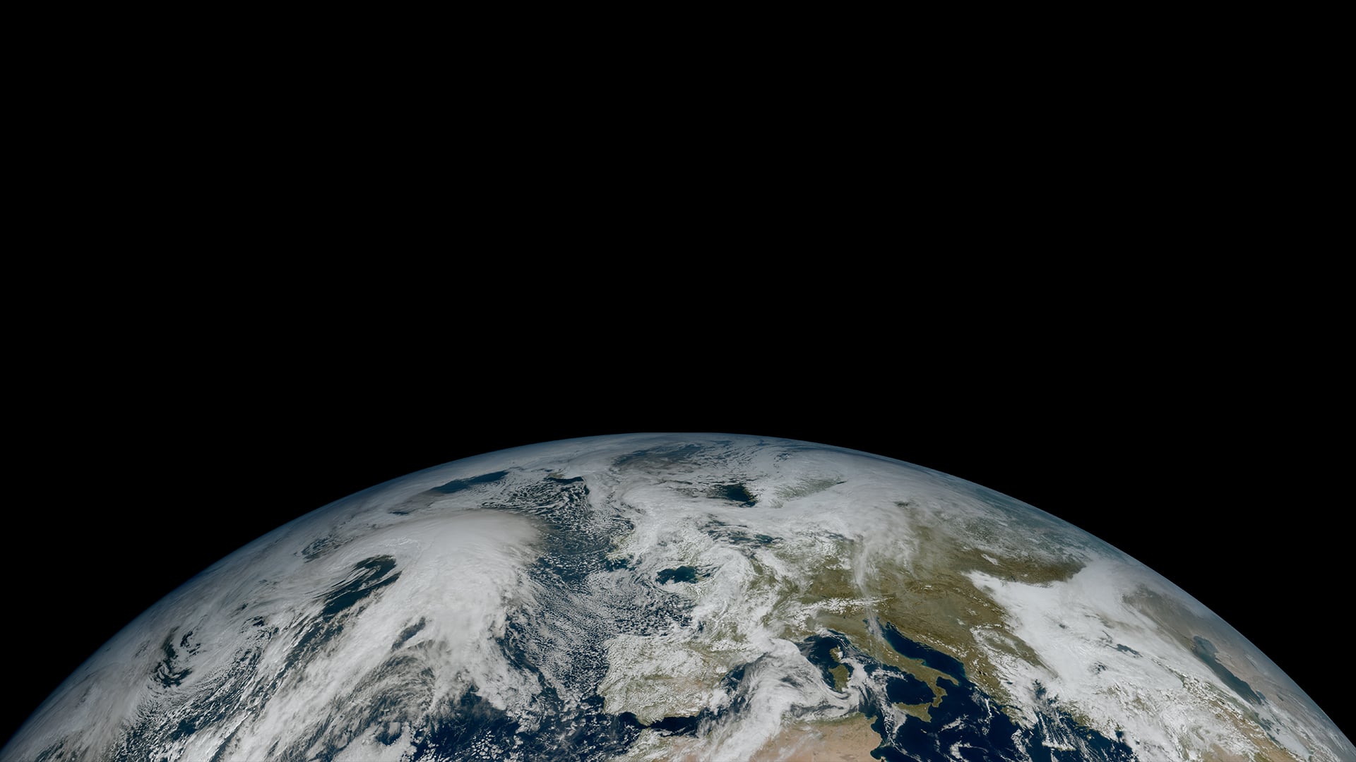
The first image captured by EUMETSAT's newest satellite, Meteosat Third Generation - Imager 1 (MTG-I1), shows an extraordinary level of detail of cloud structures over Europe, Africa, and the Atlantic. The higher resolution imagery and more frequent production of images will enable forecasters to detect and predict severe weather events more rapidly and accurately. The satellite and its instruments are undergoing testing, calibration, and validation until late 2023, when the images will be produced every 10 minutes and released operationally for use in weather forecasts.
Topics:science#eumetsat#mtg-i1#satellite-imagery#science-and-technology#severe-weather-events#weather-forecasting
- Discover the first images of MTG-I1 EUMETSAT
- Stunning new image of Earth from 36 000 km away European Space Agency, ESA
- Meteosat-12: Europe's new weather satellite takes first photos BBC
- New weather satellite reveals spectacular images of Earth Phys.org
- Europe's newest weather satellite reveals Earth in all her (cloudy) beauty E&T Magazine
Reading Insights
Total Reads
0
Unique Readers
6
Time Saved
1 min
vs 2 min read
Condensed
64%
236 → 85 words
Want the full story? Read the original article
Read on EUMETSAT