Severe Storms Expected Tonight and Sunday.
TL;DR Summary
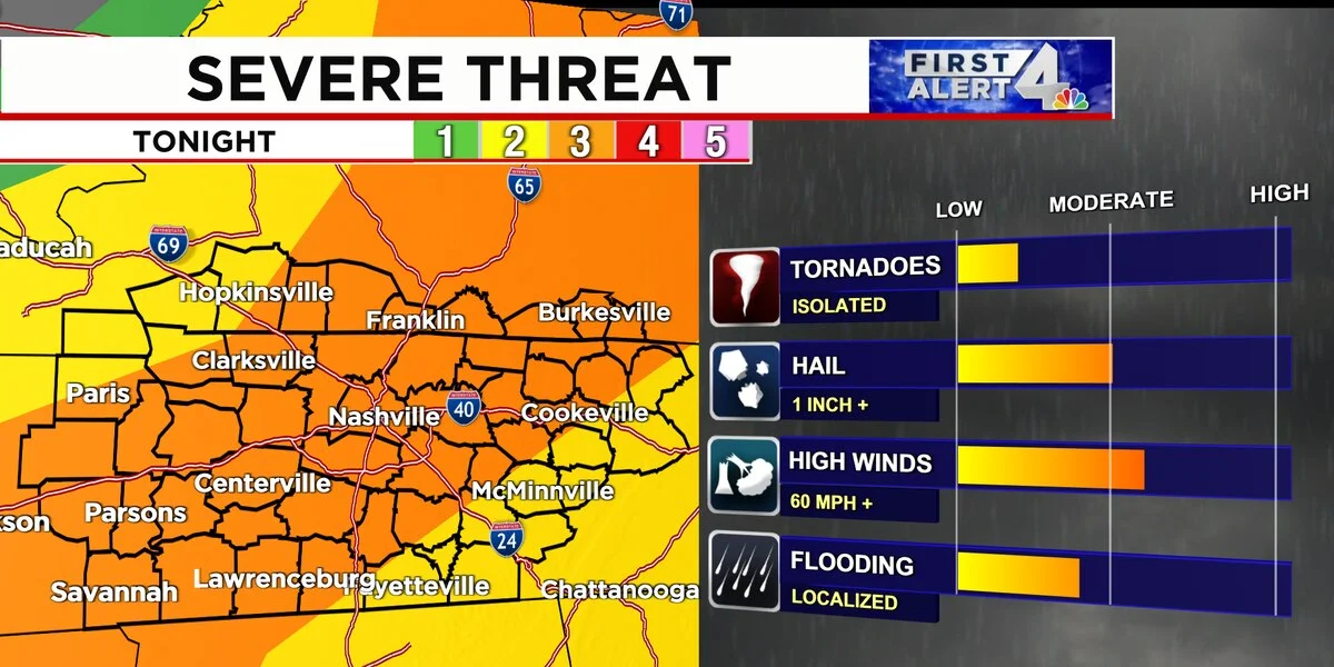
A First Alert Weather Day has been issued for Middle Tennessee and Southern Kentucky as strong-to-severe storms are expected to develop from 8:00 P.M. to 2:00 A.M. Damaging straight-line winds, large hail, and heavy downpours leading to localized flooding are possible. The tornado threat is low but not zero. The severe threat will diminish after the line of storms moves through, with mostly sunny days and high temperatures around 90º expected for Monday, Tuesday, and Wednesday.
- First Alert Weather Day: Strong to Severe Storms Tonight WSMV 4
- Much needed rain and a few stronger storms return to the forecast Sunday WWMT-TV
- Tracking severe weather threat: Tornado watch issued for Greater Cincinnati region WLWT Cincinnati
- Severe weather risk Sunday | WTHR Weather Blog WTHR
- Sunday's Storms could become severe, timing and main threats to be aware of News 5 Cleveland WEWS
Reading Insights
Total Reads
0
Unique Readers
4
Time Saved
1 min
vs 2 min read
Condensed
71%
262 → 76 words
Want the full story? Read the original article
Read on WSMV 4