"Record Warmth Continues: Weekend Snow Threat and Cool Air Ahead"
TL;DR Summary
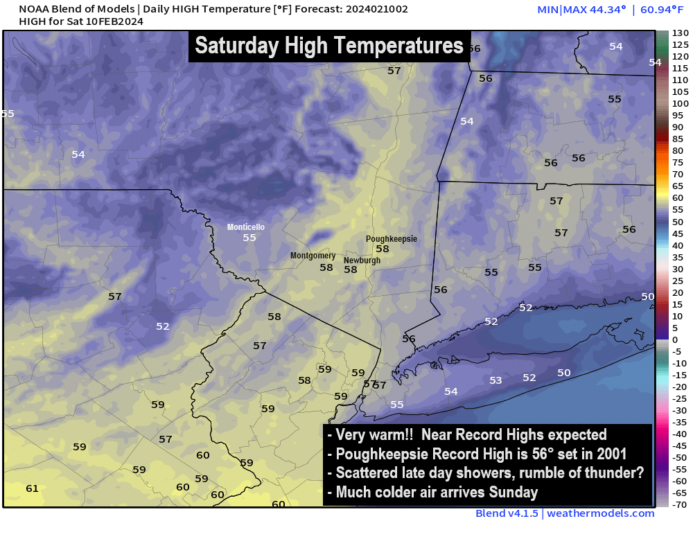
Record warmth is expected in the Hudson Valley on Saturday, with temperatures surging into the middle and upper 50s before a cold front brings a shift to colder weather. A potential winter storm is forecasted for Monday night into Tuesday, with significant snowfall possible for the region. The track of the storm is still uncertain, but there is growing confidence that the Hudson Valley will be impacted, with a 60% chance of significant snowfall and a 30% chance of seeing less than 3 inches. The Canadian model has also shifted to agree with other models, increasing confidence in the forecast.
- Saturday Discussion : Record Warmth, Watching Snow Threat Hudson Valley Weather
- PM Update: Another warm one Saturday, with a small chance of showers The Washington Post
- 02/10/2024: Record Warmth, Thunder Possible Saturday NEWS10 ABC
- One more day of warmth: When cool air will hit WJW FOX 8 News Cleveland
- Near record warmth; cooler flow for weekend ahead FOX 59 Indianapolis
Reading Insights
Total Reads
0
Unique Readers
0
Time Saved
3 min
vs 4 min read
Condensed
84%
625 → 100 words
Want the full story? Read the original article
Read on Hudson Valley Weather