Michigan Braces for Tuesday Storm with Snow and Varying Impacts
TL;DR Summary
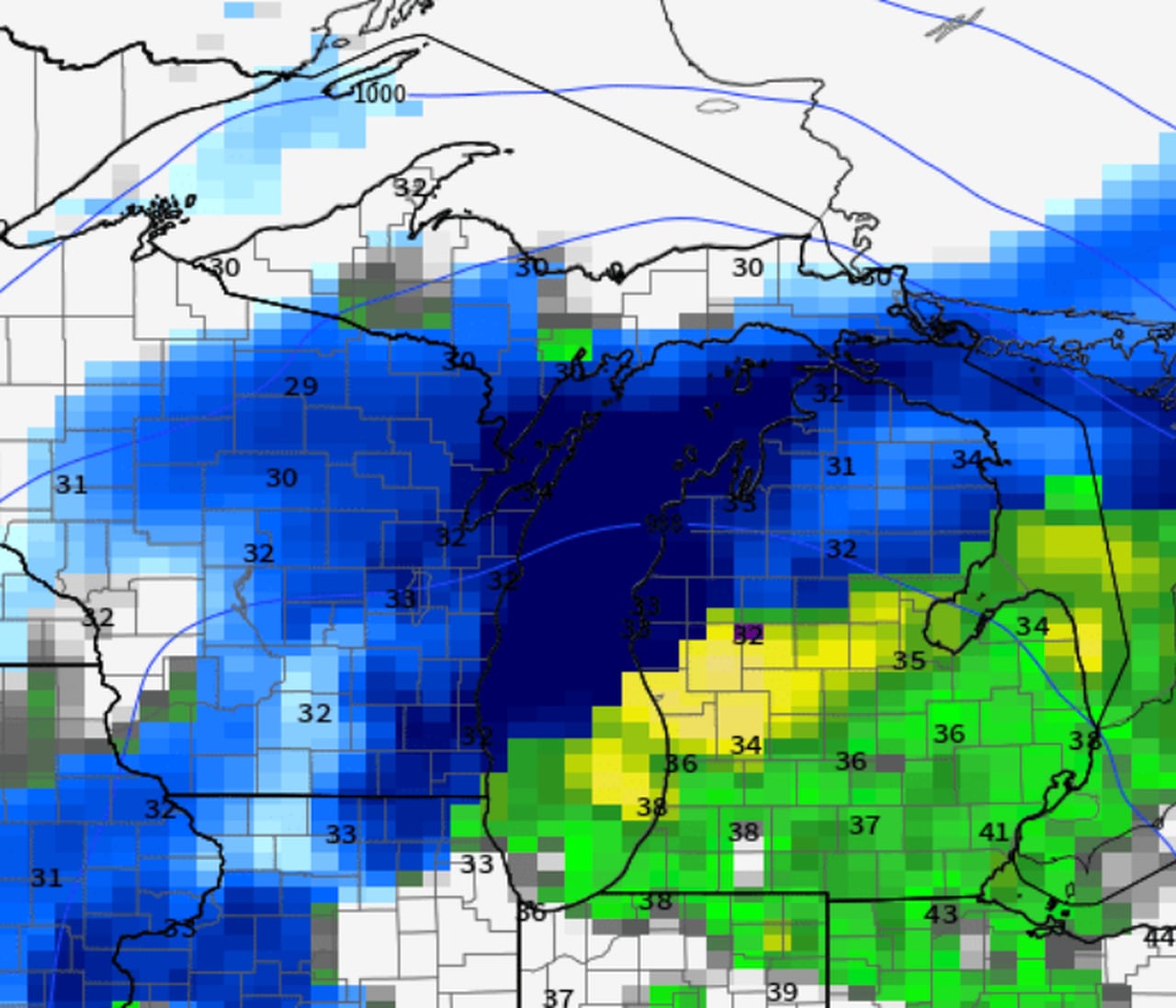
The rain-snow line for the upcoming Tuesday/Wednesday storm in Michigan is expected to be positioned just north of Muskegon to around Clare to Tawas City, with areas north of this line likely to see all snow and heavier accumulations. The U.S. GFS model suggests a slightly warmer scenario, favoring rain over snow due to the prevailing warmth in the region. No freezing rain is expected, and the storm is anticipated to bring a mix of snow and rain to various parts of Michigan, with the precipitation eventually changing back to snow showers by Wednesday morning.
- Rain-snow line location continues to solidify with Tuesday storm MLive.com
- Sloppy winter weather Tuesday with varying impacts across West Michigan 13 ON YOUR SIDE
- Storm expected to hit Michigan on Tuesday; up to 4 inches of snow possible Detroit News
- Two blasts of snow with coming Michigan storm MLive.com
- TV5 Issues two FIRST ALERT WEATHER DAYS for Tuesday Night & Wednesday WNEM
Reading Insights
Total Reads
0
Unique Readers
6
Time Saved
2 min
vs 3 min read
Condensed
83%
555 → 95 words
Want the full story? Read the original article
Read on MLive.com