"Level 3 Severe Weather Threat for Central NC on Monday"
TL;DR Summary
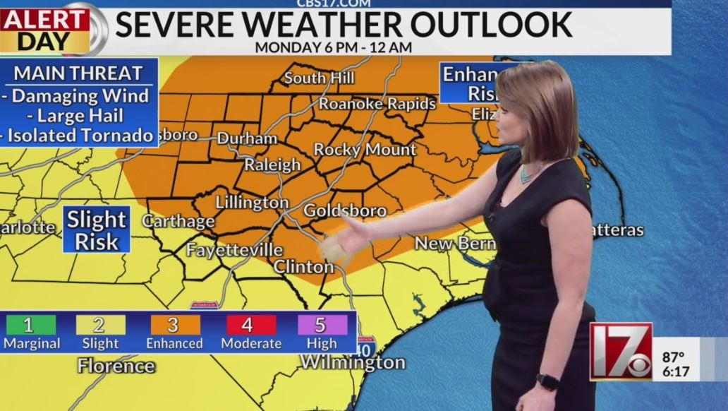
The Storm Prediction Center has issued a rare Level 3, "Enhanced Risk" for severe weather in most of Central North Carolina on Monday, with damaging wind gusts and large hail being the primary threats. Thunderstorms are expected to develop in the early afternoon and strengthen as they move east, with the primary window for thunderstorms between 3 p.m. to 10 p.m. There is also a low risk for a brief spin-up tornado. The severe threat will end overnight from west to east. CBS 17 Storm Team has issued an "Alert Day" for Monday.
- Rare ‘Level 3 Risk’ of severe weather issued for Triangle, central NC Monday CBS17.com
- IMPACT DAY: Severe weather on the table Monday wgaltv
- WATCH: Enhanced risk of severe weather in Triad on Monday WGHP FOX8 Greensboro
- NC weather: Level 3 risk of severe storms Monday -- strong wind, damaging hail most likely threats; flooding, tornados less likely WTVD-TV
- Monday is an Impact Day WGAL Susquehanna Valley Pa.
Reading Insights
Total Reads
0
Unique Readers
4
Time Saved
0 min
vs 1 min read
Condensed
47%
175 → 93 words
Want the full story? Read the original article
Read on CBS17.com