Front-Driven Storms Trigger Widespread Warnings Across Western PA
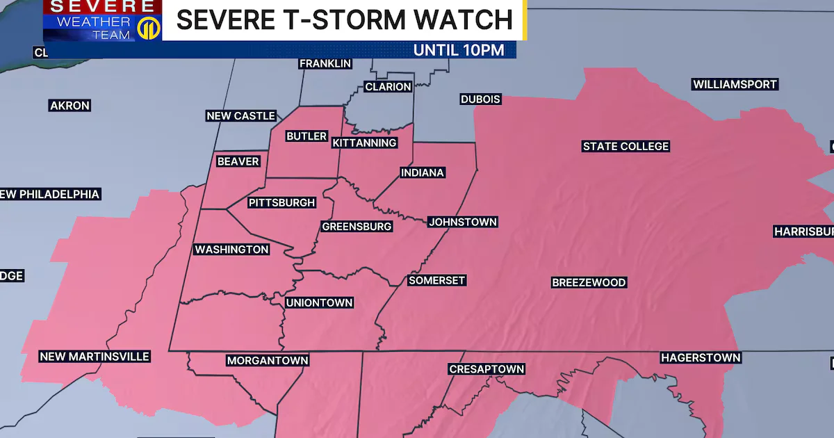
A cold front crossing western Pennsylvania is triggering widespread severe storms, with multiple Severe Thunderstorm Warnings in effect for parts of Allegheny, Westmoreland, Beaver, Washington and Butler counties and a Severe Thunderstorm Watch in place for Beaver, Butler, Armstrong, Indiana, Allegheny, Westmoreland, Washington, Fayette and Greene counties until 10 p.m. Sunday. The system could bring large hail, damaging winds, and, in some areas, isolated tornadoes, with heavy rain continuing into the evening and early overnight. Cooler air arrives Monday (highs in the 40s, lows in the 20s Tuesday). A return to sunshine and 50s is expected midweek, with another rain chance late Wednesday night into Thursday. Track storms with radar and local alerts.
- LIVE UPDATES: Most of area under Severe Thunderstorm Watch; storms could bring large hail, high wind WPXI
- Pittsburgh region under severe thunderstorm watch as dramatic weather shift unfolds Pittsburgh Post-Gazette
- Thunderstorms and strong wind to impact the Philly region on Sunday night NBC10 Philadelphia
- 2-Inch Hail Possible Sunday In Eastern PA As Severe Thunderstorms Threaten Area Patch
- Severe Thunderstorm Watch issued for most of the Susquehanna Valley WGAL
Reading Insights
0
6
1 min
vs 2 min read
69%
367 → 113 words
Want the full story? Read the original article
Read on WPXI