"First Alert: Winter Weather Advisory for Accumulating Snow Tonight"
TL;DR Summary
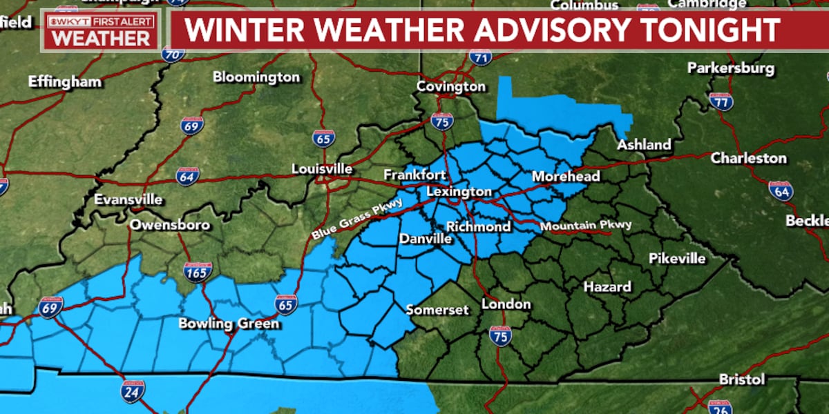
WKYT declares a First Alert Weather Day as they monitor a complex snow forecast, with rain expected to transition into thunder and then heavy snow as low pressure moves through the region. The band of heavy snow is predicted to set up near Lexington into southern and southeastern Kentucky, potentially bringing a few inches of snow. Despite the snow, temperatures are expected to rise in the coming days, reaching the 40s and even 50s, with the possibility of another winter blast over the weekend.
- FIRST ALERT WEATHER DAY | Chris Bailey Tracks Snow For Some WKYT
- Winter weather advisory for parts of Kentucky, but not Louisville WLKY Louisville
- FIRST ALERT WEATHER DAY | A round of accumulating snow moves in tonight WKYT
- Freezing overnight temperatures likely to cause slick driving conditions WSAZ
- Winter Weather Advisory Issued for Accumulating Snow by Tuesday Morning WDRB
Reading Insights
Total Reads
0
Unique Readers
0
Time Saved
0 min
vs 1 min read
Condensed
46%
156 → 84 words
Want the full story? Read the original article
Read on WKYT